

Languages
Pages
Legal

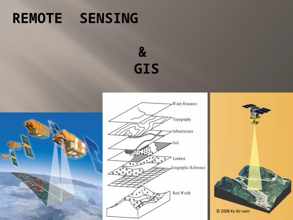
REMOTE SENSING &
GIS
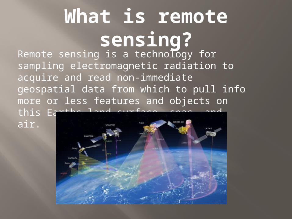
What is remote sensing?Remote sensing is a technology for sampling electromagnetic radiation to acquire and read non-immediate geospatial data from which to pull info more or less features and objects on this Earths land surface, seas, and air.
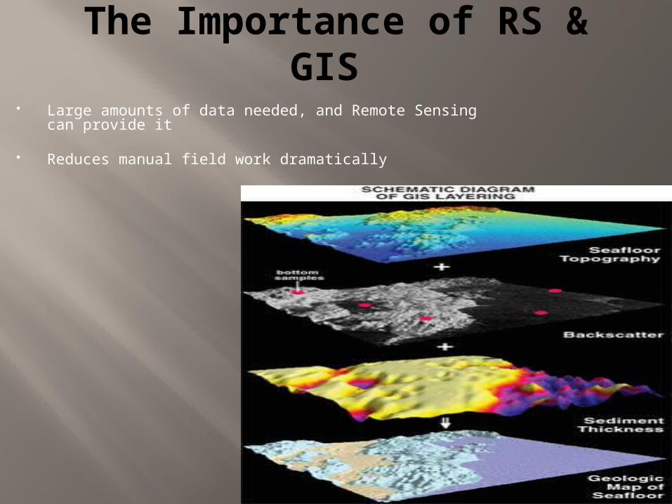
The Importance of RS & GIS
Large amounts of data needed, and Remote Sensing can provide it
Reduces manual field work dramatically
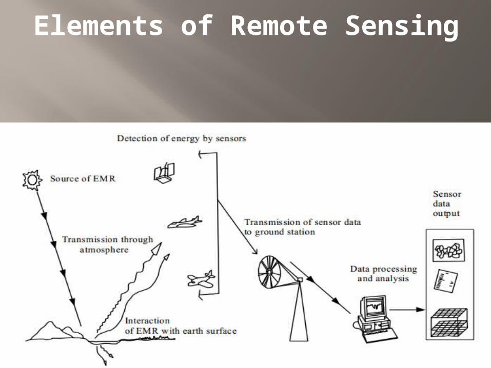
Elements of Remote Sensing
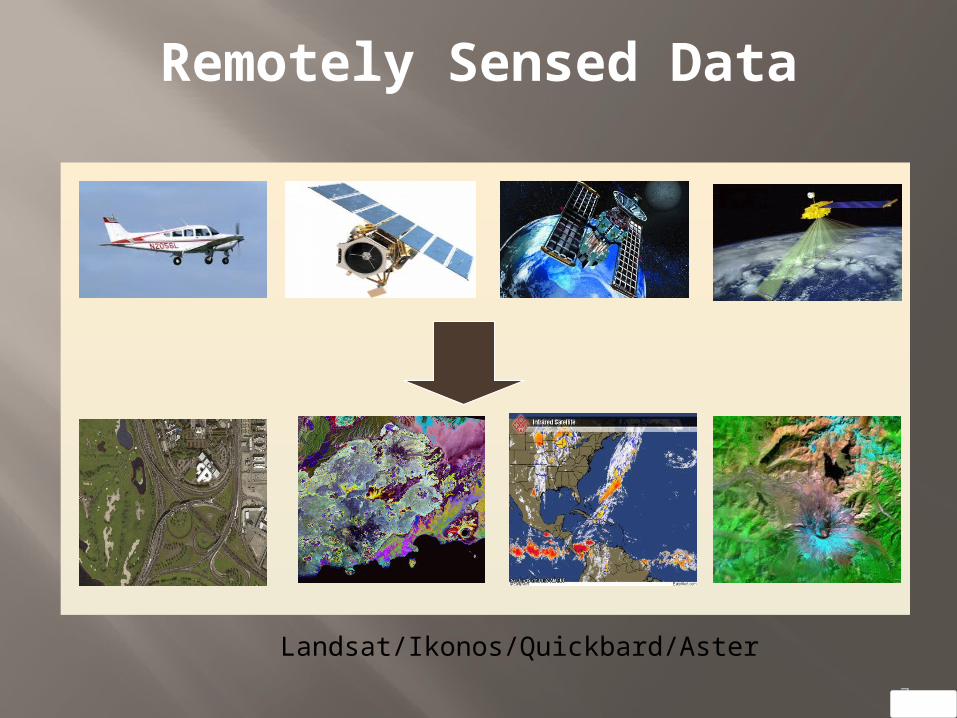
Remotely Sensed Data
7
Landsat/Ikonos/Quickbard/Aster
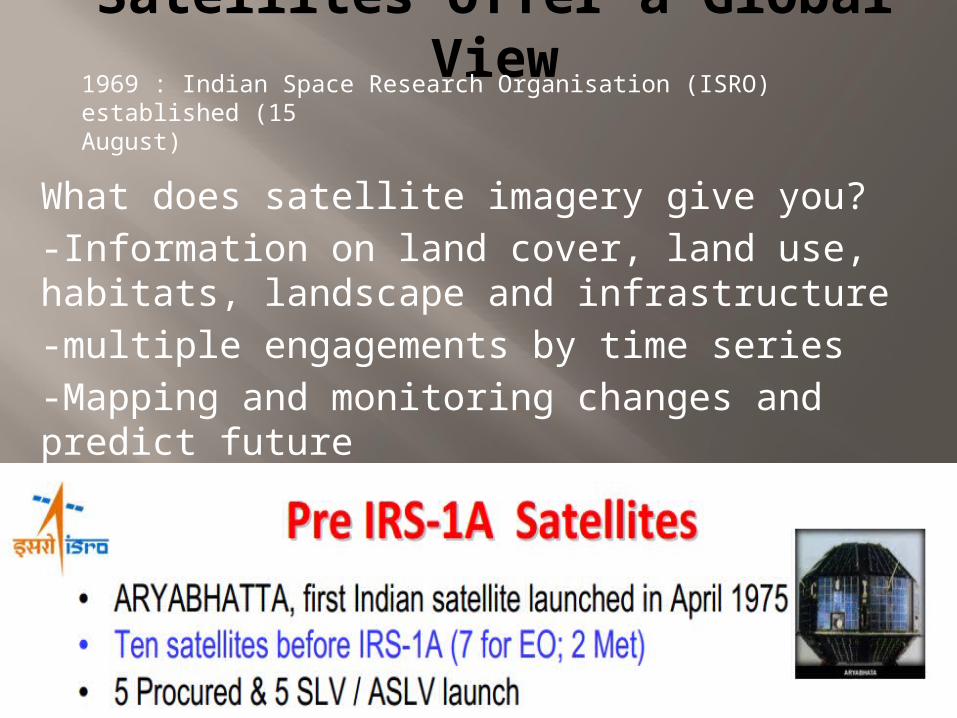
Satellites offer a Global View
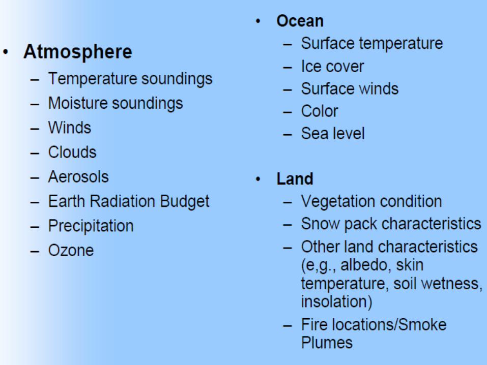
What does satellite imagery give you? -Information on land cover, land use, habitats, landscape and infrastructure -multiple engagements by time series-Mapping and monitoring changes and predict future
1969 : Indian Space Research Organisation (ISRO) established (15August)
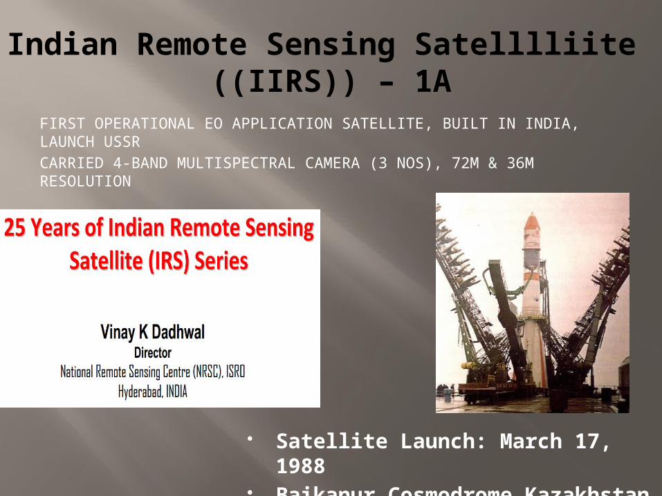
Indian Remote Sensing Satelllliite ((IIRS)) – 1A
FIRST OPERATIONAL EO APPLICATION SATELLITE, BUILT IN INDIA, LAUNCH USSRCARRIED 4-BAND MULTISPECTRAL CAMERA (3 NOS), 72M & 36M RESOLUTION
Satellite Launch: March 17, 1988 Baikanur Cosmodrome
Kazakhstan
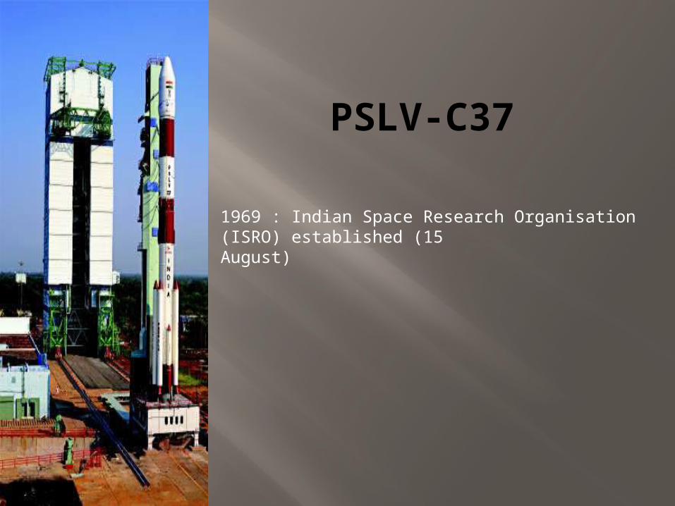
PSLV-C37
1969 : Indian Space Research Organisation (ISRO) established (15August)
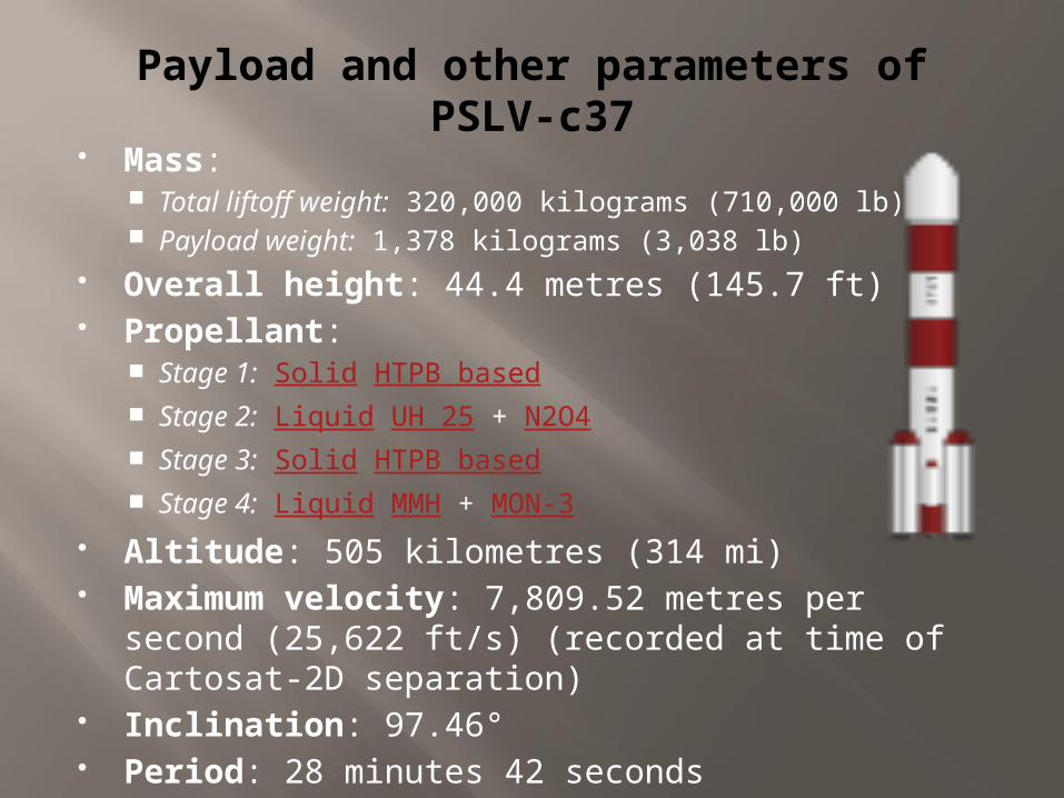
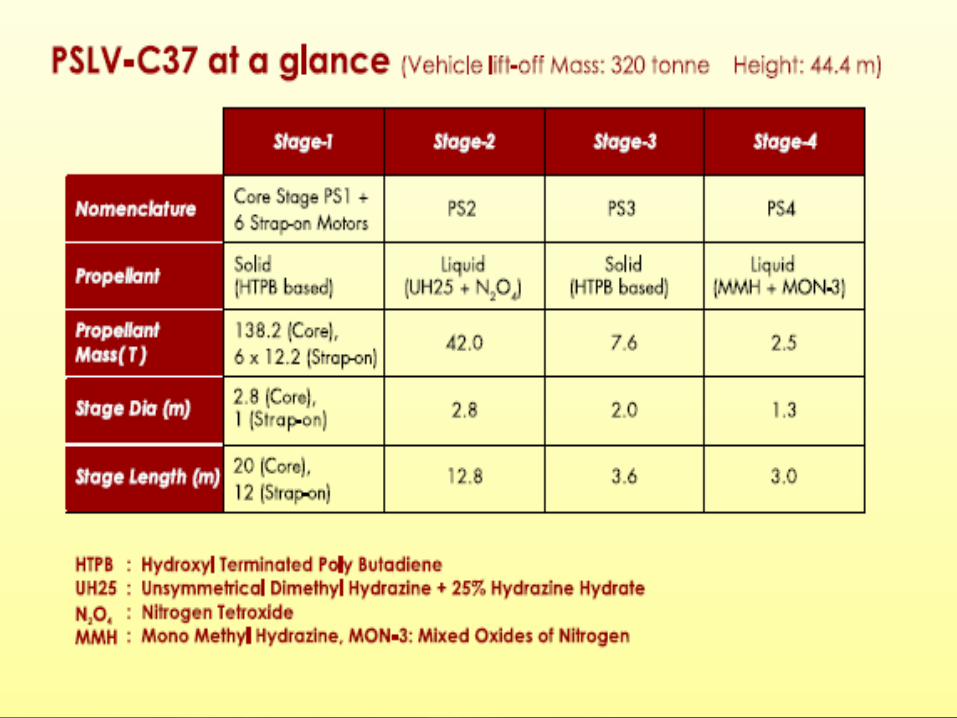
Payload and other parameters of PSLV-c37
Mass: Total liftoff weight: 320,000 kilograms (710,000 lb) Payload weight: 1,378 kilograms (3,038 lb)
Overall height: 44.4 metres (145.7 ft) Propellant:
Stage 1: Solid HTPB based Stage 2: Liquid UH 25 + N2O4 Stage 3: Solid HTPB based Stage 4: Liquid MMH + MON-3
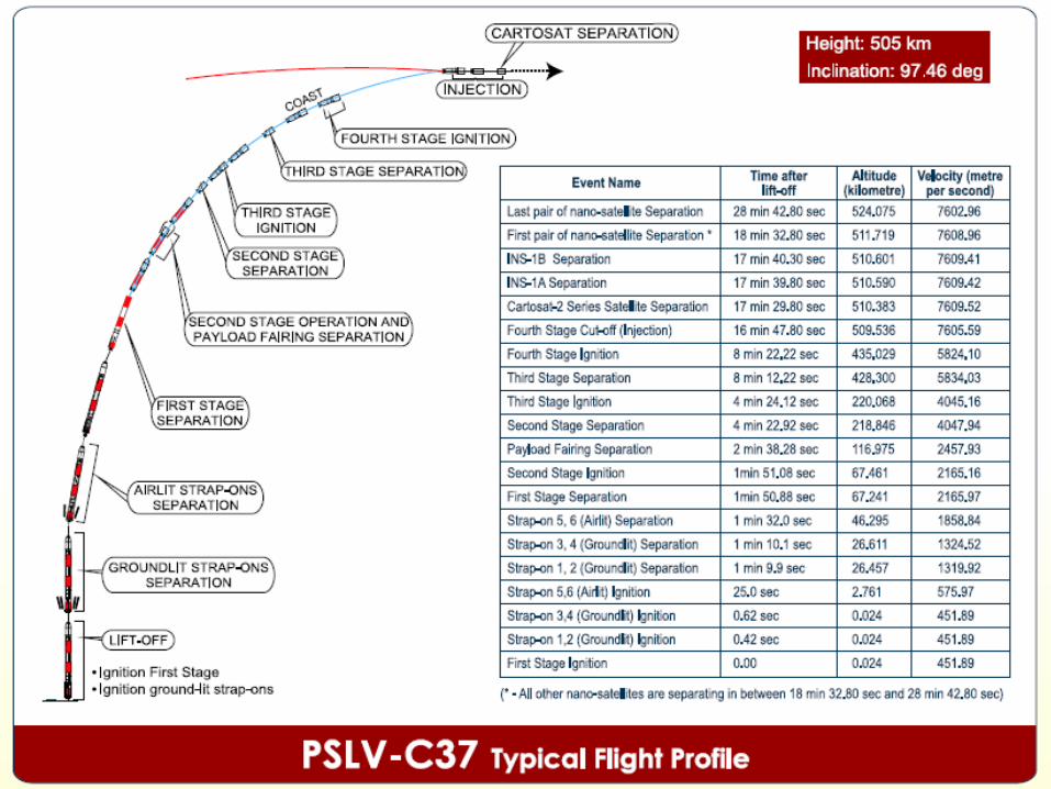
Altitude: 505 kilometres (314 mi) Maximum velocity: 7,809.52 metres per second
(25,622 ft/s) (recorded at time of Cartosat-2D separation)
Inclination: 97.46° Period: 28 minutes 42 seconds
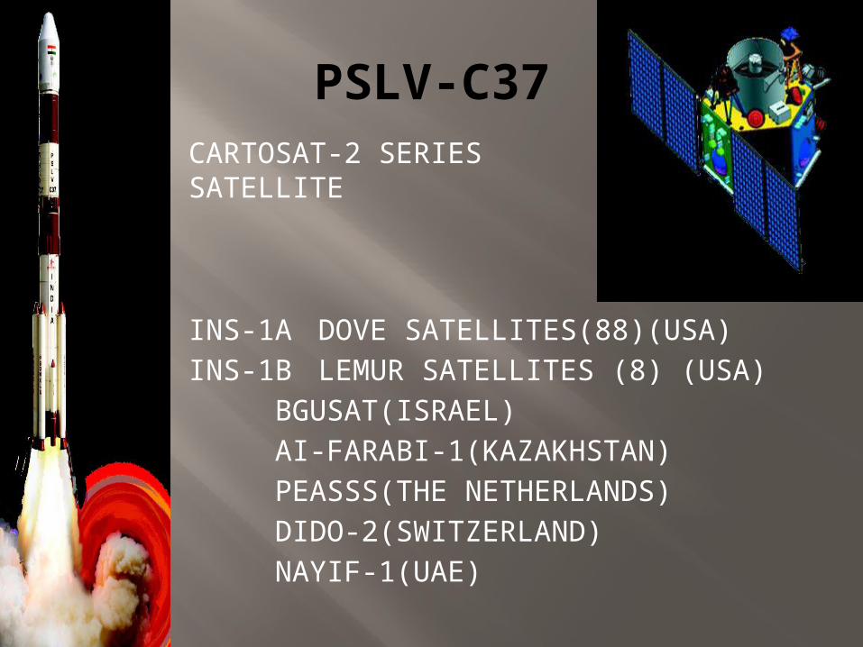
PSLV-C37
INS-1A DOVE SATELLITES(88)(USA)INS-1B LEMUR SATELLITES (8) (USA)
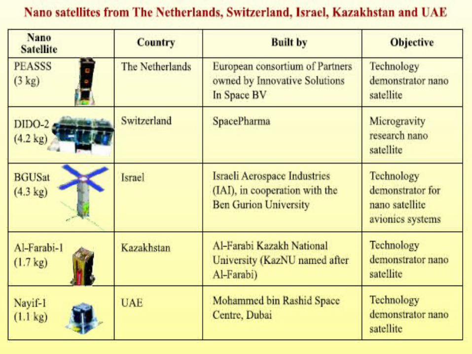
BGUSAT(ISRAEL)AI-FARABI-1(KAZAKHSTAN)PEASSS(THE NETHERLANDS)DIDO-2(SWITZERLAND)NAYIF-1(UAE)
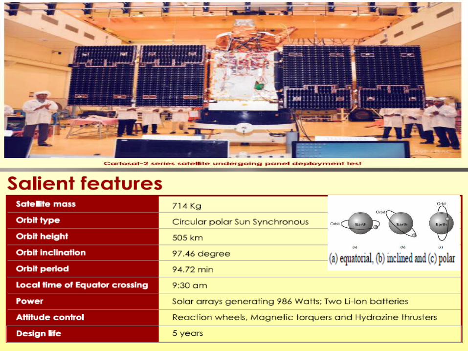
CARTOSAT-2 SERIES SATELLITE
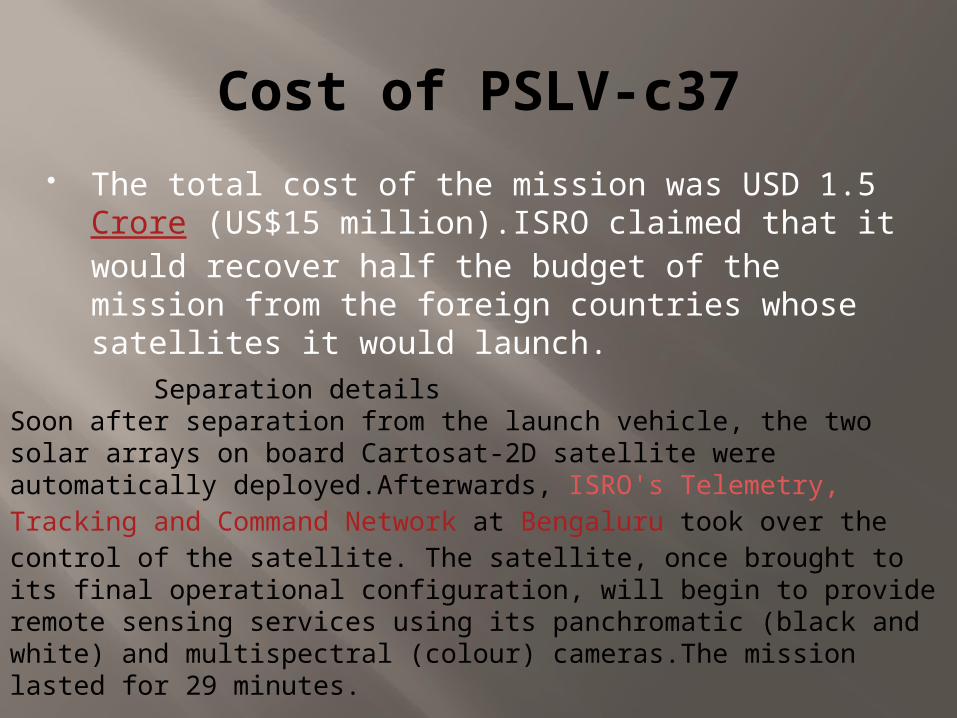
Cost of PSLV-c37 The total cost of the mission was USD 1.5 Crore
(US$15 million).ISRO claimed that it would recover half the budget of the mission from the foreign countries whose satellites it would launch.
Separation detailsSoon after separation from the launch vehicle, the two solar arrays on board Cartosat-2D satellite were automatically deployed.Afterwards, ISRO's Telemetry, Tracking and Command Network at Bengaluru took over the control of the satellite. The satellite, once brought to its final operational configuration, will begin to provide remote sensing services using its panchromatic (black and white) and multispectral (colour) cameras.The mission lasted for 29 minutes.
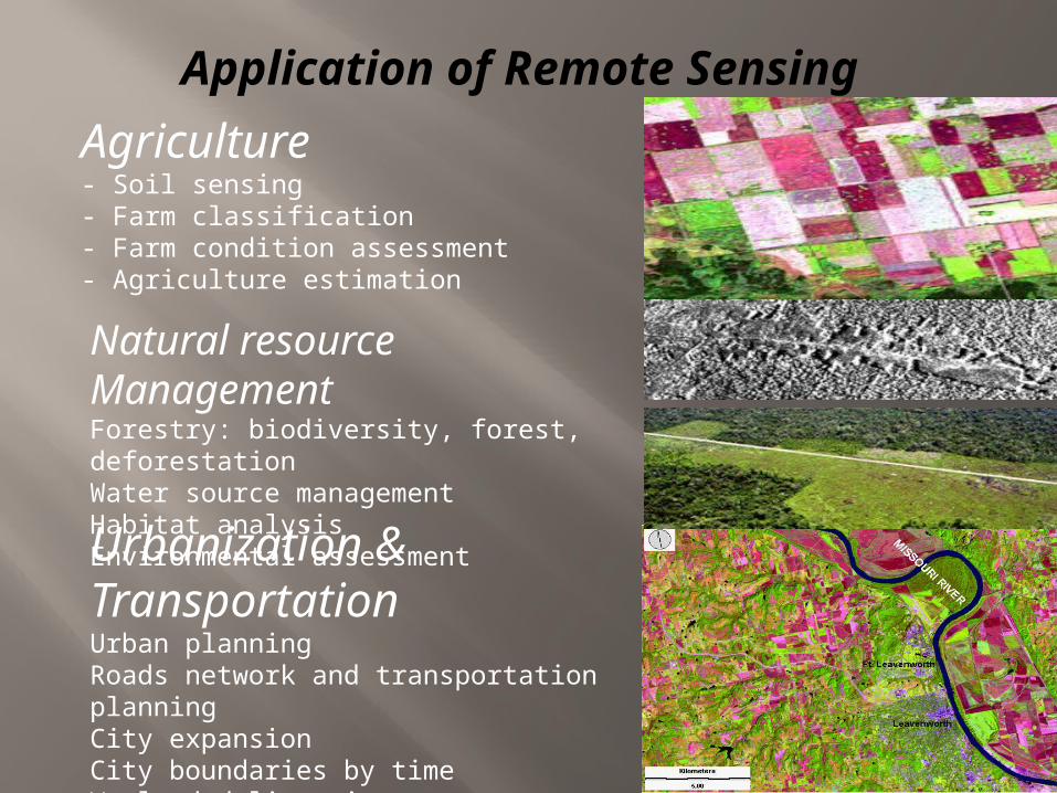
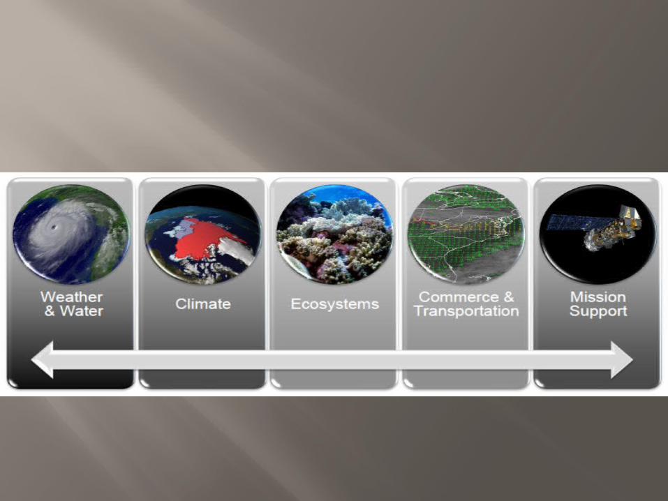
Application of Remote Sensing
Image source: www.ldeo.columbia.edu
Image source: www.geospectra.net
Agriculture- Soil sensing- Farm classification - Farm condition assessment - Agriculture estimation
Natural resource ManagementForestry: biodiversity, forest, deforestationWater source managementHabitat analysisEnvironmental assessment
Urbanization & TransportationUrban planningRoads network and transportation planningCity expansionCity boundaries by timeWetland delineation
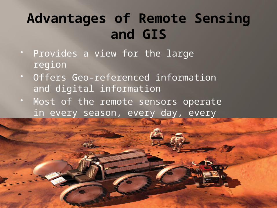
Advantages of Remote Sensing and GIS Provides a view for the large region Offers Geo-referenced information and digital
information Most of the remote sensors operate in every
season, every day, every time and even in real tough weather
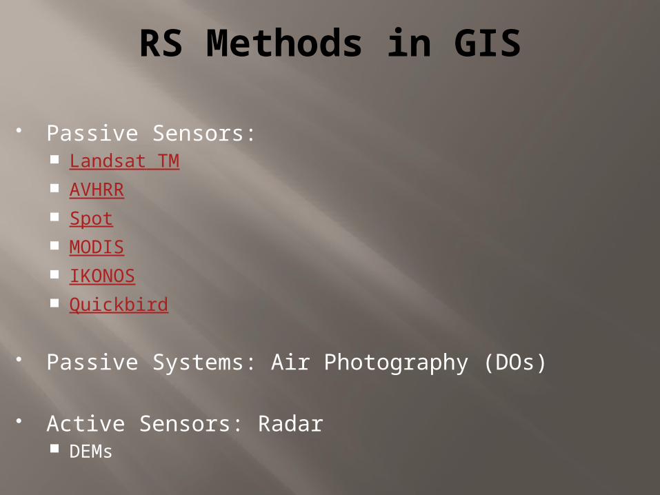
RS Methods in GIS
Passive Sensors: Landsat TM AVHRR Spot MODIS IKONOS Quickbird
Passive Systems: Air Photography (DOs)
Active Sensors: Radar DEMs
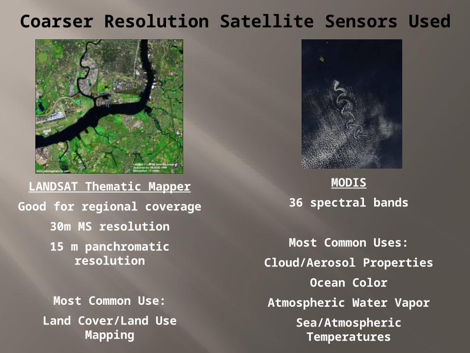
Coarser Resolution Satellite Sensors Used
LANDSAT Thematic MapperGood for regional coverage
30m MS resolution15 m panchromatic
resolution
Most Common Use:Land Cover/Land Use
Mapping
MODIS36 spectral bands
Most Common Uses:Cloud/Aerosol Properties
Ocean ColorAtmospheric Water Vapor
Sea/Atmospheric Temperatures
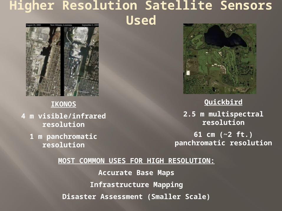
Higher Resolution Satellite Sensors Used
Quickbird2.5 m multispectral
resolution61 cm (~2 ft.) panchromatic
resolution
IKONOS4 m visible/infrared
resolution1 m panchromatic
resolution
MOST COMMON USES FOR HIGH RESOLUTION:Accurate Base Maps
Infrastructure MappingDisaster Assessment (Smaller Scale)
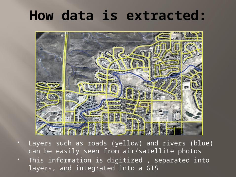
How data is extracted:
Layers such as roads (yellow) and rivers (blue) can be easily seen from air/satellite photos
This information is digitized , separated into layers, and integrated into a GIS
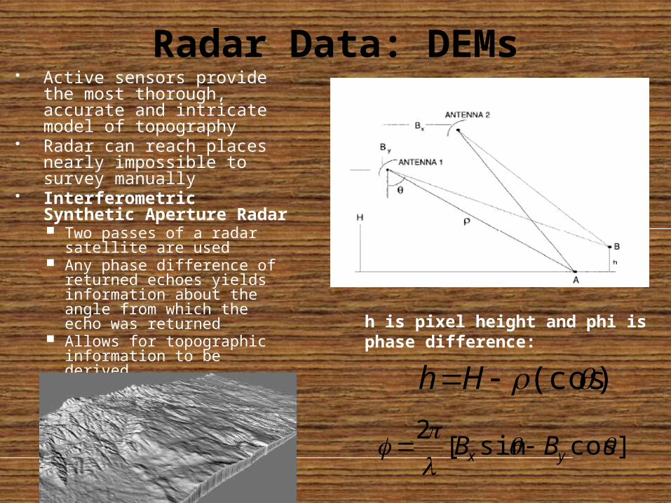
Radar Data: DEMs Active sensors provide the
most thorough, accurate and intricate model of topography
Radar can reach places nearly impossible to survey manually
Interferometric Synthetic Aperture Radar Two passes of a radar
satellite are used Any phase difference of
returned echoes yields information about the angle from which the echo was returned
Allows for topographic information to be derived
]cossin[2 yx BB
)(cosHh
h is pixel height and phi is phase difference:
Some Image Processing Software ERDAS Imagine ENVI ILWIS ArcGIS
25
Conclusion and Futures ofRemote Sensing & GIS
User interfaces continue to become more standardized An increased number of RS platforms is leading to more
accurate and more easily acquirable data Geospatial Law & Privacy Issues
becoming more of an issue as resolution increases who has a right to be looking at pictures of one’s home in ½ m
resolution? GIS is becoming more globally accepted Increasing resolutions of RS platforms has lead to increasing
amounts of data can the large amount of data be handled and stored efficiently? can this data be incorporated into a GIS that is not overwhelmingly
large? The current era (and times to come, most likely) continues to
emphasize visualization of information Remote Sensing images are key to this aspect
THANK YOU
PRESENTED BY NACHIAPPAN V
Top Related