


![Paper T03 Groundwater Recharge final - Uni Stuttgart€¦ · The Role of Groundwater Recharge in Regional Scale Integrated Groundwater Flow Modelling [1]Roland BARTHEL, [1]Johanna](https://static.fdocument.pub/doc/165x107/5ecce93663134f68651a6ecd/paper-t03-groundwater-recharge-final-uni-stuttgart-the-role-of-groundwater-recharge.jpg)


Languages
Pages
Legal

1
ISMAIL C.MOHAMAD
GROUNDWATER
MONITORING
IN
MALAYSIA
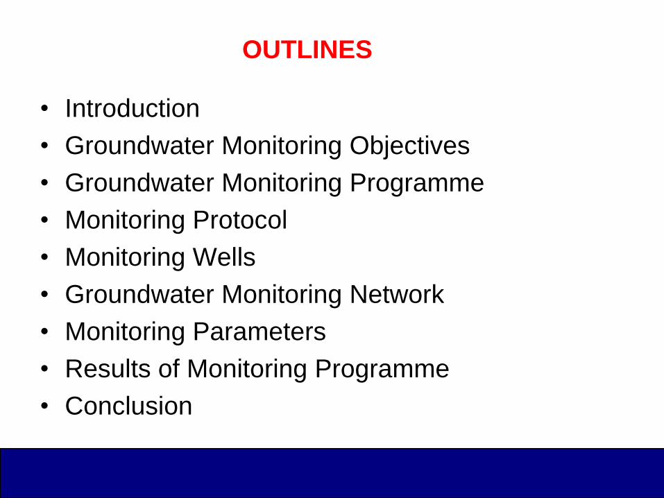
OUTLINES
• Introduction
• Groundwater Monitoring Objectives
• Groundwater Monitoring Programme
• Monitoring Protocol
• Monitoring Wells
• Groundwater Monitoring Network
• Monitoring Parameters
• Results of Monitoring Programme
• Conclusion
INTRODUCTION
• One of the activities carried out by the Minerals
and Geoscience Department (JMG) is to monitor
the groundwater quality.
• Since the programme started in 1989 until 2009,
more than 400 monitoring wells were
established .
• It involves periodical monitoring of groundwater
levels and groundwater quality at the selected
wells on a periodic basis.
GROUNDWATER MONITORING OBJECTIVES
• Performed in a number of situations with varying
objectives.
• Generally, to determine the quality and trends of
water quality especially at public water supply
sources.
• Also to determine contaminants if they are
increasing, decreasing, or remaining in the same
range at contamination site.
• JMG objective: to acquire data for regional
groundwater management plans.
GROUNDWATER MONITORING PROGRAMME
• Initiated by the Geological Survey Department
(GSD) in 1989
• A network of monitoring wells was specially
designed and constructed to monitor the water
quality and water level changes in the alluvial
aquifer systems of Kelantan River basin.
• Programme was expanded as to include areas
where active groundwater pumping was being
carried out by state water supply authority, such
as in Terengganu, Pahang, Kedah and Perlis.

GROUNDWATER MONITORING PROGRAMME
cont..
• Monitoring was carried out using existing
JKR/JBA wells and supplemented by GSD's own
well where is possible
• In Kuantan-Pekan-Rompin area, the exploration
wells constructed during Regional
Hydrogeological Studies by GSD were used as
monitoring wells.
• In that time, Hydrogeological Unit, in Ipoh role
over all the monitoring programme.
• Previously, a total of 130 wells is monitored
regularly in Peninsular Malaysia

Location of Groundwater Monitoring Sites
A – Kota Bharu (Network)
B – Kg. Kepong, K. Terengganu
C – Kg. Sg. Ular, Kuantan
D – Kg. Padang, Kuantan
E – Nenasi Water work, Pekan
F – Kuantan – Pekan (Network)
G – Kuala Rompin
H – Kg. Pulau Manis, Pekan
I – Kg. Bohor Bharu, Temerloh
J – Arau, Perlis
K – Alor Semadong, Perlis
L – Chuping, Perlis
M – Rimba Mas, Perlis
N – Bukit Kemoja, P. Langkawi
O – Bukit Dundong, P. Langkawi
P – Teluk Datuk, Olak Lempit

STATETOTAL NOS.
OF WELLLOCATION
Terengganu 55 Besut, Kuala Terengganu, Kemaman, Setiu, Dungun, Kuala. Berang, Pulau
Redang, Pulau Perhentian, Pulau Kapas, and Pulau Bidong)
Kelantan 69 Bharu, Tumpat and Bachok
Pahang 16 Sg. Ular, Cherating; Kg. Padang, Kuantan; Pulau Manis, Kuantan; Nenasi,
Bohor Bharu (1994), Rompin (1991); Network Pekan
Kedah 15 Kuala Muda, Yan dan Pendang
Perlis 1 Arau
Pulau Pinang 3 Permatang Bongor
Perak 40 Pengkalan Hulu,
Selangor 40 Banting
Negeri Sembilan 12 Jelebu, Kuala Pilah, Rembau, Tampin and Sban
Melaka 6 Jasin and Alor Gajah
Johor 50 Johor Bharu, Pontian, Tinggi, Keluang, Segamat, Muar, Bat Pahat and
Mersing
Sabah 60 Sipitang, Beaufort, Kuala Penyu, Menumbok, Papar, Kota Belud, Kota
Marudu, Pitas dan Kudat
Sarawak 52 (JKR well fields) Kabong, Belawai, Paloh, Igan, Oya and Kuala Tatau,
(selected area) Kuala Sibuti, Kuala Nyalau, Rambungan and Bako
TOTAL 419
LOCATION OF MONITORING WELL SITES IN MALAYSIA
GROUNDWATER MONITORING PROGRAMME
cont.. • Groundwater monitoring programme carried out by
Department of Environment (DOE) has been
intensifically established since 1997.
• The groundwater monitoring programme was expanded
for Sarawak in October 2002 and Sabah in December
2002.
• To-date there are 122 groundwater monitoring wells that
constitute the DOE‘s monitoring network.
• Monitoring well sites targeted at areas potentially
vulnerable to contamination which based on landuse.
(eg. industrial, animal burial, rural, urban/suburban,
agricultural area; golf courses and landfills).

Groundwater Monitoring sites
- DOE
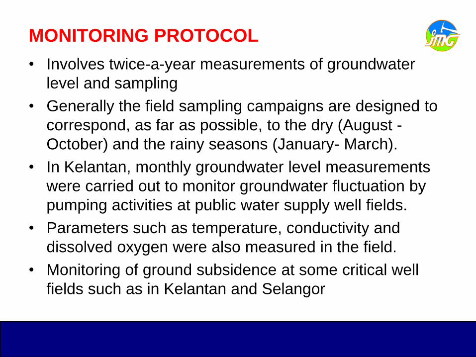
MONITORING PROTOCOL
• Involves twice-a-year measurements of groundwater
level and sampling
• Generally the field sampling campaigns are designed to
correspond, as far as possible, to the dry (August -
October) and the rainy seasons (January- March).
• In Kelantan, monthly groundwater level measurements
were carried out to monitor groundwater fluctuation by
pumping activities at public water supply well fields.
• Parameters such as temperature, conductivity and
dissolved oxygen were also measured in the field.
• Monitoring of ground subsidence at some critical well
fields such as in Kelantan and Selangor
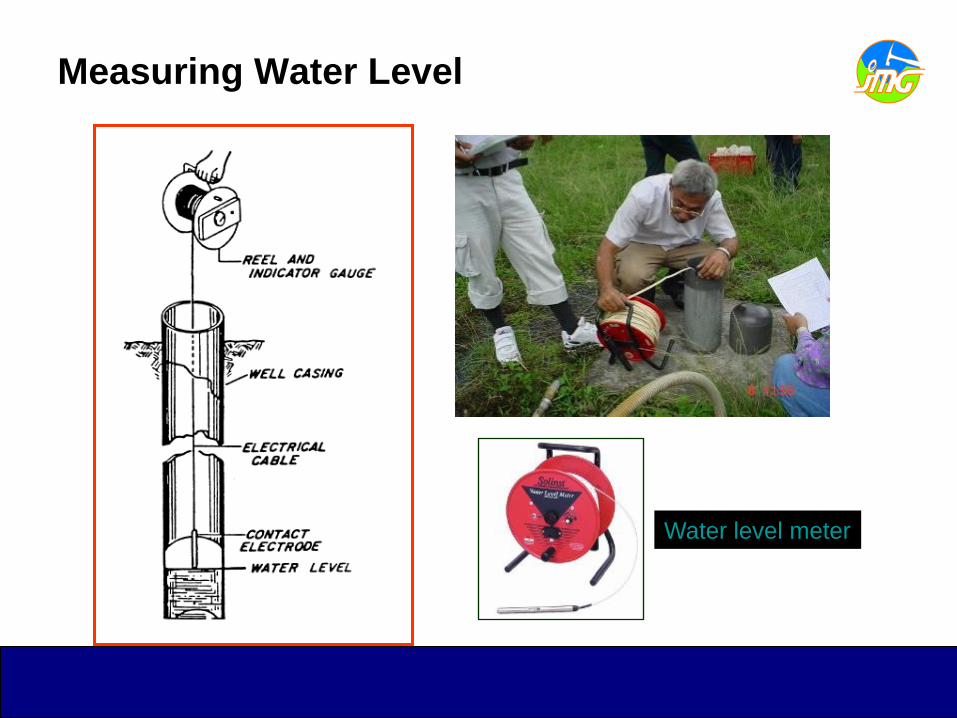
Measuring Water Level
Water level meter
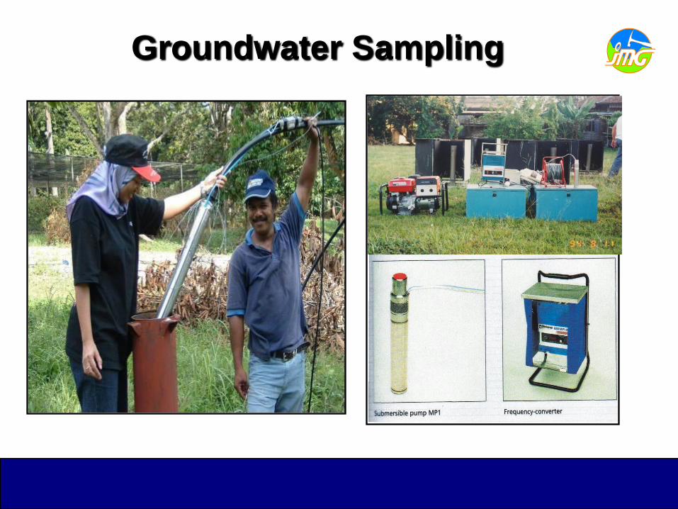
Groundwater Sampling
MONITORING WELL
• Generally, two types of monitoring wells are used which
is cluster type and individual wells.
• Cluster type represents as a multilevel-type of monitoring
system that permits sampling of groundwater from
several different depths.
• This type of well was constructed in monitoring well
networks at Kelantan (Kelantan River Basin), Selangor
(Langat River Basin) and Pahang (Pekan-Nenasi area).
• The individual wells are mainly exploration wells that
converted to monitoring wells.
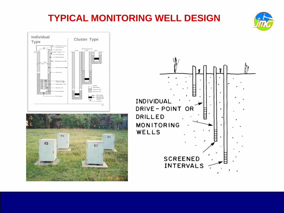
TYPICAL MONITORING WELL DESIGN
Individual
TypeCluster Type

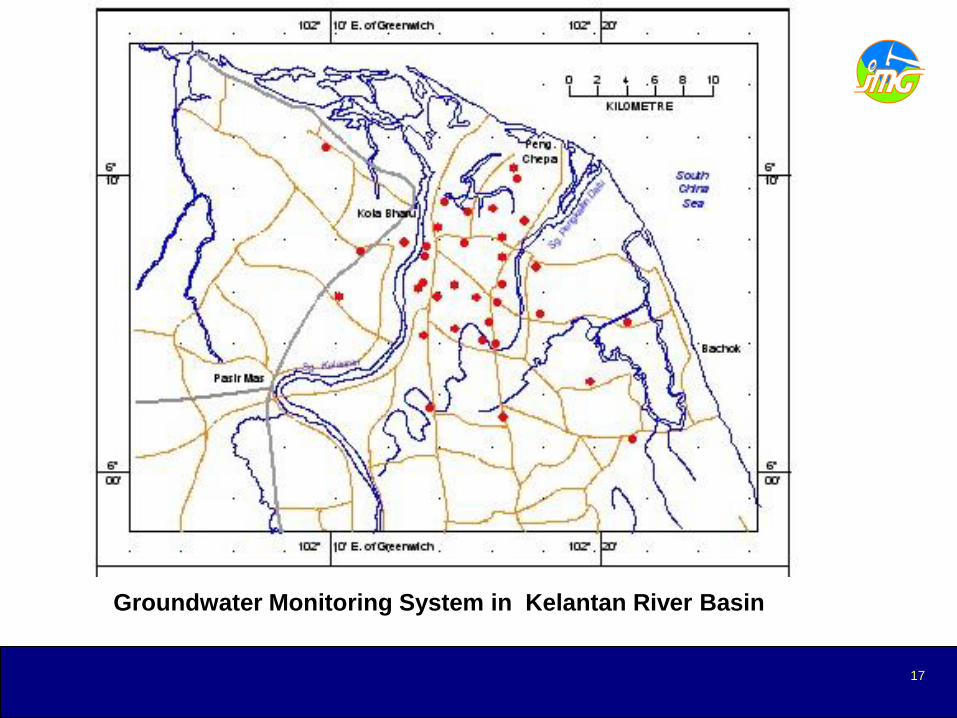
Kelantan River Basin
• Total 69 Nos. of monitoring wells (cluster and individual type)
• Constructed on 1989-1992
• Well depth ranging from 10m – 75m
Langat River Basin
• Total 24 Nos. of monitoring wells (12 shallow and 12 deep)
• Constructed on 1998-2000
• Well depth ranging from 5m – 50m
Kuantan – Pekan – Rompin
• Total 31 Nos. of monitoring wells
• Constructed on 1991-1992
• Well depth ranging from 6.1m – 119.5m
Groundwater Monitoring Network
17
Groundwater Monitoring System in Kelantan River Basin
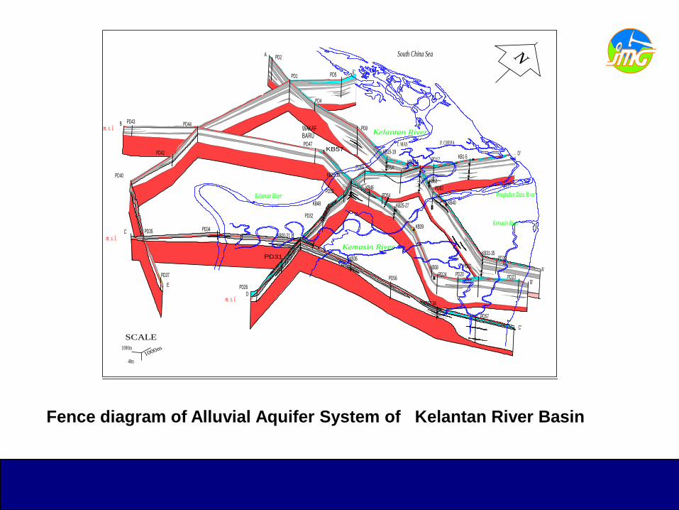
Fence diagram of Alluvial Aquifer System of Kelantan River Basin
A
A'
B
B'
C
C'
D
D'
E
E'
PD2
PD1 PD5
PD43 PD44
PD42
PD40
PD35
PD37
PD34
PD26
KB20-21
PD32
KB48
PD52
KB28-30
PD55 PD14KB6-14 PD17
KB1-5
KB36
PD56
KB22-34
PD57
PD47
KB46
PD54
KB25-27
KB39
KB58
PD24 PD20
PD21
PD23
PD4
PD8
KB15-19
PD62
KB40
KB31-35PD22
KB57
WAKAF BARU
T. MAS P. CHEPA
SCALE
1000m1000m
40m
N
Aquifer (Sand, Gravel)
1 - Shallow aquifer2 - Deep aquifer
Aquitard (Clay, Silt)
Basement Rocks
(granite, metasediment)
Screen position of monitoring well
Screen position of production well
LEGEND
South China Sea
Kelantan River
Kemasin River
Kelantan Riverm. s. l.
m. s. l.
m. s. l.
Pengkalan Datu River
KB52
PD31
Kemasin River
Mean Sea level - m.s.l.12
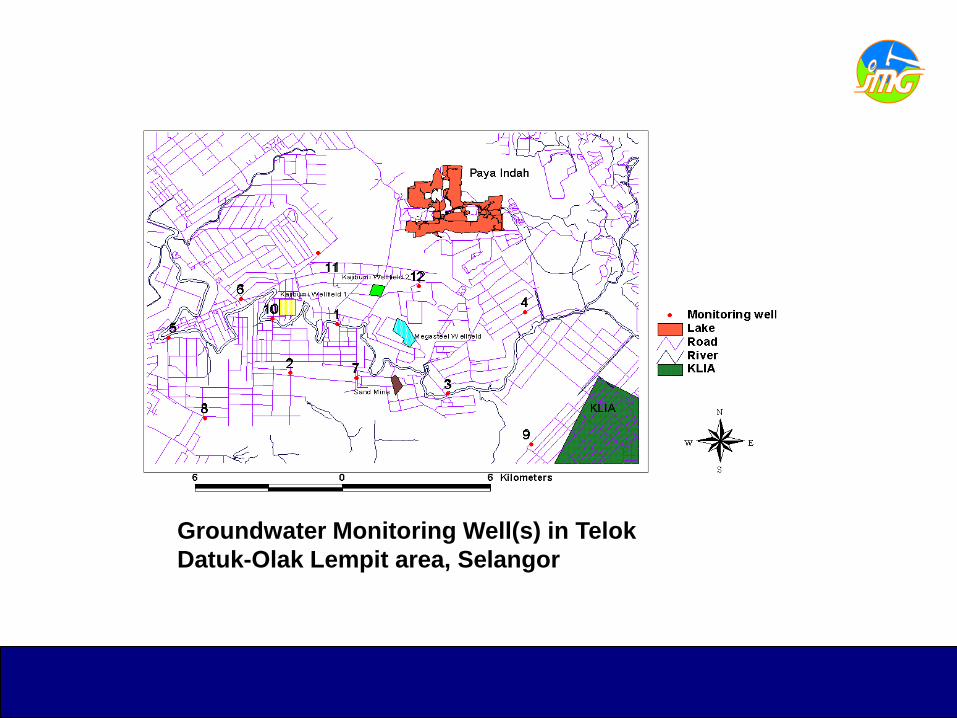
Groundwater Monitoring Well(s) in Telok
Datuk-Olak Lempit area, Selangor

Kuantan
Tanjong Agas
Tanjong Batu
Kuala Rompin
Nenasi
S.K
uantan
S. Belat
S.Penor
S.PAHANG
S.Bebar
S.Merchong
S.R
om
pin
S.Pontian
Anak
Kg. Runchang
Song Cheng Enterprise (M)Sdn. Bhd.(Kolam Ternak Belut)
Laut China Selatan
KN 5
KN 1KN 2
KN 3-4
KN 9-10KN 6-8
KN 23-24
KN 27
KN 28
KN 11-12
KN 21-22
KN 25
KN 26
KN 19-20
KN 17-18
KN 16
KN 14-15
KN 13
103 15' T 103 30' T
Skala
0 2 4 6 8 10 KmKm
Pekan
245' U
300' U
315' U
330' U
345' U
245' U
300' U
315' U
330' U
345' U
103 15' T 103 30' T
Groundwater Monitoring Well(s) in
Kuantan-Pekan-Rompin area, Pahang
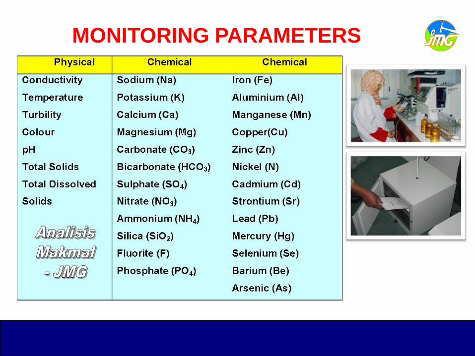
MONITORING PARAMETERS
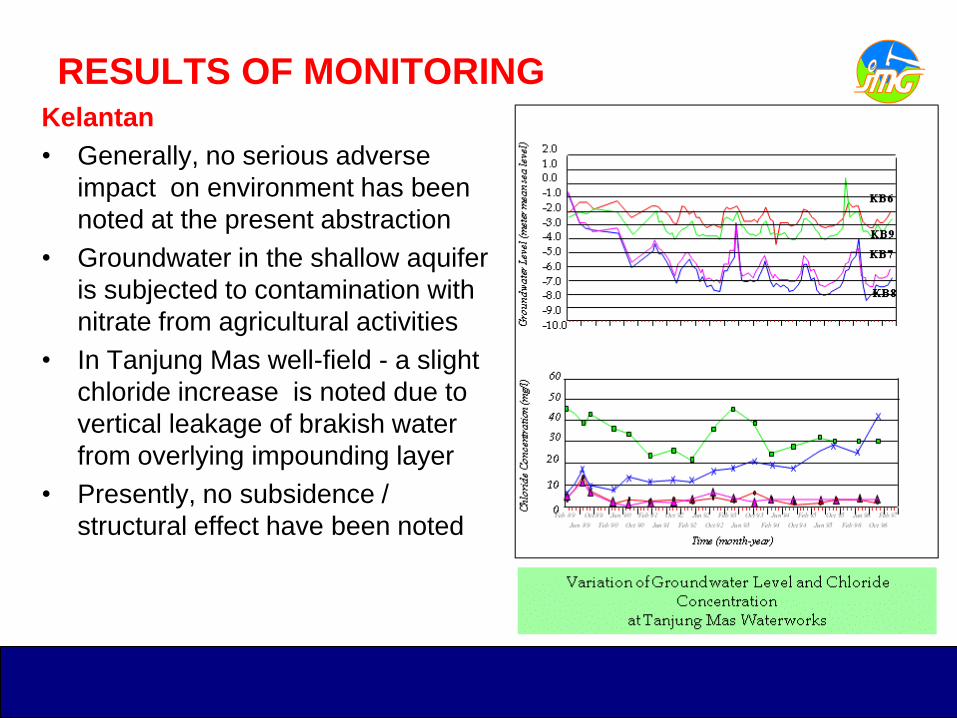
RESULTS OF MONITORINGKelantan
• Generally, no serious adverse
impact on environment has been
noted at the present abstraction
• Groundwater in the shallow aquifer
is subjected to contamination with
nitrate from agricultural activities
• In Tanjung Mas well-field - a slight
chloride increase is noted due to
vertical leakage of brakish water
from overlying impounding layer
• Presently, no subsidence /
structural effect have been noted
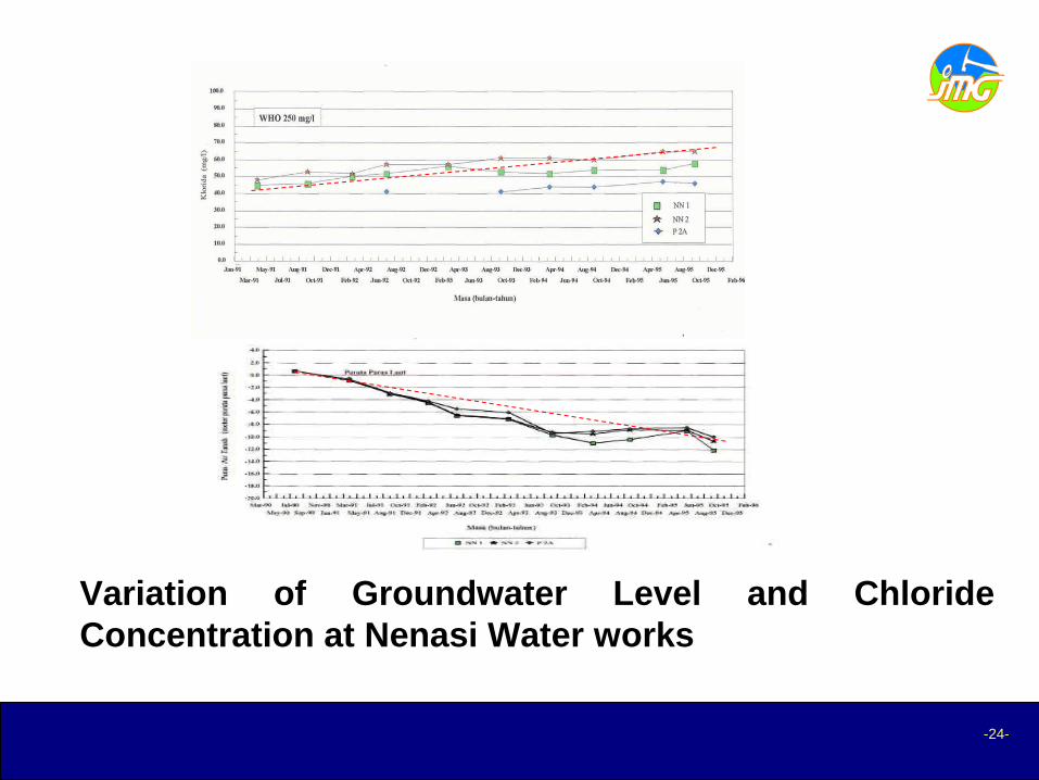
RESULTS OF MONITORINGPahang
• Results from the monitoring programme shows that the overall
groundwater quality remain at the original state except in the
confined aquifer of Tanjung Batu and Nenasi areas, which
register increase in chloride content.
• A significant lowering of groundwater level also was indicated in
the confined aquifer in Pekan - Nenasi area due to large scale
groundwater abstraction in this area in 1996 until 2001. While, the
groundwater level for others areas remain high.
• Iron is also generally high and can even exceed 30 mg/l.
• Nitrate is generally low except in the Sungai Merchong area
where values between 10-20 mg/l are noted.
-24-
Variation of Groundwater Level and Chloride
Concentration at Nenasi Water works
-25-
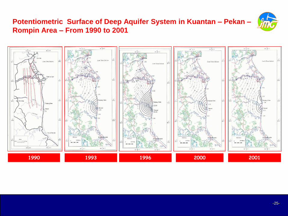
Potentiometric Surface of Deep Aquifer System in Kuantan – Pekan –
Rompin Area – From 1990 to 2001
1990 1993 1996 2000 2001
-26-
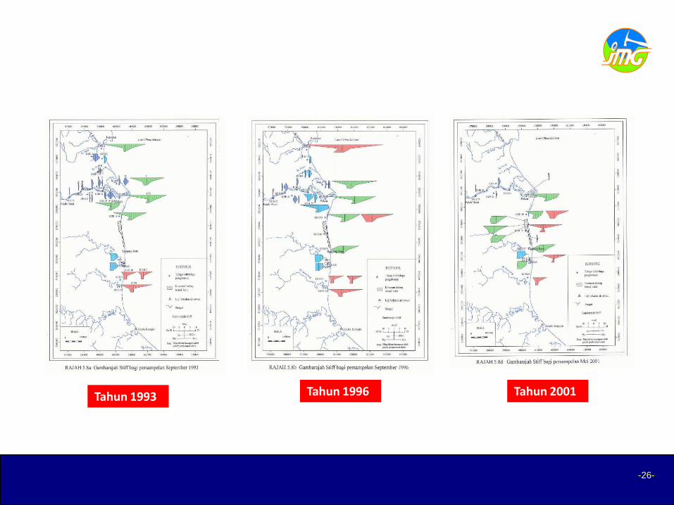
Tahun 1993 Tahun 1996 Tahun 2001
RESULTS OF MONITORING cont…
Selangor
• From the initial observations made at the monitoring
wells, the quality of groundwater does not change much
as only some variations occur.
• The high values of chloride is found only at the western
part of the lower Sungai Langat basin closer to the coast.
• Only few monitoring wells show results which have some
influence on the pumping activities. The obvious drops in
water level is the monitoring well MWDI.
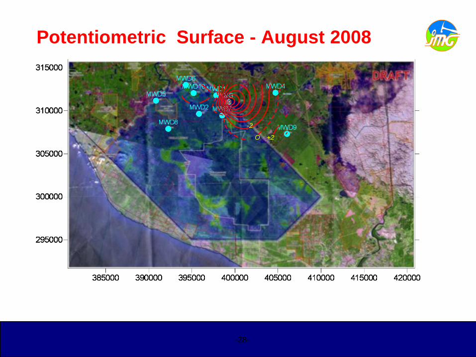
Potentiometric Surface - August 2008
O +2
-2
-28-

Land Subsidence
• In Langat River Basin, elevations of twenty shallow (20)
benchmarks were measured to monitor the land
subsidence.
• JICA reported on 2002, a total of eight (8) benchmarks,
namely BM3, 4, 7, 12, 14, 15, 16 and 20, indicate
continuous settlement.
• Consolidation by draining of peaty/clayey material that
are widely spread over the Basin may result in the
subsidence around the area.
29
RESULTS OF MONITORING

Land Subsidence Measurement
14 February 2006
Land subsidence measurement by 20 shallow benchmarks with corresponding deep datum

• Monitoring on ground subsidence, showing in 8 years period,
the ground subsidence is about 20-30cm
• Occur in area about 1 km from the active pumping activity
(Megasteel).
GROUND SUBSIDENCE CONTOUR
Sarawak
• Two areas that have significant change in groundwater quality is
Kabong and Igan. Other areas have little change in groundwater
quality. Changes in concentrations and trends of some ions such as
sulfate may be suggested that groundwater is being partly affected
by human activities such as agricultural activities.
Sabah
• Overall groundwater quality is good except of iron, manganese, and
nitrate slightly exceeded WHO standard.
Perak
• The general water quality is good, except of high iron content (well
No. 151 – 178)
32
RESULTS OF MONITORING
Kedah
• The general water quality at both the monitoring sites remains good,
and no significant change from the original quality is noted except of
high iron content
Perlis
• In Arau, Perlis, the chloride content is slightly higher than usual for
groundwater derived from a limestone aquifer due to mixing of
slightly brackish water from the overlying clay. ).
• Elevated of nitrate level (10-25 mg/l) found in groundwater sample
collected from Rimba Mas well due to anthropogenic activities
carried out from agricultural practices in the surrounding area.
Pulau Pinang
• Chloride content found exceeded WHO drinking water standard
content found in groundwater sample collected from Permatang
Bongor area..
33
RESULTS OF MONITORING
Negeri Sembilan
• The general water quality at both the monitoring sites remains good,
and no significant change from the original quality is noted except of
high iron content. High fluoride content found in groundwater sample
collected from Jelebu area.
Melaka
• No significant change from the original quality is noted except of
high iron content. Elevated fluoride level found in groundwater
sample collected from Alor Gajah area (MTW 32)
Johor
• The groundwater quality remains very good and no significant
changes.
Terengganu
• The groundwater quality remains very good and no significant
changes.
34
RESULTS OF MONITORING

CONCLUSION
• The overall groundwater quality remain at the original
state except in the confined aquifer of Tanjung Batu
areas of Pahang.
• Generally, iron and manganese content in groundwater
usually found exceeding the limits recommended by the
WHO especially in alluvial aquifer.
• However, due to rapid urbanisation and industrial as well
as agricultural developments, there is an increasing
threat of contamination to the groundwater
• Groundwater protection zone need to be established to
avoid contamination and sterilization of aquifers

Top Related