What they are and how to get them - preparingtexas.org Conference...What they are and how to get...
24
Emergency Response Maps What they are and how to get them … David W. Allen, GISP State Director of Operations Texas Emergency GIS Response Team [email protected] www.TexasEGRT.org Slide 1 of 314
-
Upload
nguyenhanh -
Category
Documents
-
view
217 -
download
4
Transcript of What they are and how to get them - preparingtexas.org Conference...What they are and how to get...
Emergency Response
Maps
What they are and how
to get them …David W. Allen, GISP
State Director of Operations
Texas Emergency GIS Response Team
www.TexasEGRT.org
Slide 1 of 314
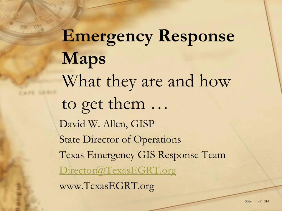
What is Texas EGRT
• Deployable GIS mapping team 1-844-Tex-EGRT
• Started as a regional group in 2006 after the Space Shuttle disaster
− Represented 14 cities
• Expanded to a state-wide group in 2014 at the request of TDEM
− Started in TDEM Region 1 as a Pilot Study
− 42 Counties in North Texas
− Trained GIS responders and participated in exercises
− Built trust with EMC’s and regional agencies
• Over 200 Members all over the State of Texas
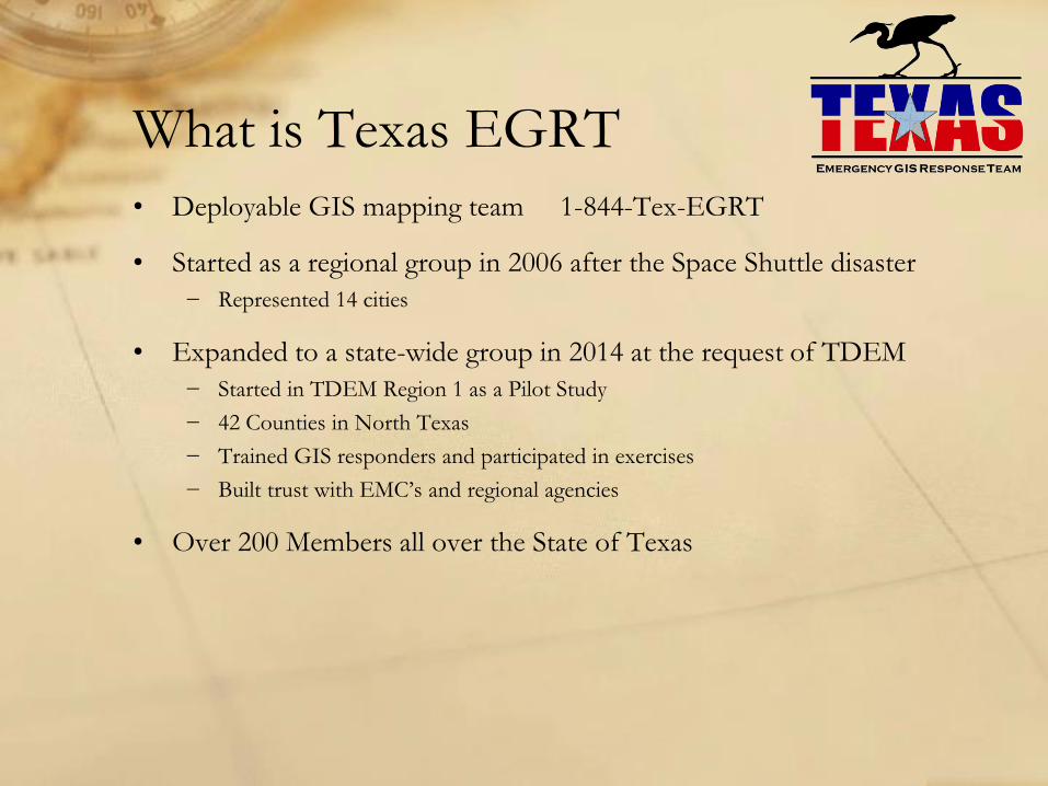
Currently Active in
Regions 1, 4, and 6
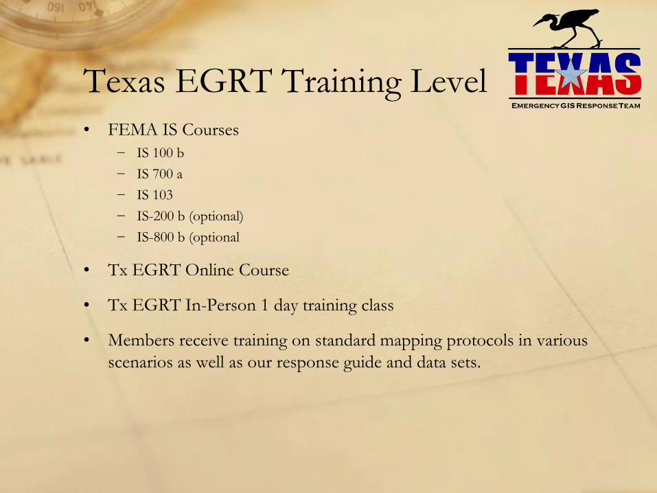
Texas EGRT Training Level
• FEMA IS Courses
− IS 100 b
− IS 700 a
− IS 103
− IS-200 b (optional)
− IS-800 b (optional
• Tx EGRT Online Course
• Tx EGRT In-Person 1 day training class
• Members receive training on standard mapping protocols in various
scenarios as well as our response guide and data sets.
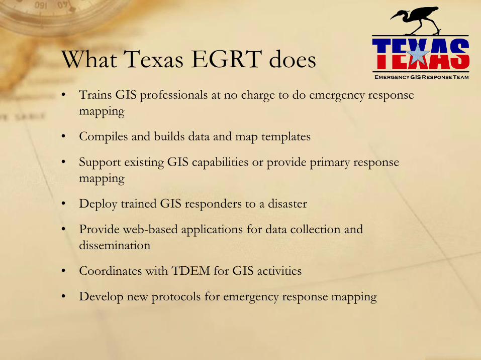
What Texas EGRT does
• Trains GIS professionals at no charge to do emergency response
mapping
• Compiles and builds data and map templates
• Support existing GIS capabilities or provide primary response
mapping
• Deploy trained GIS responders to a disaster
• Provide web-based applications for data collection and
dissemination
• Coordinates with TDEM for GIS activities
• Develop new protocols for emergency response mapping
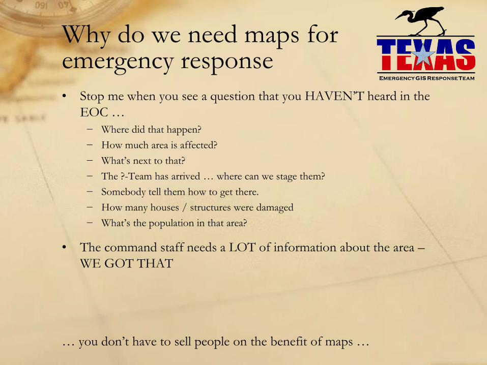
Why do we need maps for emergency response
• Stop me when you see a question that you HAVEN’T heard in the
EOC …
− Where did that happen?
− How much area is affected?
− What’s next to that?
− The ?-Team has arrived … where can we stage them?
− Somebody tell them how to get there.
− How many houses / structures were damaged
− What’s the population in that area?
• The command staff needs a LOT of information about the area –
WE GOT THAT
… you don’t have to sell people on the benefit of maps …
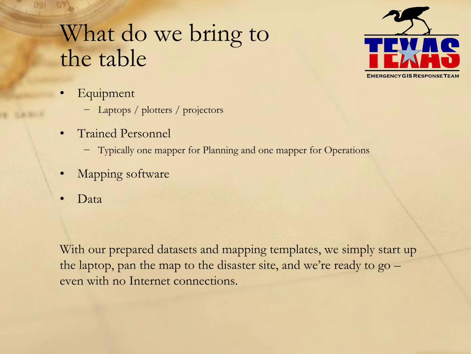
What do we bring to the table
• Equipment
− Laptops / plotters / projectors
• Trained Personnel
− Typically one mapper for Planning and one mapper for Operations
• Mapping software
• Data
With our prepared datasets and mapping templates, we simply start up
the laptop, pan the map to the disaster site, and we’re ready to go –
even with no Internet connections.
Why call us … Why not DIY?
• Don’t tie up your trained responders by appointing them “The Map
Guy”
• We integrate well with specialty response teams that realize they
need mapping
• We utilize high-level map software and apps with tons of capabilities
− 9 Piece Tinker Toy Set VS. Deluxe Erector Set
− We got the Tools … We got the Talent
Emergency Mapping in Texas
• Many larger cities and state agencies have formed GIS response
teams
− Members from multiple departments
− Compiled local datasets
• Texas Emergency GIS Response Team (Tx EGRT)
− Training protocols set up
− Available ArcGIS software and ArcGIS Online
− Over 200 members state-wide
− State-wide data and map templates set up and ready
• Texas Division of Emergency Management (TDEM)
− GIS analysts on staff for the State Operations Center w/ support
− Plotters at the regional EOC’s
− Available computers (coming soon)
The goal is to integrate other response teams, Texas EGRT, and TDEM
into a state-wide GIS resource
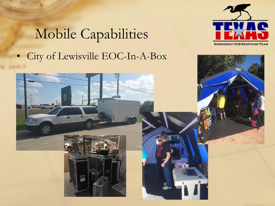
Mobile Capabilities
• City of Lewisville EOC-In-A-Box
Mobile Capabilities
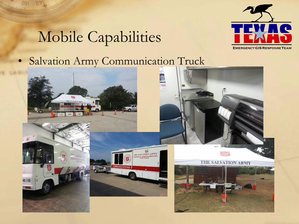
• Salvation Army Communication Truck
Mobile Capabilities
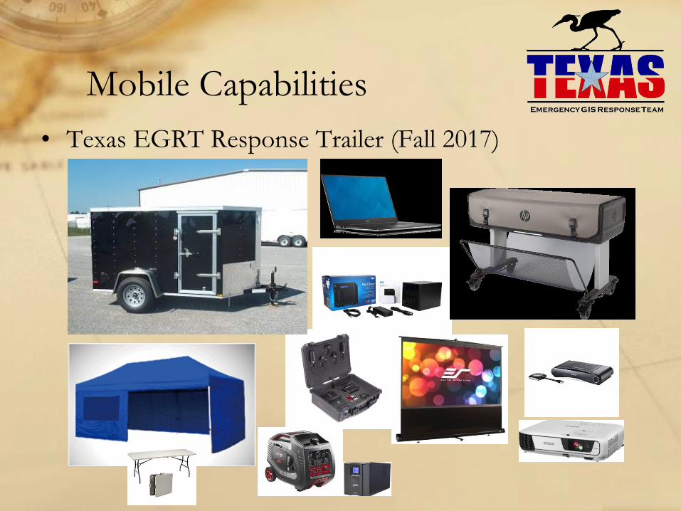
• Texas EGRT Response Trailer (Fall 2017)
Texas EGRT Responses
• Multiple flood events
• Dam monitoring events
• LP Tanker truck accident
• Pope’s visit to Juarez, Mexico (supporting state operations in El
Paso)
• Multiple full-scale exercises
• High profile responses:
− Ebola cases in Dallas
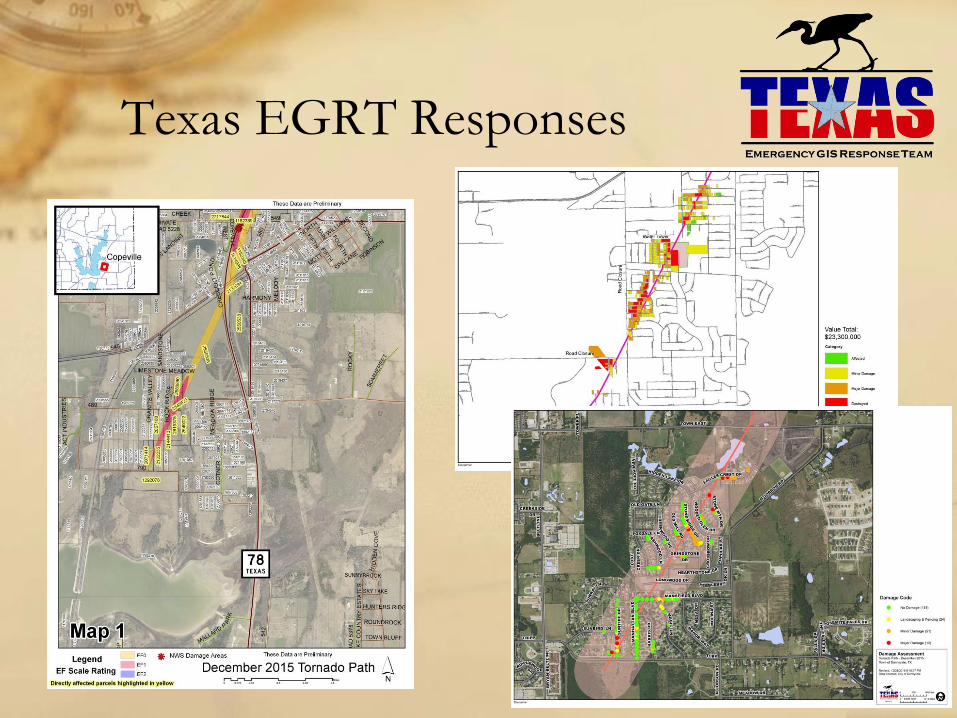
− Christmas 2015 tornadoes in Rowlett / Garland
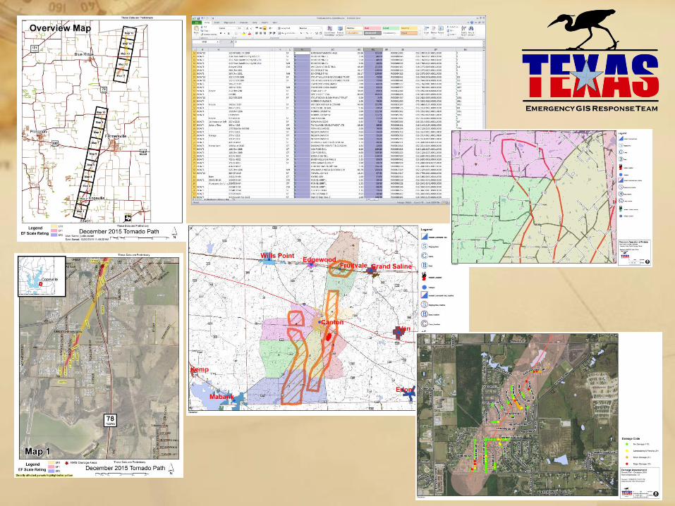
− April 2017 tornadoes in Canton / Van Zandt County
Texas EGRT Responses
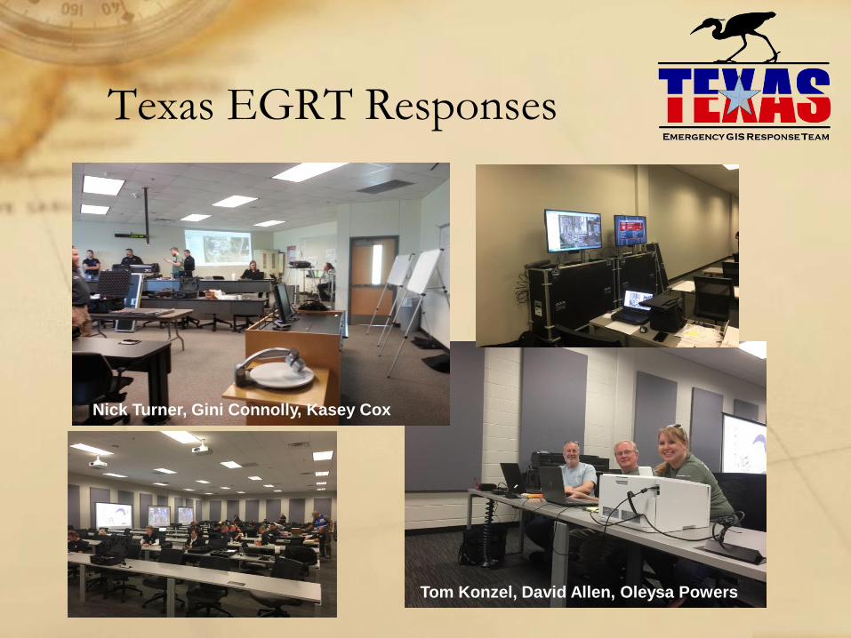
Nick Turner, Gini Connolly, Kasey Cox
Tom Konzel, David Allen, Oleysa Powers
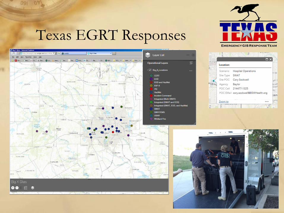
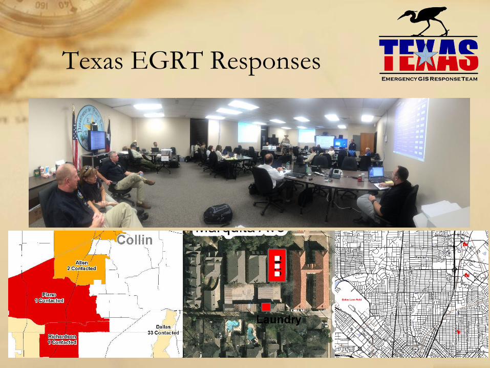
Texas EGRT Responses
Texas EGRT Responses
Texas EGRT Responses
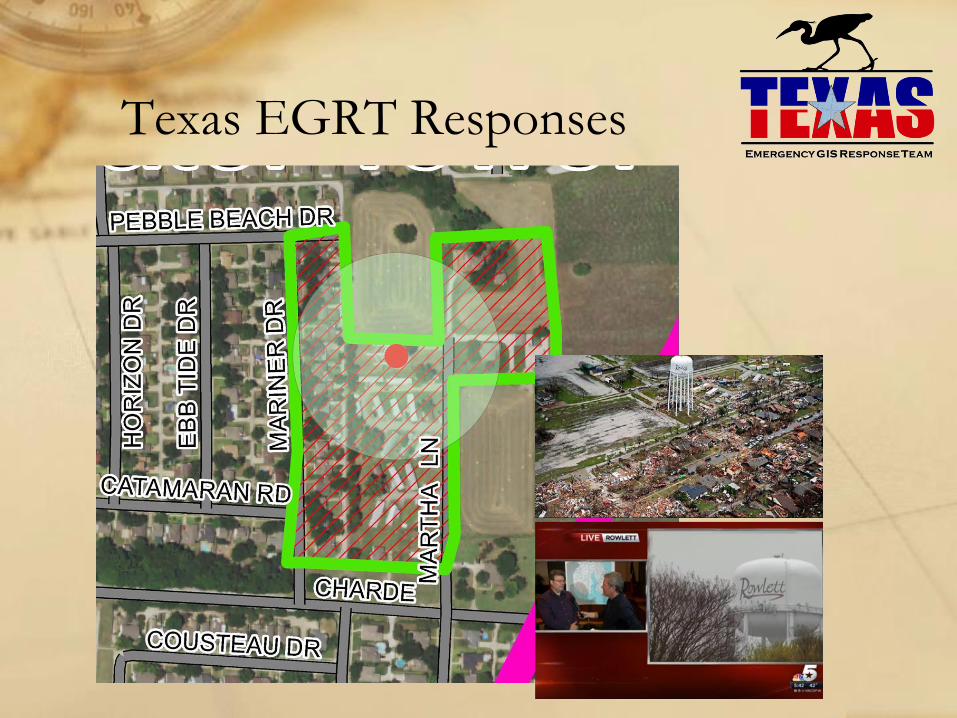
Texas EGRT Responses

Future for Emergency Response Mapping
• Drone Information can be imported into the mapping or put on a
web map.
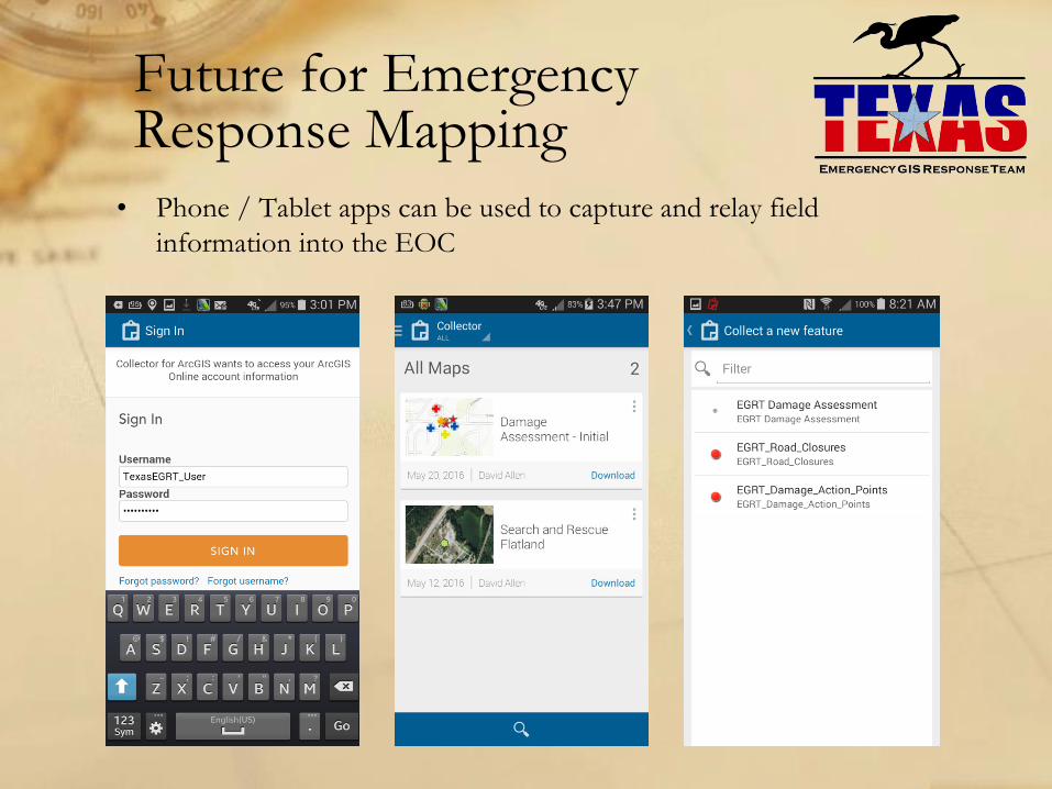
Future for Emergency Response Mapping
• Phone / Tablet apps can be used to capture and relay field
information into the EOC
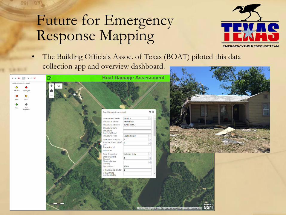
Future for Emergency Response Mapping
• The Building Officials Assoc. of Texas (BOAT) piloted this data
collection app and overview dashboard.
Conclusions
• Texas EGRT is experienced and prepared to provide mapping
services in the EOC / Command Post in most of the state
• There are other agencies at the local, regional, or state level that can
supply on-site mapping services
• Mapping is expanding from printed paper maps to include web
services
• Drones and or Mobile Device apps can be used for field collection
• We are working to integrate mapping capabilities across different
agencies to provide comprehensive mapping support

Questions
& CommentsDavid W. Allen, GISP
817-685-1633
www.TexasEGRT.org