Water Report Pacific Crest Trail - WordPress.com · text (619) 734-7289 ... The Water Report uses a...
20
Pacific Crest Trail Water Report March 11, 2016 7PM Pacific Standard Time Please put phones on mute unless speaking. This will reduce background noise. Thank You!!!
-
Upload
vuongkhuong -
Category
Documents
-
view
213 -
download
0
Transcript of Water Report Pacific Crest Trail - WordPress.com · text (619) 734-7289 ... The Water Report uses a...
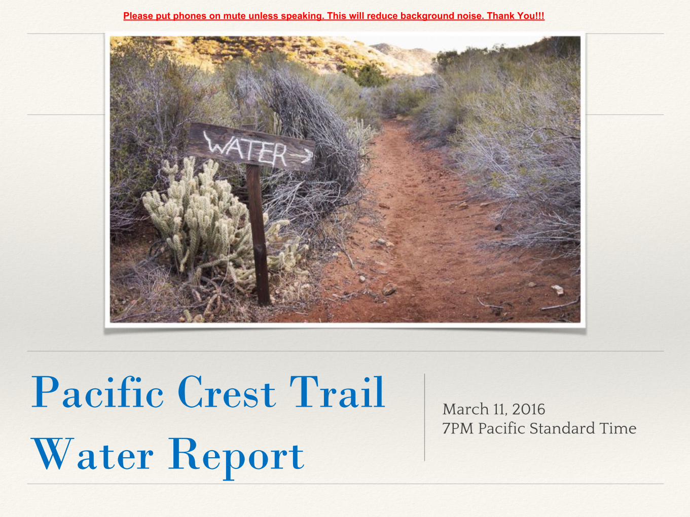
Pacific Crest TrailWater Report
March 11, 20167PM Pacific Standard Time
Please put phones on mute unless speaking. This will reduce background noise. Thank You!!!

About the PCT Water Report● This presentation can be downloaded in PowerPoint format at
● Available online at www.pctwater.com
● Water reports from Pacific Crest Trail hikers on the trail
● HTML or PDF file formats
● Often updated several times a day
● Please send Water Report updates to:
● email [email protected]
● text (619) 734-7289
● call (619) 734-7289 (no one will answer, leave voice mail)

New for 2016● The Water Report was started and maintained for many
years by AsABat. It is now maintained by Halfmile and DoubleTap.
● Expanded coverage for NorCal, Oregon, Washington.
● Reformatted: Campo to Idyllwild, Idyllwild to Action, and Acton to Cottonwood pass for more convenient printing and downloading.
● Stricter standards for reports about water caches.
● @pctwater Twitter account for 2016.

A note about PCTHYOH app
● Sadly, Ruffwork the developer of the PCTHYOH app passed away on April 17, 2014.
● Many hikers used the PCTHYOH app to cache the Water Reports for offline viewing on smartphones.
● The PCTHYOH app no longer available in the iPhone app store. It should still work if already installed on your iPhone. Still available on the Google Play store.
● The PCTHYOH app will not display the new Northern California, Oregon, and Washington Water Reports.
● We suggest using one of the many available PDF reader apps offline Water Report viewing.


Water Caches
● Should not be relied on.
● With increased numbers of hikers, water caches will be even less reliable in 2016 than previous years.
● The Water Report uses a stricter standard for reporting of water cache info this year.
● Several water caches are no longer maintained — Scissors Crossing, 2 water caches in Section F.
● Unmaintained water caches are strongly discouraged.

3rd Gate Water Cache
• Mile 91.2 (1/4 mile east of PCT)• No other cache on the PCT as reliable as the 3rd gate cache — don’t
expect to find any other caches like this one!• Take the minimum amount needed• No campfires• Barrel Spring is only 9.9 miles north on the PCT
Source: Jan
3rd Gate Water Cache Usage (gallons)
Year 2012 2013 2014 2015 2016
Use before Feb 25 100 54 62
Use by March 31 80 86 172 162
Use by April 30 399 486 628 756
Use by May 31 737 716 882 1090
Use by Summer 1136
Total Water Used in Gallons 737 716 882 1136

Lower Morris Meadow — mile 39 Piped Spring — mile 317
Willow Spring — mile 620 (1.6 miles off trail)
Golden Oak Spring — mile 583

Beware of Contaminated Water
Purify backcountry water. Things that could make you sick are too small to see. You don’t know if a dead carcass was just removed from that tank/spring/creek or what’s hidden upstream. Close lids on springs and tanks to protect water quality.
ALWAYS treat water that comes from a pipe spring or a tank. They cannot even guess what might be lurking in the water.
Barrel Spring on 4/16/15, just before cleaning by Lawrence the Spring Guy.
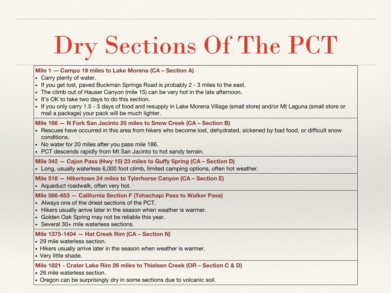
Dry Sections Of The PCTMile 1 — Campo 19 miles to Lake Morena (CA – Section A)• Carry plenty of water.• If you get lost, paved Buckman Springs Road is probably 2 - 3 miles to the east.• The climb out of Hauser Canyon (mile 15) can be very hot in the late afternoon.• It’s OK to take two days to do this section.• If you only carry 1.5 - 3 days of food and resupply in Lake Morena Village (small store) and/or Mt Laguna (small store or
mail a package) your pack will be much lighter.
Mile 186 — N Fork San Jacinto 20 miles to Snow Creek (CA – Section B)• Rescues have occurred in this area from hikers who become lost, dehydrated, sickened by bad food, or difficult snow
conditions.• No water for 20 miles after you pass mile 186.• PCT descends rapidly from Mt San Jacinto to hot sandy terrain.
Mile 342 — Cajon Pass (Hwy 15) 23 miles to Guffy Spring (CA – Section D)• Long, usually waterless 6,000 foot climb, limited camping options, often hot weather.
Mile 518 — Hikertown 24 miles to Tylerhorse Canyon (CA – Section E)• Aqueduct roadwalk, often very hot.
Mile 566-653 — California Section F (Tehachapi Pass to Walker Pass)• Always one of the driest sections of the PCT.• Hikers usually arrive later in the season when weather is warmer.• Golden Oak Spring may not be reliable this year.• Several 30+ mile waterless sections.
Mile 1375-1404 — Hat Creek Rim (CA – Section N)• 29 mile waterless section.• Hikers usually arrive later in the season when weather is warmer.• Very little shade.
Mile 1821 - Crater Lake Rim 26 miles to Thielsen Creek (OR – Section C & D)• 26 mile waterless section.• Oregon can be surprisingly dry in some sections due to volcanic soil.

Section A - Campo to Warner Springs

Section F — Tehachapi Pass to Walker Pass
Water Sources:Mile 566 — Tehachapi (36 miles to next water source)• Golden Oak Spring WR583 is probably
not reliable this year.• Starting at Tehachapi-Willow Springs
Rd adds 8 miles to the waterless stretch (making it 44 miles).
Mile 602 — Robin Bird Spring (7 miles to next water source)
Mile 609 — Landers Camp (11 miles to next water source)
Mile 620 — Willow Spring (31 miles to next water source)• Willow Spring is 1.6 miles off-trail

Section F — Tehachapi Pass to Walker Pass

Southern California Snow● It can snow at any place and anytime
along the PCT.● 2016 snow levels for the Sierra are just
above average with plenty of winter left (3/8/16)
● Mt Laguna (mile 42) can get light snow, but it usually melts quickly and not dangerous.
● Mt San Jacinto (mile 170-191) can have steep dangerous snow. A PCT hiker died in this area during a snowstorm in 2005.
● Big Bear area (mile 245 - 275) can have snow. Usually not steep or dangerous along the PCT near Big Bear.
● Mt Baden-Powell (mile 375 - 385) can have steep dangerous snow.

Southern California Rainfall 2014-16October November December January February March Total Inches % Normal
2016
Lake Henshaw Dam (near mile 110) 1.52 1.12 3.09 6.09 0.05 11.87 65%
Big Bear Fire Station (near mile 266) 0.43 2.23 1.39 6.75 0.09 10.89 78%
Mount Wilson (near mile 403) 1.96 0.72 1.93 11.21 1.68 17.50 70%
Average of locations 13.42 71%
2015
Lake Henshaw Dam (near mile 110) 0.00 0.88 5.40 0.68 1.78 2.41 11.15 49%
Big Bear Fire Station (near mile 266) 0.00 0.88 7.81 1.12 1.48 0.66 11.95 72%
Mount Wilson (near mile 403) 0.82 1.62 9.70 2.84 3.43 0.90 19.31 62%
Average of locations: 14.1 61%
2014
Lake Henshaw Dam (near mile 110) 0.76 0.60 1.02 0.38 4.30 2.68 9.74
Big Bear Fire Station (near mile 266) 1.78 0.74 1.12 0.31 1.25 4.75 9.95
Mount Wilson (near mile 403) 1.40 1.97 0.57 0.51 9.60 1.87 15.92
Average of locations: 11.87
• More rain has fallen in Southern California in 2016 than 2014 or 2015 but rainfall is still below normal. So far, El Nino appears to have missed the Southern California sections of the PCT.
Source: California Nevada River Forecast Center — http://www.cnrfc.noaa.gov/rainfall_data.php

Sierra Snow● As of March 10, 2016 Sierra snow
levels are about 70% - 80% of normal, but about twice the levels of 2014 and 2015.
● Snow can linger on north and east facing mountain slopes or in shade.
● Snow can melt during the day and refreeze at night causing slick dangerous conditions in the morning.
● Hiking on snow be slower than hiking on dry trail even if conditions are not dangerous.
● Snow can completely obscure the trail making navigation difficult.
● Sonora Pass (mile 1017) can have a lot of snow.

PCT Closures● Mountain Fire — Mile 163 to 178: On Mount San Jacinto near Idyllwild. An unofficial 20.4
mile detour bypasses the Mountain Fire closure area and rejoins the PCT at mile 178 near Tahquitz Peak.
• Avoid hiking on Hwy 243 into Idyllwild
● Lake Fire, South of Big Bear — Mile 236.5 to 252: Still closed, no known detours.
● Endangered Species Closure — Mile 386 or 390: After Wrightwood. A 20.5 mile detour that bypasses 7.8 miles of the PCT or the old 4.9 mile detour that bypasses 4 miles of the PCT are possible.
• This closure has been in place for many years to protect the Mountain Yellow-Legged Frog.
• Old detour is shorter but requires 2.7 miles of road walking along a potentially dangerous highway
● Powerhouse Fire — Mile 478 to 492: Near Lake Hughes. An unofficial 12.9 mile detour bypasses 15.2 miles of the PCT.
For the latest closure information see:http://www.pcta.org/discover-the-trail/trail-conditions-and-closures/http://www.pctmap.net/updates/

Other Information● Warner Springs Community Center — Mile 109: The Warner Springs Community
Center [near the 1st PCT crossing of Hwy 74] is very hiker-friendly with wi-fi internet access, phone charging, hot meals at reasonable prices, and a small but surprisingly well stocked hiker store. Open 8-4 daily.
● The Saufley’s in Agua Dulce is open for 2016! — Mile 454: Hiker Heaven [AKA the Saufley’s]. Alternate resupply options:

QUESTIONS & ANSWERS
Halfmile(Lon Cooper)
DoubleTap(Matt Parker)