QGISを使った土地利用/被覆のモデル化とシミュレーション:進捗状況(アジア航測株式会社・Gismondi様)...
17
QGIS を使った土地利用 / 被覆変化 のモデル化とシミュレーション : 進捗状況 Presented by Matteo Gismondi Asia Air Survey Co., Ltd. Modelling and simulating land use/cover changes using QGIS: Current Progress
-
Upload
osgeo-japan -
Category
Documents
-
view
915 -
download
0
Transcript of QGISを使った土地利用/被覆のモデル化とシミュレーション:進捗状況(アジア航測株式会社・Gismondi様)...

QGISを使った土地利用 /被覆変化のモデル化とシミュレーション :
進捗状況
Presented byMatteo Gismondi
Asia Air Survey Co., Ltd.
Modelling and simulating land use/cover changes using QGIS:
Current Progress
2
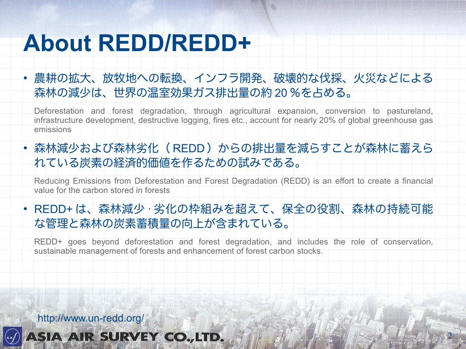
About REDD/REDD+● 農耕の拡大、放牧地への転換、インフラ開発、破壊的な伐採、火災などによる
森林の減少は、世界の温室効果ガス排出量の約 20 %を占める。Deforestation and forest degradation, through agricultural expansion, conversion to pastureland, infrastructure development, destructive logging, fires etc., account for nearly 20% of global greenhouse gas emissions
● 森林減少および森林劣化( REDD )からの排出量を減らすことが森林に蓄えられている炭素の経済的価値を作るための試みである。Reducing Emissions from Deforestation and Forest Degradation (REDD) is an effort to create a financial value for the carbon stored in forests
● REDD+ は、森林減少 · 劣化の枠組みを超えて、保全の役割、森林の持続可能な管理と森林の炭素蓄積量の向上が含まれている。REDD+ goes beyond deforestation and forest degradation, and includes the role of conservation, sustainable management of forests and enhancement of forest carbon stocks.
http://www.un-redd.org/
3
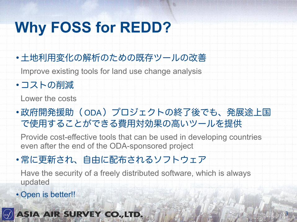
Why FOSS for REDD?
● 土地利用変化の解析のための既存ツールの改善Improve existing tools for land use change analysis
● コストの削減Lower the costs
● 政府開発援助( ODA)プロジェクトの終了後でも、発展途上国で使用することができる費用対効果の高いツールを提供Provide cost-effective tools that can be used in developing countries even after the end of the ODA-sponsored project
● 常に更新され、自由に配布されるソフトウェアHave the security of a freely distributed software, which is always updated
● Open is better!!
4
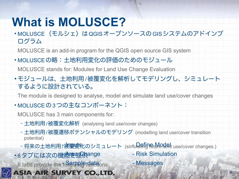
What is MOLUSCE?● MOLUSCE(モルシェ)は QGISオープンソースの GISシステムのアドインプログラムMOLUSCE is an add-in program for the QGIS open source GIS system
● MOLUSCEの略:土地利用変化の評価のためのモジュールMOLUSCE stands for: Modules for Land Use Change Evaluation
● モジュールは、土地利用 /被覆変化を解析してモデリングし、シミュレートするように設計されている。The module is designed to analyse, model and simulate land use/cover changes
● MOLUSCEの 3つの主なコンポーネント:MOLUSCE has 3 main components for:
– 土地利用 /被覆変化解析 (analysing land use/cover changes)
– 土地利用 /被覆遷移ポテンシャルのモデリング (modelling land use/cover transition potential)
– 将来の土地利用 /被覆変化のシミュレート (simulating future land use/cover changes.)
● 6タブには次の機能を提供6 tabs provide the following functions
- Inputs - Define Model
- Area Change - Risk Simulation
- Sample data - Messages
5
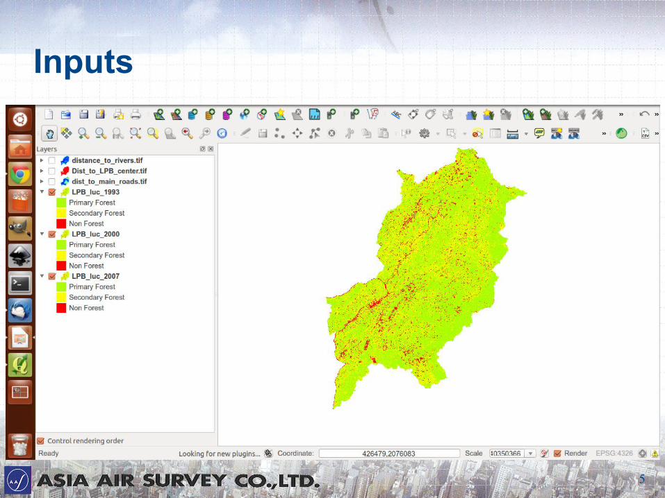
Inputs
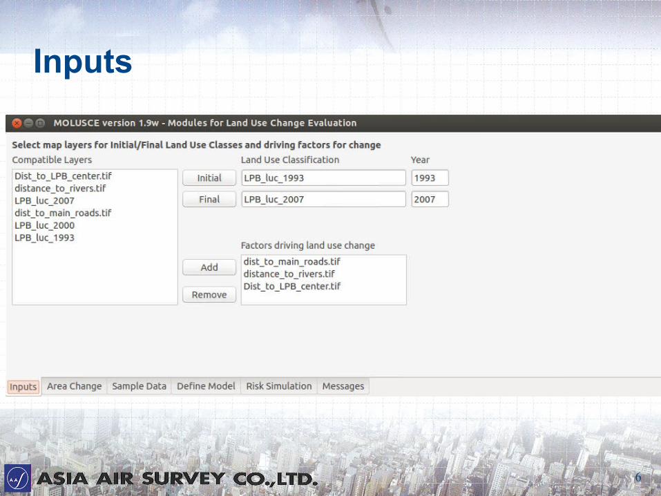
6
Inputs
7
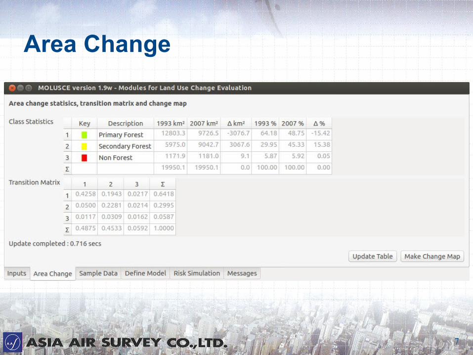
Area Change
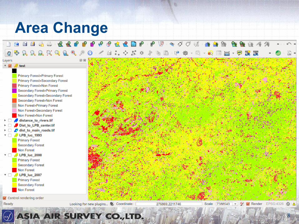
8
Area Change
9
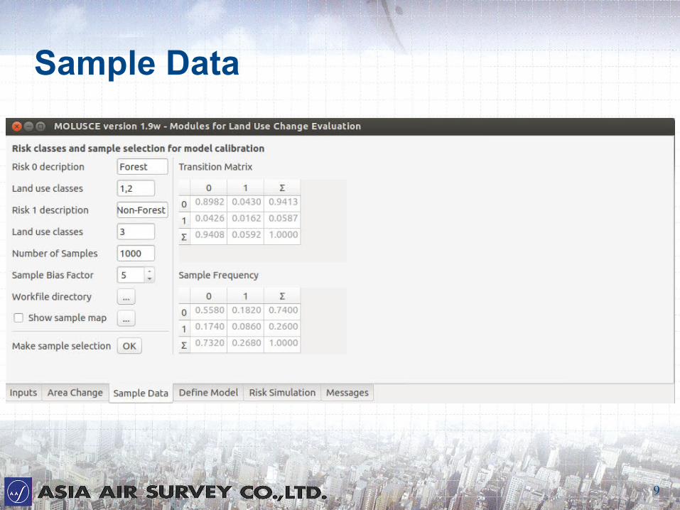
Sample Data

10
Sample Data
11
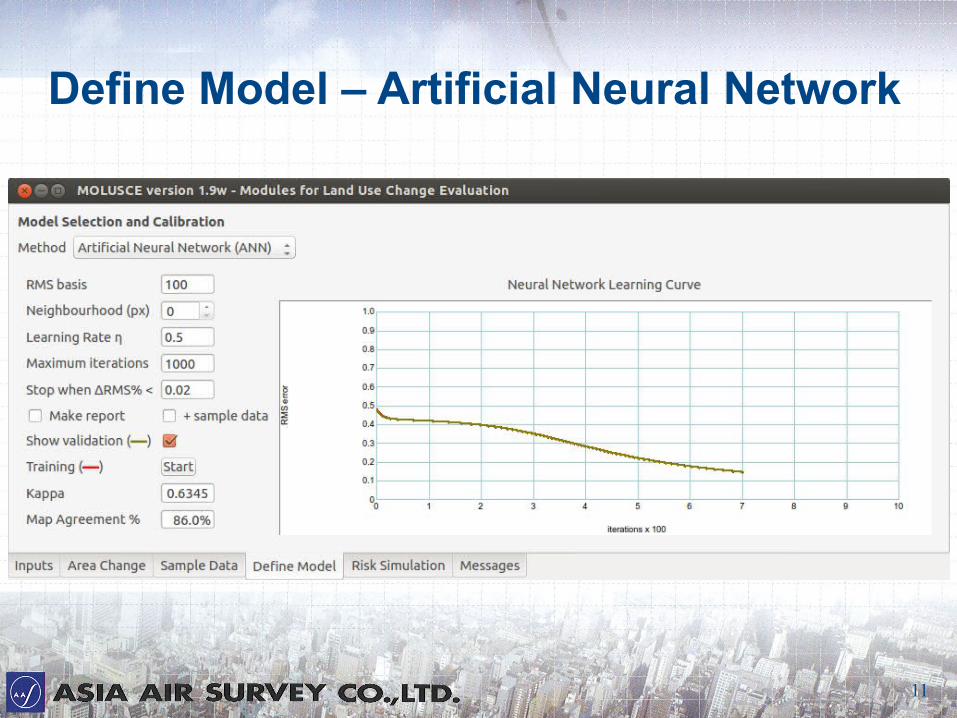
Define Model – Artificial Neural Network
12
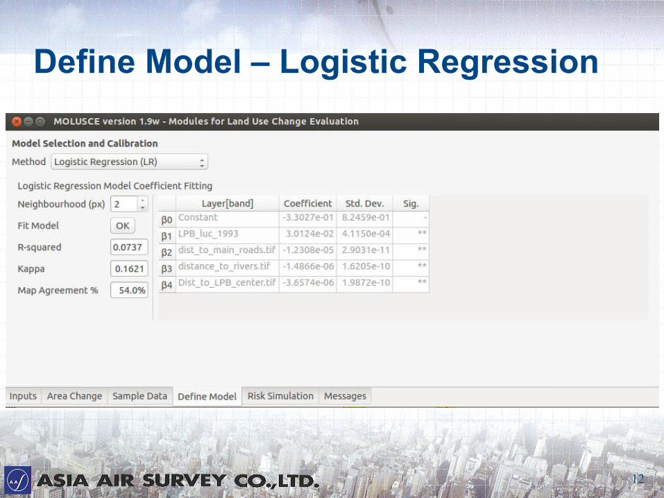
Define Model – Logistic Regression
13
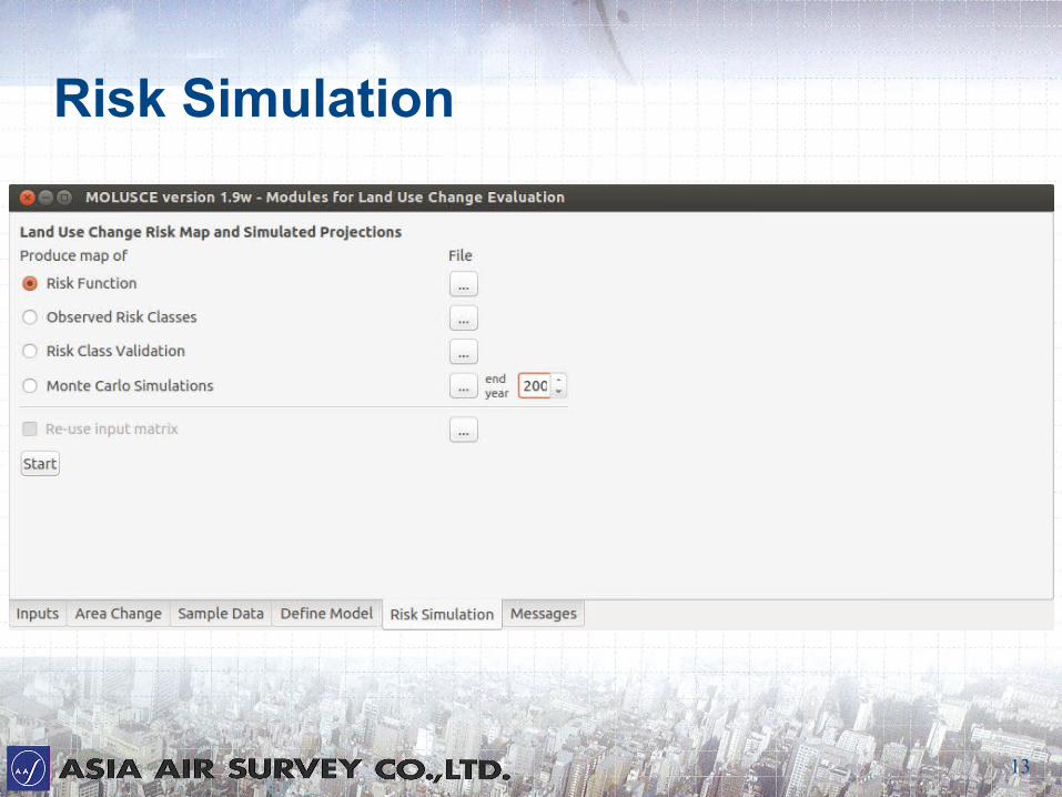
Risk Simulation
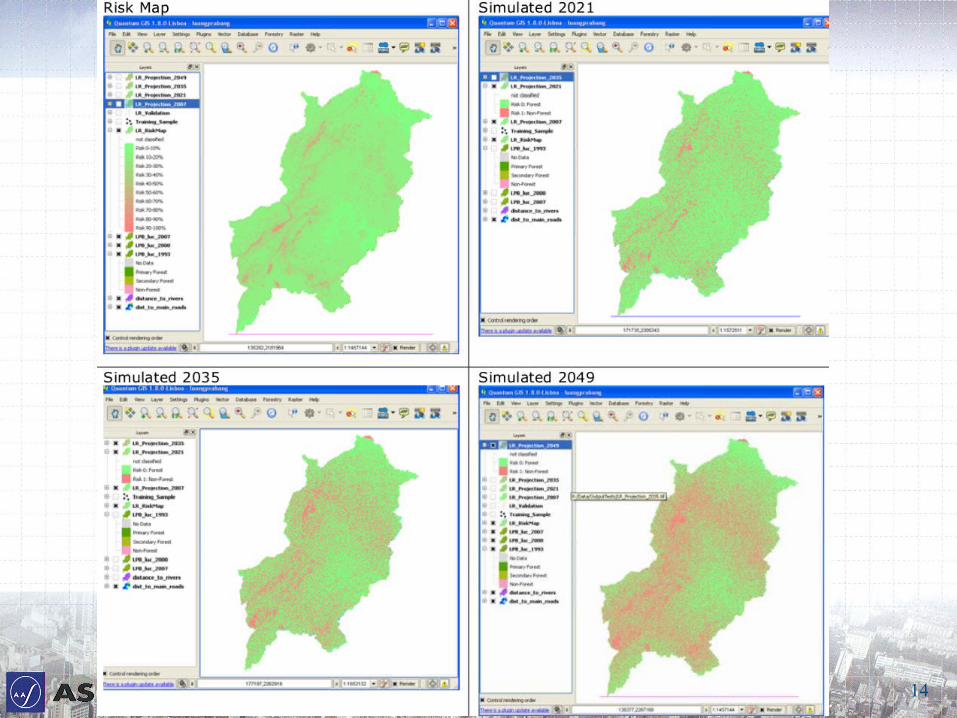
14
15
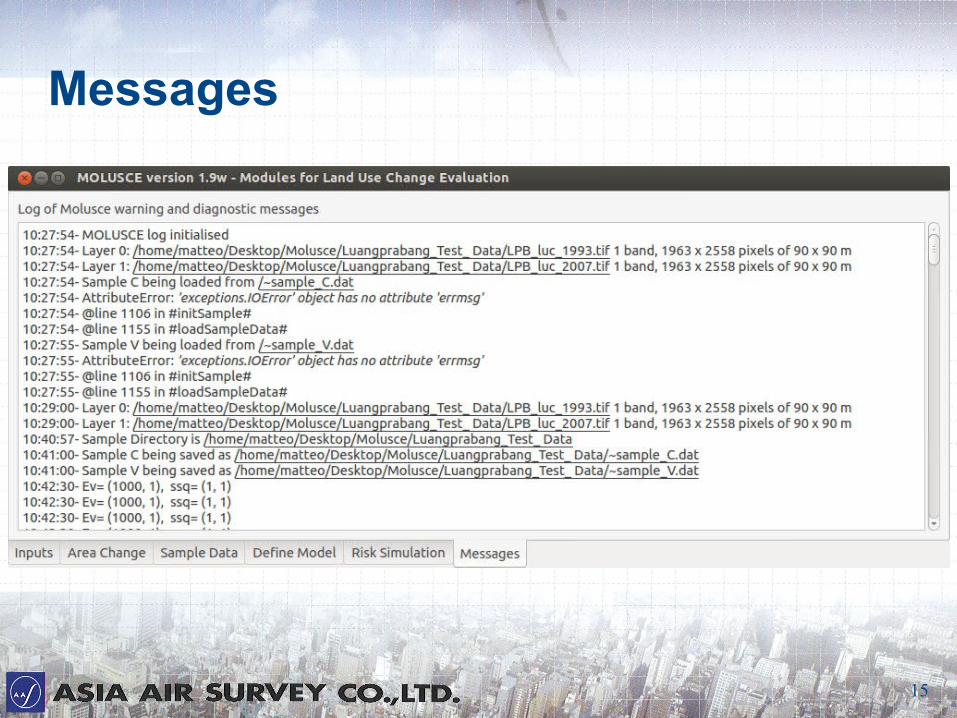
Messages

16
Summary● モデリング遷移の可能性のために提案された方法 :
– 人工ニューラルネットワーク( ANN )
– ロジスティック回帰( LR)
– 証拠の重み( WoE )
– 多基準評価( MCE )
● 半自動工程
● 高速データ処理
● 必要に応じ、更なる試験
● Quantum GIS は完全にプロの作業環境で使用できるようになった。
Proposed method for modelling transition potential:
Artificial Neural Network (ANN)
Logistic Regression (LR)
Weights of Evidence (WoE)
Multi-Criteria Evaluation (MCE)
Semi-automated process
Fast data processing
Further testing required
Quantum GIS is ready to be used in a fully professional working environment
17
Thank you for your attention
● 連絡先 Contact information
MATTEO GISMONDI
Email [email protected]
Company Website http://www.ajiko.co.jp/
Overseas Operations Division +81-44-969-7510