Portfolio - Phillip Geiman Spring 2014
58
-
Upload
phillip-geiman -
Category
Documents
-
view
215 -
download
1
description
Phillip Geiman / Master of Architecture
Transcript of Portfolio - Phillip Geiman Spring 2014


CONTENTS
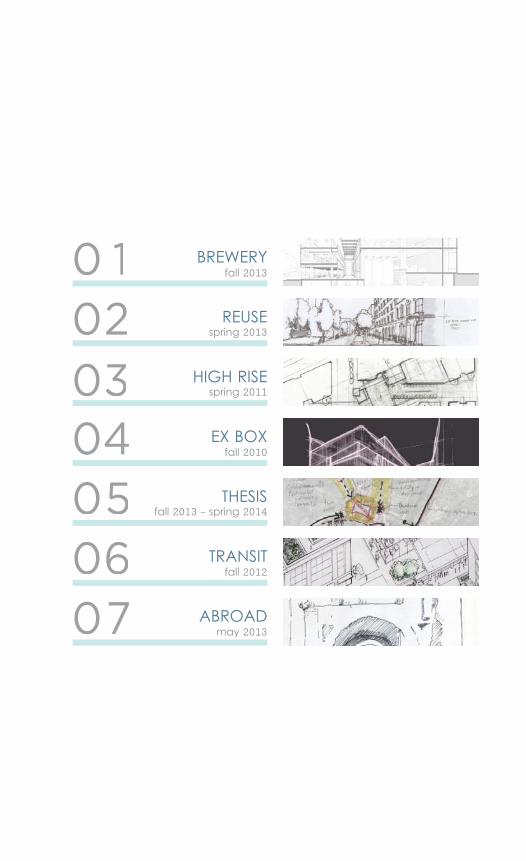
0 1
0302
04050607
fall 2013
spring 2013
spring 2011
fall 2010
fall 2012
may 2013
fall 2013 - spring 2014
BREWERY
REUSE
HIGH RISE
EX BOX
THESIS
TRANSIT
ABROAD
Urban BreweryManufacturing + Public Use
Knoxville, TN
Professors John Sanders + Brandon Pace
Fall 2013
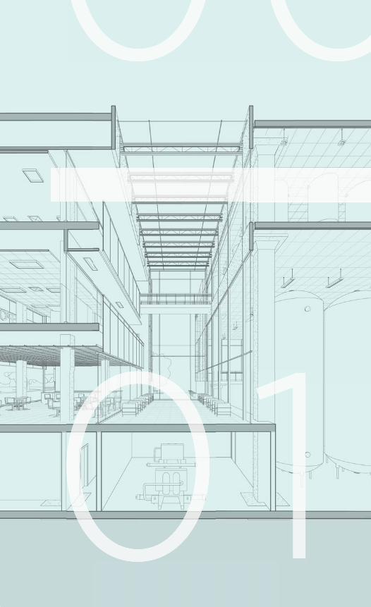
This project developed an urban brewery, with an extensive manufac-turing component and more public use of cafe, office and administra-tive space. The design spanned from initial programmatic and schematic to the level of mechanical, structural, and wall detail. The site on Depot Street, a formerly industrial neigh-borhood, is considered for future development to bridge together the commercial downtown and residen-tial North Knoxville. This zero-lot mixed used structure was unique in contain-ing both a manufacturing and public function, in both representing the in-dustrial nature of its context and the new vision for the area.
BREWERY
00
6
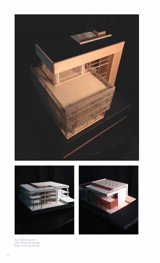
top: Detail ModelLeft: Structural ModelRight: Massing Model
7
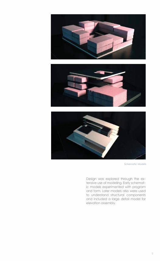
Design was explored through the ex-tensive use of modeling. Early schemat-ic models experimented with program and form. Later models also were used to understand structural components and included a large detail model for elevation assembly.
Schematic Models
8
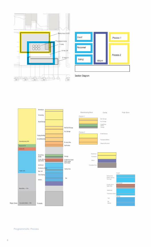
Programmatic Process
Manufacturing Block Overlap Public Block
Process 2Bright/Storage
Packaging/Bottling
Shipping/Receiving
EatingCafe
KitchenBar
Personnel
Auditorium
Private officesOpen office
Conference Room
Process 1Cold Storage
Dry Storage
StorageQA/QCSmall Brew
Event
Tasting AreaExterior TerraceBeer Hall
Circulation/Core
Fermenting
Atrium
Brewhouse
9
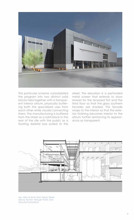
This particular scheme consolidated the program into two distinct solid blocks held together with a transpar-ent interior atrium, physically buffer-ing both the specialized uses from each other while visually connecting them. The manufacturing is buffered from the street as a solid block in the rear of the site with the public as a floating skeletal box pulled to the
street. The elevation is a perforated metal screen that extends to show reveals for the recessed first and the third floor so that the glass southern facades are shaded. This facade wraps to the interior so that the exte-rior finishing becomes interior to the atrium further reinforcing its appear-ance as transparent.
top: View of entry from Depot Streetabove: Section Through Public and Manufacturing Block
10
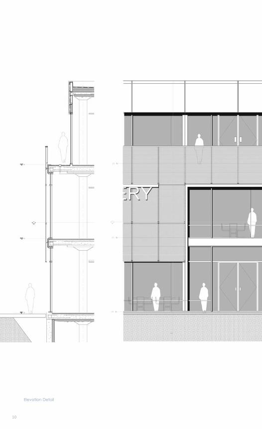
Elevation Detail
11
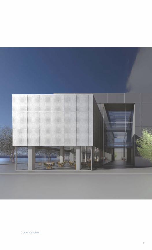
Corner Condition
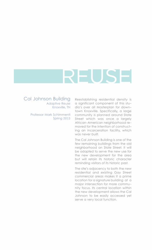
Reestablishing residential density is a significant component of this stu-dio’s over all Masterplan for down-town Knoxville. Specifically, a large community is planned around State Street which was once a largely African-American neighborhood re-moved for the intention of construct-ing an incarceration facility, which was never built.
The Cal Johnson Building is one of the few remaining buildings from the old neighborhood on State Street. It will be adapted to serve the new use for the new development for the area but will retain its historic character reminding visitors of its historic past.
The site’s adjacency to both the new residential and existing Gay Street commercial areas makes it a prime location for a signature building at a major intersection for more commu-nity focus. Its central location within the new development allows the Cal Johnson to be easily accessed yet serve a very local function.
Cal Johnson BuildingAdaptive Reuse
Knoxville, TN
Professor Mark SchimmentiSpring 2013
REUSE
2
0101
14
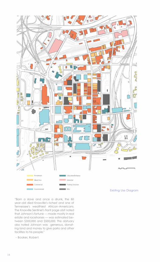
Existing Use Diagram
Residential
Mixed Use
Commercial
Governmental
Education/Religious
Industrial
Parking Structure
Misc Existing Use Diagram
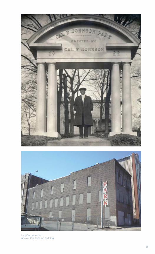
“Born a slave and once a drunk, the 80 year-old died Knoxville’s richest and one of Tennessee’s wealthiest African-Americans. The Knoxville Sentinel’s front page obit noted that Johnson’s fortune — made mostly in real estate and racehorses — was estimated be-tween $300,000 and $500,000. The obituary also noted Johnson was generous, donat-ing land and money to give parks and other facilities to his people.”
- Booker, Robert.
15
top: Cal Johnsonabove: Cal Johnson Building
16
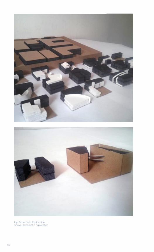
top: Schematic Explorationabove: Schematic Exploration
17
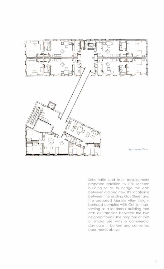
Apartment Plan
Schematic and later development proposed addition to Cal Johnson building so as to bridge the gab between old and new. It’s location is between the existing Gay Street and the proposed Marble Alley Neigh-borhood complex with Cal Johnson serving as a landmark building that acts as transition between the two neighborhoods. The program of that of mixed use with a commercial day care in bottom and converted apartments above.
18
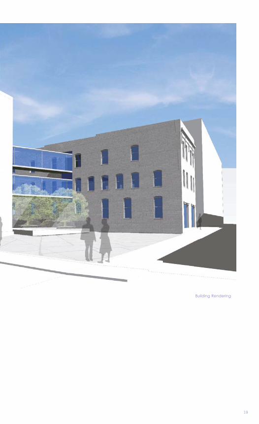
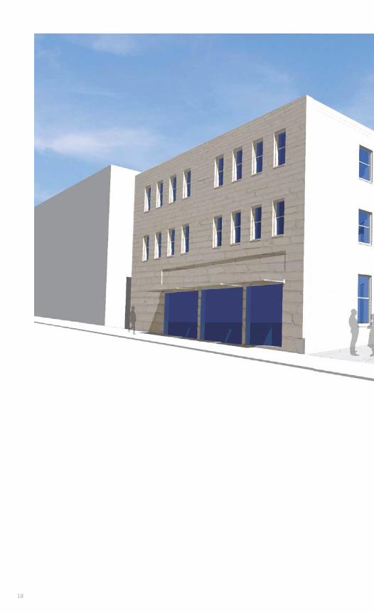
19
Building Rendering
This project explored the development of an under-utilized block in North-west DC, starting with a block devel-opment plan further exploring one building within the block. This was ex-plored in two directions, one in which the block was designed as a public garden with a central building within, and the second developed fully with commercial properties, taking one of the buildings and developing it further into a high rise structure.
Urban DevelopmentMixed Use/ Commercial
Washington DC
Professor George HartmanSpring 2011
HIGH RISE
3
02
22
23
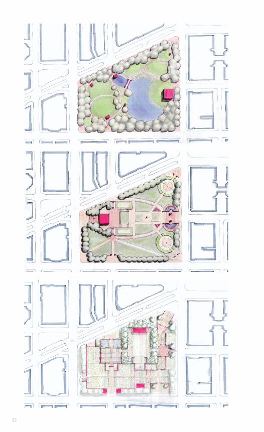
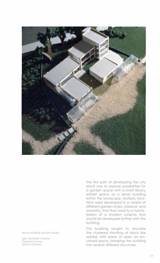
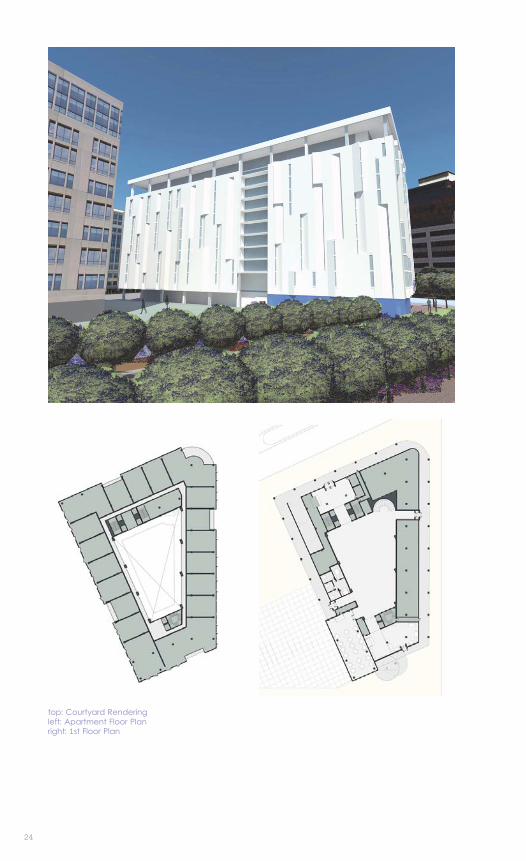
The first part of developing the city block was to explore possibilities for a garden space with a small library, exhibit space as a jewel building within the landscape. Multiple itera-tions were developed in a variety of different garden styles, classical and romantic, that then lead to a hybrid-ization of a modern scheme that would be developed further with the building.
This building sought to emulate the clustered stacking of block like adobe, with areas of open an en-closed space, breaking the building into several different structures.
above: Building and Site Model
right: Romantic SchemeClassical SchemeTerrace Scheme
24
top: Courtyard Renderingleft: Apartment Floor Planright: 1st Floor Plan
25
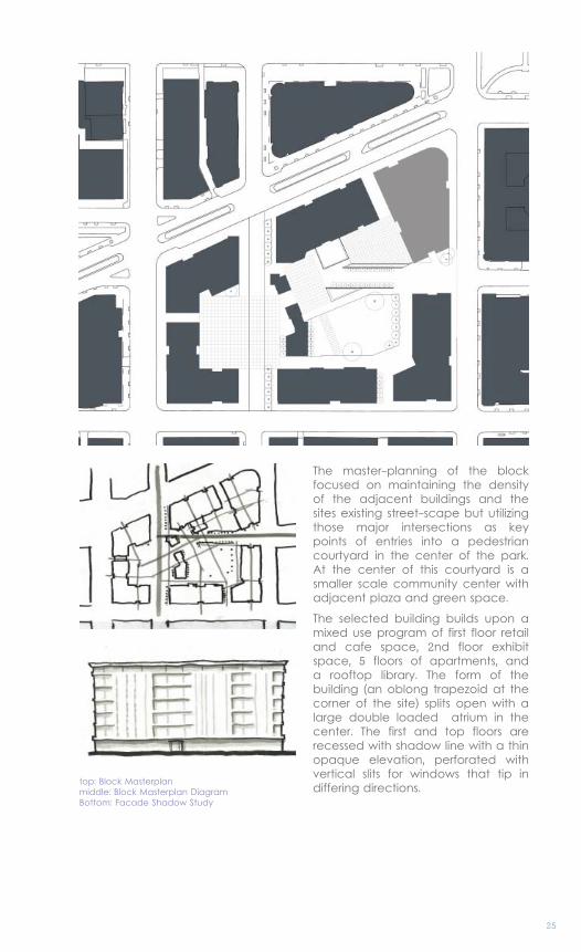
top: Block Masterplanmiddle: Block Masterplan DiagramBottom: Facade Shadow Study
The master-planning of the block focused on maintaining the density of the adjacent buildings and the sites existing street-scape but utilizing those major intersections as key points of entries into a pedestrian courtyard in the center of the park. At the center of this courtyard is a smaller scale community center with adjacent plaza and green space.
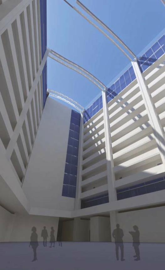
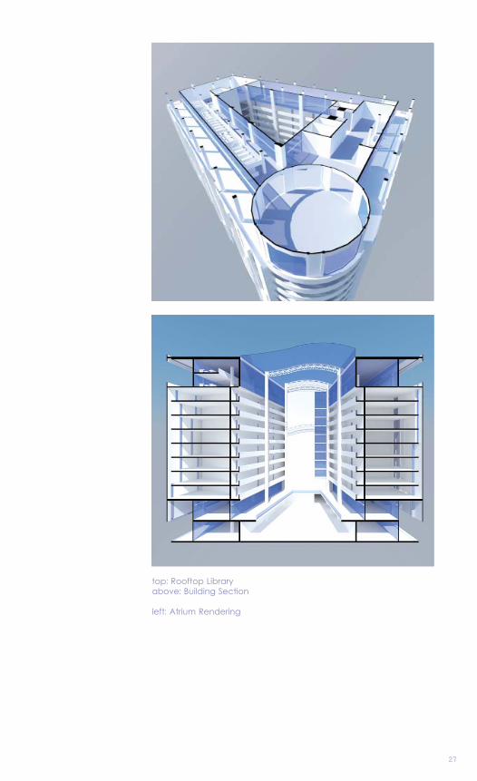
The selected building builds upon a mixed use program of first floor retail and cafe space, 2nd floor exhibit space, 5 floors of apartments, and a rooftop library. The form of the building (an oblong trapezoid at the corner of the site) splits open with a large double loaded atrium in the center. The first and top floors are recessed with shadow line with a thin opaque elevation, perforated with vertical slits for windows that tip in differing directions.
26262
27
top: Rooftop Libraryabove: Building Section
left: Atrium Rendering
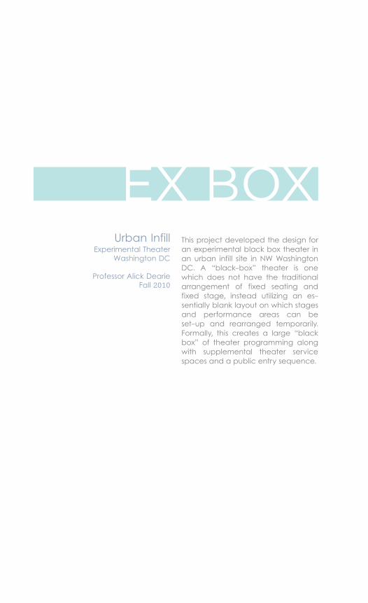
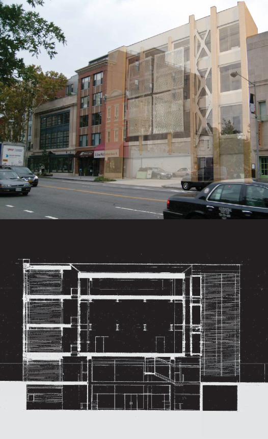
This project developed the design for an experimental black box theater in an urban infill site in NW Washington DC. A “black-box” theater is one which does not have the traditional arrangement of fixed seating and fixed stage, instead utilizing an es-sentially blank layout on which stages and performance areas can be set-up and rearranged temporarily. Formally, this creates a large “black box” of theater programming along with supplemental theater service spaces and a public entry sequence.
Urban InfillExperimental Theater
Washington DC
Professor Alick DearieFall 2010
EX BOX
4
03
30
31
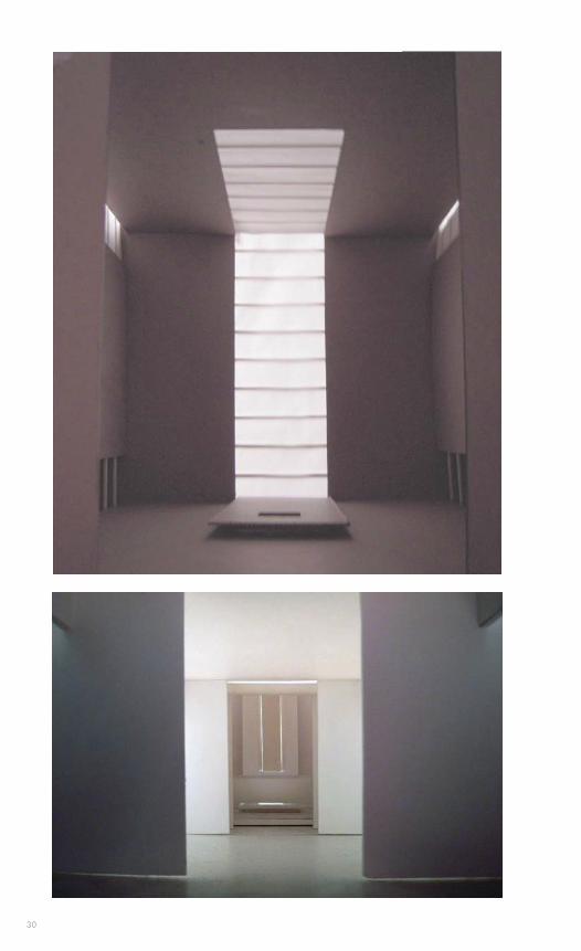
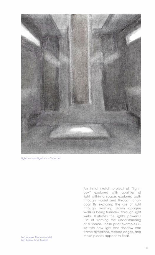
Left Above: Process ModelLeft Below: Final Model
An initial sketch project of “light-box” explored with qualities of light within a space, explored both through model and through char-coal. By exploring the use of light through washing down opaque walls or being funneled through light wells, illustrates the light’s powerful use of framing the understanding of a space. These prior examples il-lustrate how light and shadow can frame directions, recede edges, and make pieces appear to float.
Lightbox Investigations - Charcoal
3232
33
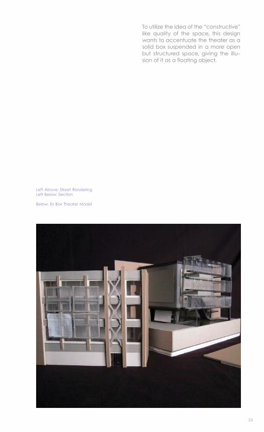
Left Above: Street RenderingLeft Below: Section
Below: Ex Box Theater Model
To utilize the idea of the “constructive” like quality of the space, this design wants to accentuate the theater as a solid box suspended in a more open but structured space, giving the illu-sion of it as a floating object.
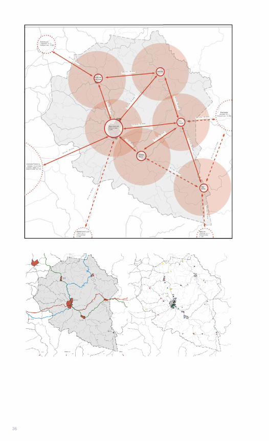
Small towns and rural areas are places with unique sites, issues, and characters that are not often seen in more urban development. The unique challenges of these areas are not often seen in cities: diminishing and aging population, decreased economic opportunities, rural pover-ty, and isolation both within the rural areas themselves and to the broader context beyond. Also in rural areas, people’s relationship to place and space is fundamentally different, emphasizing ownership, practicality, and long distance relationships.
Small Town UrbanismResearch/Masterplanning
Manchester, KY
Professor John McRaeFall 2013 + Spring 2014
THESIS
505
0404
36
37
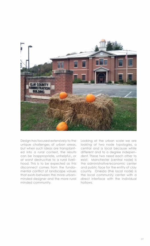
Design has focused extensively to the unique challenges of urban areas, but when such ideas are transplant-ed into a rural context, the results can be inappropriate, unhelpful., or at worst destructive to a rural liveli-hood. This is to be expected as this disconnect comes from the funda-mental conflict of landscape values that exists between the more urban-minded designer and the more rural minded community.
Looking at the urban scale we are looking at two node typologies, a central and a local because while different and to a degree indepen-dent. These two need each other to exist. Manchester (central node) is the administrative/economic center and public face for the entity of clay county. Oneida (the local node) is the local community center with a direct interface with the individual hollows.
38
39
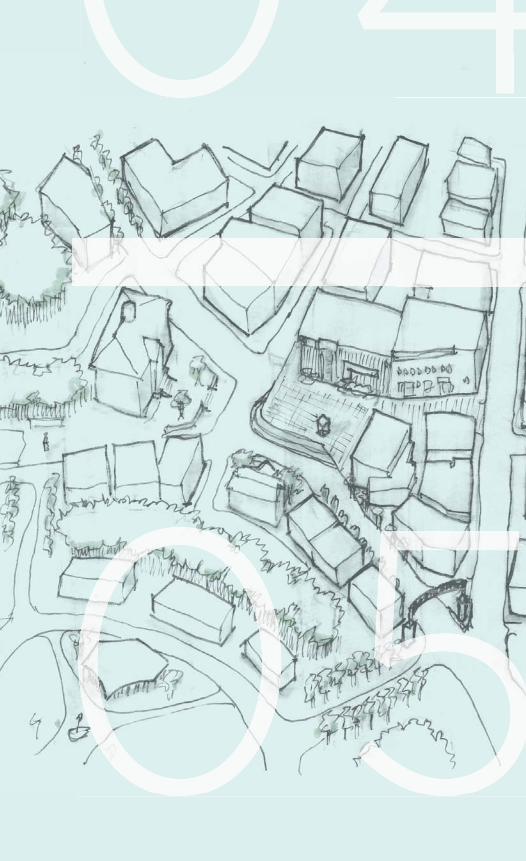
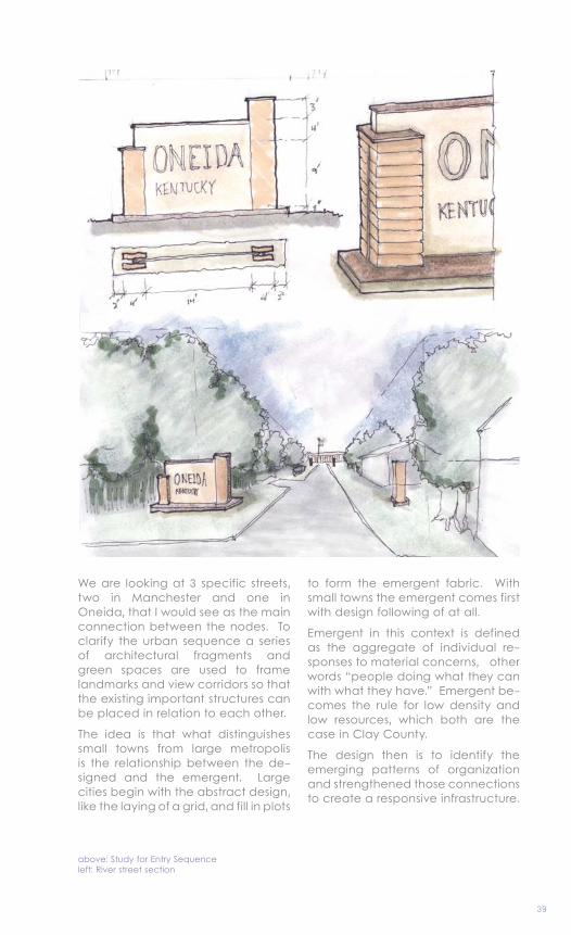
above: Study for Entry Sequence left: River street section
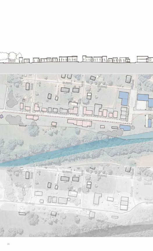
We are looking at 3 specific streets, two in Manchester and one in Oneida, that I would see as the main connection between the nodes. To clarify the urban sequence a series of architectural fragments and green spaces are used to frame landmarks and view corridors so that the existing important structures can be placed in relation to each other.
The idea is that what distinguishes small towns from large metropolis is the relationship between the de-signed and the emergent. Large cities begin with the abstract design, like the laying of a grid, and fill in plots
to form the emergent fabric. With small towns the emergent comes first with design following of at all.
Emergent in this context is defined as the aggregate of individual re-sponses to material concerns, other words “people doing what they can with what they have.” Emergent be-comes the rule for low density and low resources, which both are the case in Clay County.
The design then is to identify the emerging patterns of organization and strengthened those connections to create a responsive infrastructure.
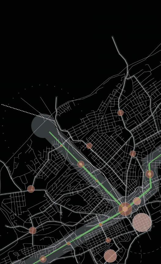
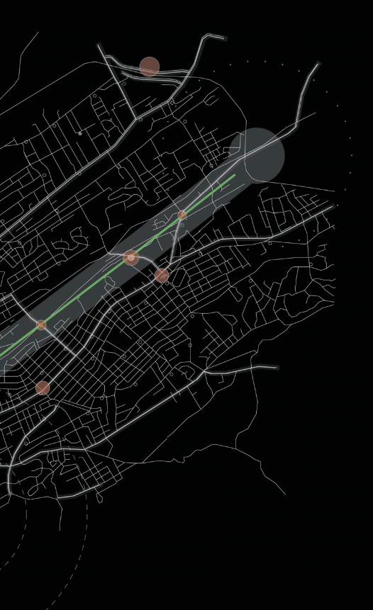
This collaborative project worked with a small group to research the hypothetical project to remove the interstate components that are within the city limits of Knoxville, TN and to develop a scheme of how to utilize the 1.1 square miles.
Further progress developed an end node condition through a phased development strategy. That strategy reflected the growth of a transit stop that serves as a catalyst for devel-opment for a new urban fabric and then the potential extension of the light rail line beyond its initial terminus.
Node DevelopmentUrban Design
Knoxville, TN
Professor Ted SheltonFall 2012
TRANSIT
6
05
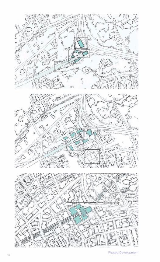
42Phased Development
43
I-40 and I-275 interstate components within Knoxville are large noisy and pollutant barriers that separate com-munities. Replacing them with green transit corridors that utilizes streetcar light rail public transit systems will allow the urban fabric broken by in-frastructure to be reconnected and provide opportunities for transit ori-ented development along a series of nodes. Development within Knoxville can be concentrated and densified allowing the full and efficient use of underutilized land and allow the city to grow in a sustainable way.
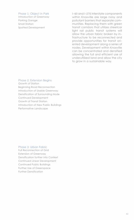
Phase 1: Object in ParkIntroduction of GreenwayParking GarageSmall StationSpotted Development
Phase 2: Extension BeginsGrowth of StationBeginning Road ReconnectionIntroduction of Usable GreenwayDensification of Surrounding NodeContinued DevelopmentGrowth of Transit StationIntroduction of New Public BuildingsPerformative Landscape
Phase 3: Urban FabricFull Reconnection of GridExtension of GreenwayDensification further into ContextContinued Linear DevelopmentContinued Public BuildingsFurther Use of GreenspaceFurther Densification
44
45
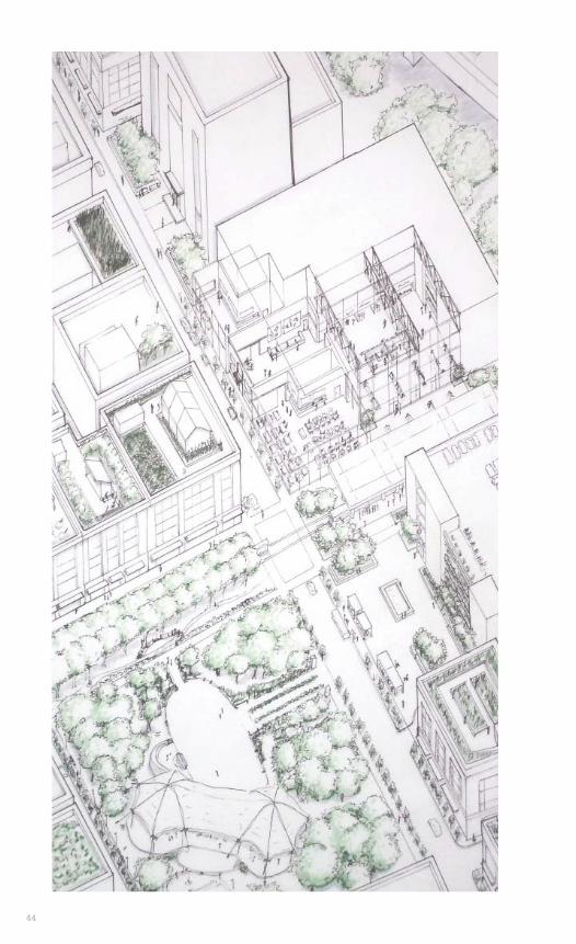
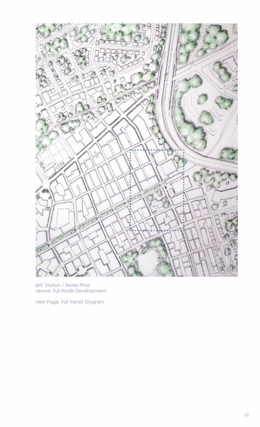
left: Station / Node Finalabove: Full Node Development
next Page: Full Transit Diagram
4646446644646464644464466464444664646464446446464466646666666666
4747
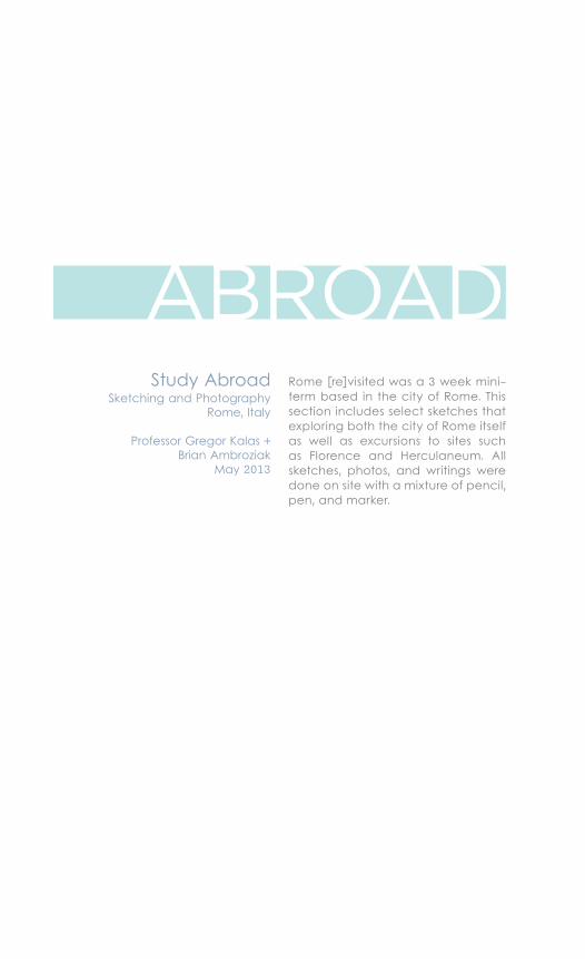
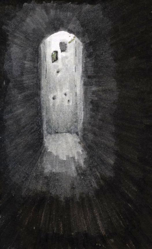
Rome [re]visited was a 3 week mini-term based in the city of Rome. This section includes select sketches that exploring both the city of Rome itself as well as excursions to sites such as Florence and Herculaneum. All sketches, photos, and writings were done on site with a mixture of pencil, pen, and marker.
Study AbroadSketching and Photography
Rome, Italy
Professor Gregor Kalas + Brian Ambroziak
May 2013
ABROAD
7
0606
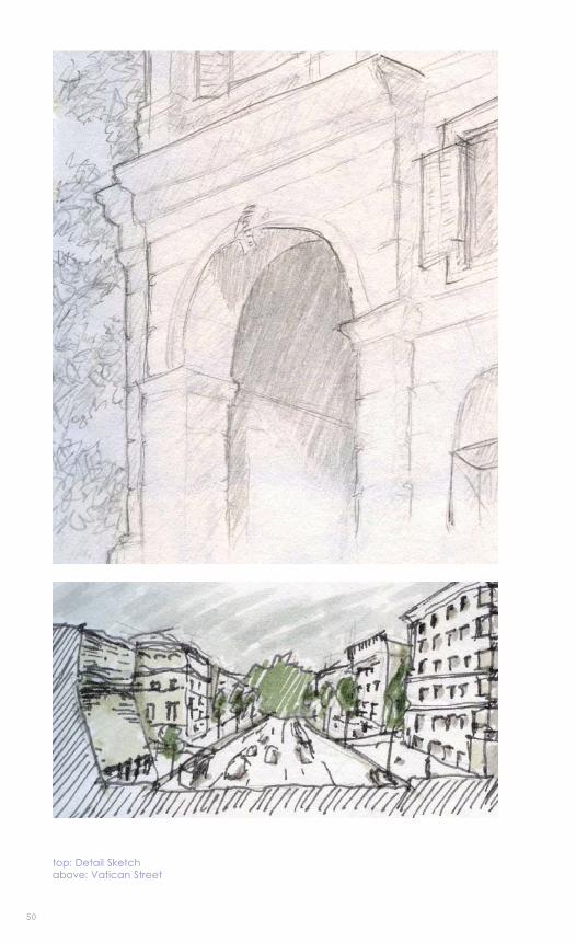
50
top: Detail Sketchabove: Vatican Street
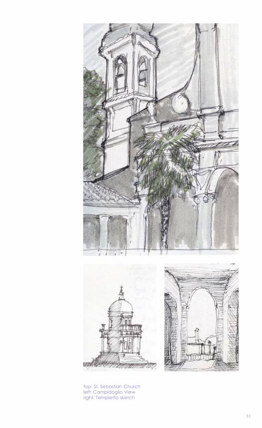
51
top: St. Sebastian Churchleft: Campidoglio Viewright: Tempietto sketch
52
53
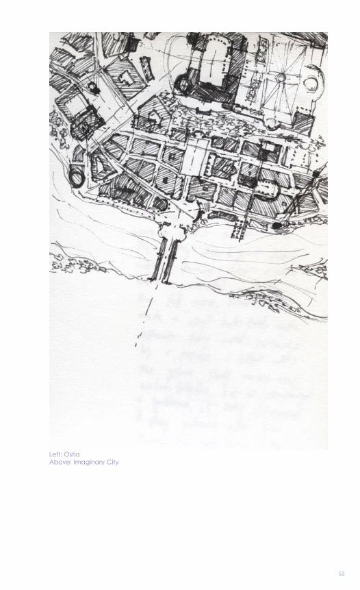
Left: Ostia Above: Imaginary City


54
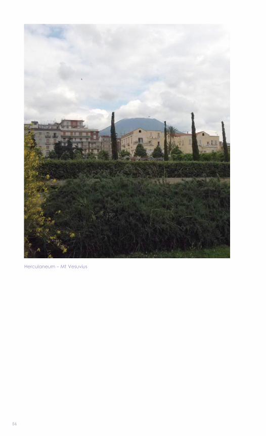
Herculaneum - Mt Vesuvius