Lewis TFTN-GIST 03282011.ppt Plan forStrategic Plan for ... TomTom Volunteered ... Case Study...
29
Strategic Plan for Strategic Plan for Transportation for the Nation (TFTN) GIS-T Symposium Steve Lewis Geospatial Information Officer, USDOT Director, Office of Geospatial Information Systems, USDOT/RITA/BTS March, 2011
Transcript of Lewis TFTN-GIST 03282011.ppt Plan forStrategic Plan for ... TomTom Volunteered ... Case Study...

Strategic Plan forStrategic Plan for Transportation for the Nation (TFTN)
GIS-T Symposium
Steve LewisGeospatial Information Officer, USDOT
Director, Office of Geospatial Information Systems, USDOT/RITA/BTSMarch, 2011,
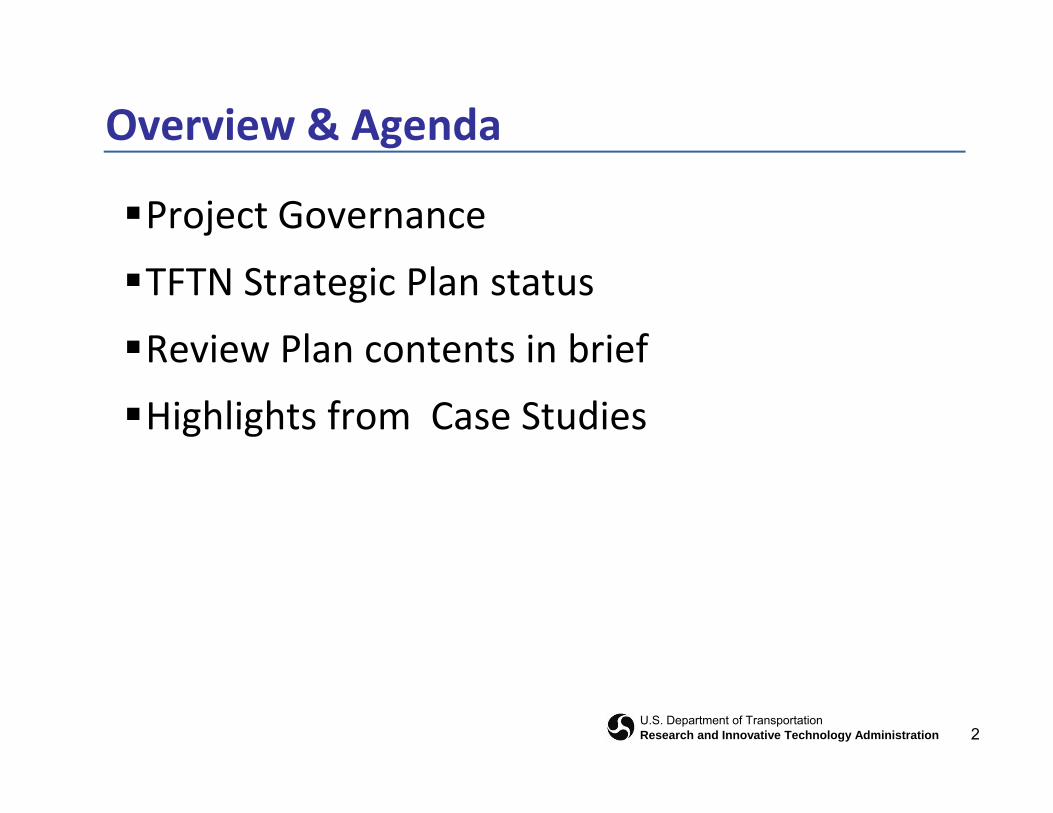
Overview & Agenda
Project Governance
TFTN Strategic Plan status
Review Plan contents in briefReview Plan contents in brief
Highlights from Case Studies
2U.S. Department of TransportationResearch and Innovative Technology Administration
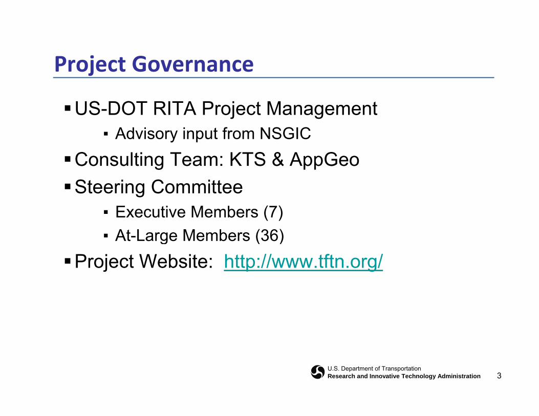
Project Governance
US-DOT RITA Project ManagementAd i i t f NSGIC▪ Advisory input from NSGIC
Consulting Team: KTS & AppGeoSt i C ittSteering Committee
▪ Executive Members (7)▪ At Large Members (36)▪ At-Large Members (36)
Project Website: http://www.tftn.org/
3U.S. Department of TransportationResearch and Innovative Technology Administration
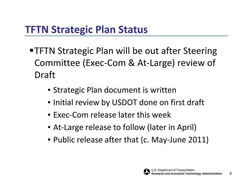
TFTN Strategic Plan Status
TFTN Strategic Plan will be out after Steering C i (E C & A L ) i fCommittee (Exec‐Com & At‐Large) review of Draft
▪ Strategic Plan document is written▪ Initial review by USDOT done on first draft▪ Exec‐Com release later this week▪ At‐Large release to follow (later in April)▪ Public release after that (c. May‐June 2011)
4U.S. Department of TransportationResearch and Innovative Technology Administration
Plan Contents
Current Situation
Vision & Goals
RequirementsRequirements
Phasing & Milestones
5U.S. Department of TransportationResearch and Innovative Technology Administration
Current Situation
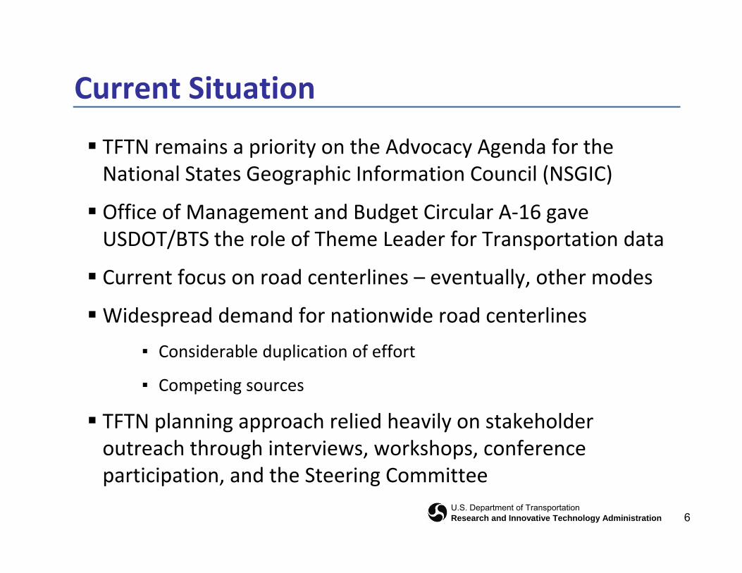
TFTN remains a priority on the Advocacy Agenda for the National States Geographic Information Council (NSGIC)National States Geographic Information Council (NSGIC)
Office of Management and Budget Circular A‐16 gave USDOT/BTS the role of Theme Leader for Transportation data
Current focus on road centerlines – eventually, other modes
Widespread demand for nationwide road centerlinesp
▪ Considerable duplication of effort
▪ Competing sources
TFTN planning approach relied heavily on stakeholder outreach through interviews, workshops, conference
d h
6U.S. Department of TransportationResearch and Innovative Technology Administration
participation, and the Steering Committee
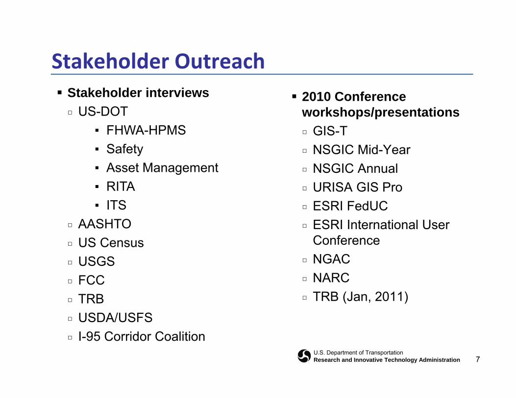
Stakeholder Outreach 2010 Conference
workshops/presentations Stakeholder interviews
□ US-DOT□ GIS-T□ NSGIC Mid-Year□ NSGIC Annual
▪ FHWA-HPMS▪ Safety▪ Asset Management
□ URISA GIS Pro□ ESRI FedUC□ ESRI International User
g▪ RITA▪ ITS
□ AASHTO □ ESRI International User Conference
□ NGACNARC
□ AASHTO□ US Census□ USGS
□ NARC□ TRB (Jan, 2011)
□ FCC□ TRB□ USDA/USFS
7U.S. Department of TransportationResearch and Innovative Technology Administration
□ I-95 Corridor Coalition
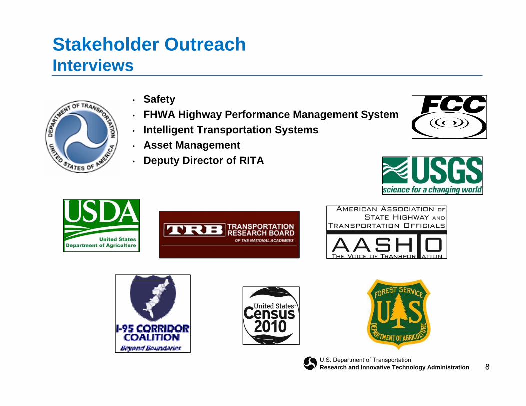
Stakeholder OutreachInterviews
• Safety• FHWA Highway Performance Management System
I t lli t T t ti S t• Intelligent Transportation Systems• Asset Management• Deputy Director of RITA
8U.S. Department of TransportationResearch and Innovative Technology Administration
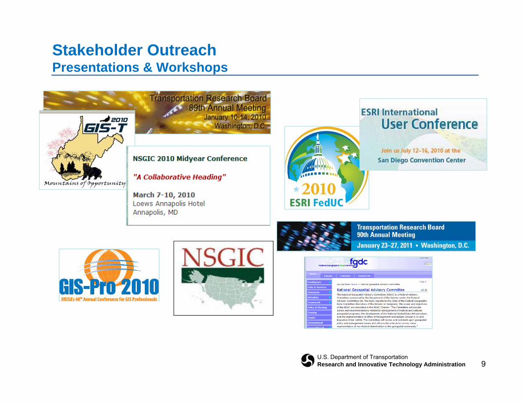
Stakeholder OutreachPresentations & Workshops
9U.S. Department of TransportationResearch and Innovative Technology Administration
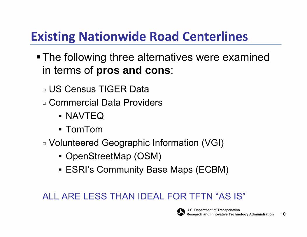
Existing Nationwide Road Centerlines
The following three alternatives were examined in terms of pros and cons:in terms of pros and cons:
□ US Census TIGER Data□ Commercial Data Providers□ Commercial Data Providers
▪ NAVTEQ▪ TomTom
□ Volunteered Geographic Information (VGI)▪ OpenStreetMap (OSM)▪ ESRI’s Community Base Maps (ECBM)
ALL ARE LESS THAN IDEAL FOR TFTN “AS IS”
10U.S. Department of TransportationResearch and Innovative Technology Administration
ALL ARE LESS THAN IDEAL FOR TFTN “AS IS”

Vision & Goals
Overarching strategic goal:
C th d l t f h i Commence the development of comprehensive, publicly available, nationwide transportation data sets.
▪ Ultimately, encompass data sets covering multiple modes of transportation.
▪ Initially focus on producing a road centerline data set that includes all types of roads, both public and private The initial TFTN data set will include:private. The initial TFTN data set will include:
– Consistent, current, high quality road centerline data
– Coverage for the entire country
11U.S. Department of TransportationResearch and Innovative Technology Administration
– Coverage for the entire country
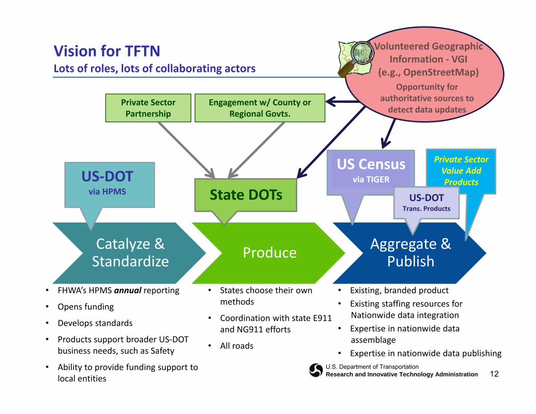
Vision for TFTNLots of roles, lots of collaborating actors
Volunteered Geographic Information ‐ VGI
(e.g., OpenStreetMap)
Private Sector Partnership
Engagement w/ County or Regional Govts.
( g , p p)Opportunity for
authoritative sources to detect data updates
US‐DOTUS Census
via TIGER
Private Sector Value Add ProductsUS DOT
via HPMSvia TIGER
State DOTsProducts
US‐DOTTrans. Products
Catalyze &Standardize Produce Aggregate &
Publish
• FHWA’s HPMS annual reporting
• Opens funding
• Develops standards
P d t t b d US DOT
• Existing, branded product• Existing staffing resources for
Nationwide data integration• Expertise in nationwide data
bl
• States choose their own methods
• Coordination with state E911 and NG911 efforts
12U.S. Department of TransportationResearch and Innovative Technology Administration
• Products support broader US‐DOT business needs, such as Safety
• Ability to provide funding support to local entities
assemblage• Expertise in nationwide data publishing
• All roads
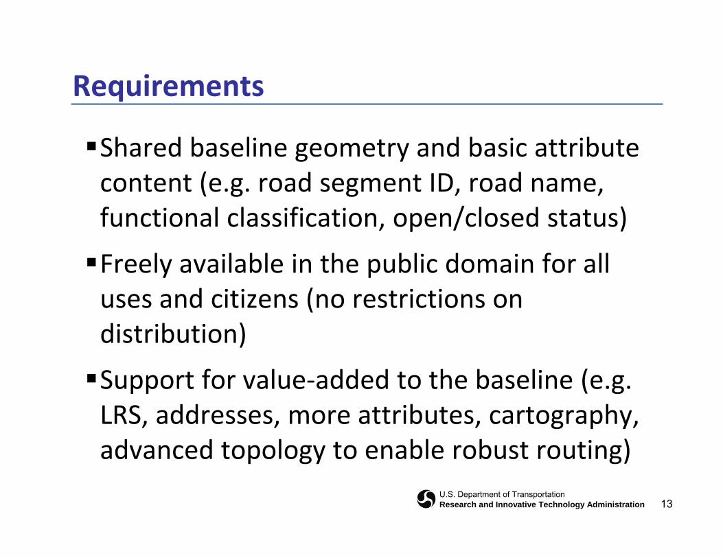
Requirements
Shared baseline geometry and basic attribute ( d ID dcontent (e.g. road segment ID, road name,
functional classification, open/closed status)
Freely available in the public domain for all uses and citizens (no restrictions on distribution)
Support for value‐added to the baseline (e gSupport for value added to the baseline (e.g. LRS, addresses, more attributes, cartography, advanced topology to enable robust routing)
13U.S. Department of TransportationResearch and Innovative Technology Administration
advanced topology to enable robust routing)

Requirements
14U.S. Department of TransportationResearch and Innovative Technology Administration

Phasing & Milestones
Review of the Draft by Steering Committee during April 2011April 2011
▪ Executive Members
▪ At‐Large Members
Public release of the document in May or June 2011, f f i i S i C i f db kafter factoring‐in Steering Committee feedback
On to the Business Pland f d f d▪ Identify cost and funding
▪ More detailed design, prototyping & business case
Begin implementation during 2012
15U.S. Department of TransportationResearch and Innovative Technology Administration
Begin implementation during 2012
Overview & Agenda
Project Governance
TFTN Strategic Plan status
Review Plan contentsReview Plan contents
Highlights from Case Studies
16U.S. Department of TransportationResearch and Innovative Technology Administration
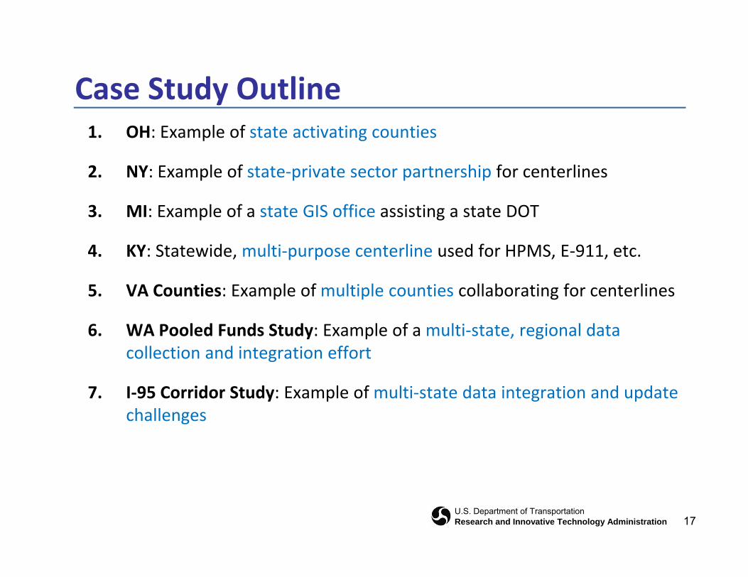
Case Study Outline1. OH: Example of state activating counties
2. NY: Example of state‐private sector partnership for centerlinesp p p p
3. MI: Example of a state GIS office assisting a state DOT
4 KY: Statewide multi‐purpose centerline used for HPMS E‐911 etc4. KY: Statewide, multi‐purpose centerline used for HPMS, E‐911, etc.
5. VA Counties: Example of multiple counties collaborating for centerlines
6 WA P l d F d St d E l f lti t t i l d t6. WA Pooled Funds Study: Example of a multi‐state, regional data collection and integration effort
7. I‐95 Corridor Study: Example of multi‐state data integration and update7. I 95 Corridor Study: Example of multi state data integration and update challenges
17U.S. Department of TransportationResearch and Innovative Technology Administration
Ohio: Collaboration on Street Centerlines
The Location Based Response System (LBRS) is a partnership between state and local government to develop:
▪ Highly-accurate (+/- 1 m), field-verified street centerlines▪ Address point locations for the entire state
Th t t h d l d t f t d d d id fi i l The state has developed a set of standards and provides financial incentive to counties through a Memorandum of Agreement (MOA) to provide funds
This effort has resulted in the successful culmination of many organizations working together to provide accurate centerline data throughout the state for use by:
▪ Emergency response organizations ▪ State geospatial programs
18U.S. Department of TransportationResearch and Innovative Technology Administration
New York: Multi‐purpose Centerline Outlook and Involvement from the State GIS Office
In the late 1990s, New York State launched a statewide baseline mapping program utilizing GIS to upgrade how the New York DOT/DMV maintained their road data
▪ Conform to the new state standard ▪ Focus on Federal regulations from such program as the g p g
FHWA Highway Performance Monitoring System (HPMS). With a single street centerline layer, other agencies will be able to
consume this data ▪ Support multiple applications▪ Support county and local government
A web portal where counties can upload/download data was A web portal where counties can upload/download data was created. The data is verified, incorporated in to the working set and then disseminated back to State and other entities such as NAVTEQ
19U.S. Department of TransportationResearch and Innovative Technology Administration
NAVTEQ.
Michigan: State GIS office Assists the Michigan DOT
The Michigan State GIS office is currently undergoing an effort called the Transportation Data Stewardship Enhancement Plan
The program utilizes five full time staff members who work constantly to maintain the data
Because of the strict nature and use of the State data model, it has been reported that the State’s submission to HPMS has had no errors over the past several years
The Michigan State GIS office has assembled a robust and accurate road centerline that covers a majority of the State
MORE FROM MICHIGAN LATER IN PROGRAM!
20U.S. Department of TransportationResearch and Innovative Technology Administration
Kentucky: Linkage of the Transportation Centerline to HPMS, other route‐dependent datasets and E‐911p
In the late 1990’s the Kentucky State Public Centerline project was originally conceived as the brainchild of Greg Witt from the Kentucky D t t f T t ti (KDOT) tDepartment of Transportation (KDOT), to:
▪ Derive better statistical information and analytical products from all of the centerline data for the State
▪ Move the State’s geospatial data infrastructure into a geographic informationMove the State s geospatial data infrastructure into a geographic information system (GIS) powered by LRS
Tremendous effort was put forth for funding to contract with Area Development Districts (ADDs) from around the State for data:
▪ Foundation data layer that could be used by other agencies within the state, the Federal Highway Administration (FHWA), and the general public
▪ These data also represent data sources that would not otherwise be available statewide without a high level of collaboration between all gstakeholders within the State
The resulting efforts have made for seamless submission to HPMS and help to enhance its performance and accuracy
21U.S. Department of TransportationResearch and Innovative Technology Administration

Virginia: Northern Virginia Regional Routable Centerline
Five Public Safety Answering Points (PSAPs) in the Northern Virginia area, the Virginia Information Technology Agency (VITA), and the Virginia Department of Transportation (VDOT) working in collaboration to:Transportation (VDOT) working in collaboration, to:
Develop a routable road centerline data set and standard usable by Computer-Aided Dispatch (CAD) systems.
Enhance VGIN Road Centerlines (RCL) for supporting routing, geocoding, and persistent updates to local 911 map systems. It will
Support each individual CAD system for data outside their own jurisdiction (while not forcing them to change the data model currently used in CAD)
The VGIN RCL project is considered a huge local success because of the The VGIN RCL project is considered a huge local success because of the communication and handshaking that occurs between the state GIS and the state DOT
Will eventually have a seamless flow from participating cities and counties up to the state and then back again to complete the round trip
Additional work on the project includes the development of maintenance tools and the integration of regional data into CAD systems
22U.S. Department of TransportationResearch and Innovative Technology Administration

Washington Pooled Funds: Example of a Multi‐State, Regional Effort to Collect and Integrate Transportation Datag g p
The Washington State Transportation Framework project (WA-Trans) is to build a framework transportation data layer in collaboration with all l l f t i l dilevels of government, including:
8 Federal Agencies, 7 States, 14 Washington State agencies, 23 counties, 10 cities, 9 tribal governments, and 20 other private and public entitiesentities
WA-Trans has been working in cooperation with six other state DOTs to develop computer-based tools that facilitate transportation data sharing
d i t ti fi d ith f d l f d ifi ll T t tiand integration financed with federal funds, specifically Transportation Pooled Funds (TPF) Executed at the state level with data collected from a local level,
integrated at a state level, and shared to all project participants
1 of 2
23U.S. Department of TransportationResearch and Innovative Technology Administration
Washington Pooled Funds: Example of a Multi‐State, Regional Effort to Collect and Integrate Transportation Datag g p
Executed at the state level with data collected from a local level, integrated at a state level, and shared to all project participantsintegrated at a state level, and shared to all project participants This collaborative collection of data plays a vital role in a Statewide
Transportation FrameworkAdd i h ld b t f ti l t f ll l l Addressing should be part of a national program to fully engage local government It is critical to have adequate funding for not only infrastructure, tools,
staffing and data, but also for outreach and communication efforts
24U.S. Department of TransportationResearch and Innovative Technology Administration
2 of 2
I‐95 Corridor: Example of Multi‐State Data Integration
In support of the I-95 Corridor Coalition, Cambridge Systematics is coordinating the development of a corridor-wide information system
Consolidates existing state roadway network databases into a single multi state Consolidates existing state roadway network databases into a single multi-state roadway network to guide regional transportation planning and emergency management efforts
Comprises of the ‘best publicly-available’ road centerline databases from each of p p ythe 16 states and the District of Columbia, who are members of the I-95 Corridor Coalition.
The individual state roadway databases are ‘stitched together’ at the state b d f l i ll i d kborders to form a topologically integrated network
Many variations in data contents and consistency for road datasets were encountered from state-to-state
Generally, useful and reasonably accurate road features were available to produce a public domain road network for the Corridor
Doing this once is the “easy part” (easy being a relative term); the “hard part” is doing this on a regular repeatable basis to keep the road network updated
25U.S. Department of TransportationResearch and Innovative Technology Administration
doing this on a regular, repeatable basis to keep the road network updated
1 of 2

I‐95 Corridor: Example of Multi‐State Data Integration
Conclusion: It might be easier to use a stripped down commercial roadway centerline network as a framework, thereby: Relieving integration requirements
Improving the consistency and convenience of updates
The issue would be ensuring public domain accessibility with no The issue would be ensuring public domain accessibility, with no license restrictions to inhibit use
26U.S. Department of TransportationResearch and Innovative Technology Administration
2 of 2
In Summary
We’ve made it this far, and have a Strategic Plan in review; a more detailed Business Plan is next
Input from Stakeholders has been useful and essential
Initially, we’re focused on road centerlines; eventually, other modes
We concluded that existing nationwide road centerlines are not adequate for TFTN requirements in their current “as is” condition or form
The main recommendation is to build on FHWA’s HPMS program, and take a new approach consistent with USDOT’s responsibility as the lead federal agency for the Transportation Theme of NSDI
Case studies indicate there are a number of working models at the grassroots level
27U.S. Department of TransportationResearch and Innovative Technology Administration

Up Next
Michigan Success Story
Rob Surber, State of Michigan, g
Maryland Success Story
Kenny Miller, State of Maryland
28U.S. Department of TransportationResearch and Innovative Technology Administration
Additional Questions?
Steve Lewis(202) 366‐9223
http://www.tftn.org
29U.S. Department of TransportationResearch and Innovative Technology Administration