LAKE LUCIE CONSERVATION AREA LAND MANAGEMENT PLAN library/environment/Lake... · LAKE LUCIE...
69
LAKE LUCIE CONSERVATION AREA LAND MANAGEMENT PLAN (Formerly known as the Fazio Property) Prepared by Orange County Environmental Protection Division Green PLACE Program February 2011
Transcript of LAKE LUCIE CONSERVATION AREA LAND MANAGEMENT PLAN library/environment/Lake... · LAKE LUCIE...

LAKE LUCIE CONSERVATION AREA
LAND MANAGEMENT PLAN
(Formerly known as the Fazio Property)
Prepared by
Orange County Environmental Protection Division Green PLACE Program
February 2011

TABLE OF CONTENTS
Page Introduction ……..…………………………………………………………………………... 1 Site Description and Location Land Management Goals …………………………………………………………................. 1 Area Overview ………………………………………………………………………………. 3 Regional Significance Acquisition History Cooperative Agreements Leases, Easements and Concessions Cultural / Historical Resources Existing Improvements / Alterations Future Land Use and Zoning Natural Resources Overview ……………………………………….……………………… 19 Topography and Surface Hydrology Soils Natural Communities Exotic and Invasive Species Listed Species Resource Management ………………………….………………………………………….. 34 Habitat Enhancement and Restoration
Forest Management Fire Management Cultural / Historical Resources
Public Access and Use ………..…………………………………………………………… 38 Access Recreation Environmental Education Security Implementation Timeline………………………………………………………………….. 41 References …………………………………………………...……………………………... 44 Appendices ………………………………………………………………………………….. 46 A. Resolution approving Property Uses for Green PLACE properties B. Deed for County Land within the Preserve C. Master Species List

LIST OF FIGURES
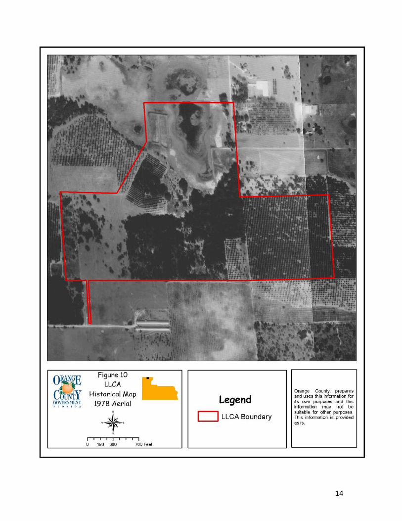
Number Page 1 General Location …………………………………………………………... 5 2 General Location 2 ………………………………………………………… 6 3 Regional Significance …………………..…………………………………. 7 4-14 Historical Aerials………………………………………..………………… 8-18 15 Topography ………….……………………………………………………. 20 16 Hydrology …………………………………………………………….…… 21 17 Quadrangle 1……………………………………………………………… 22 18 Quadrangle 2 ………………….………………………………………….. 23 19 Soils ……………………..….…………………………………………….. 27 20 Natural Communities …………………………………………………...... 29
LIST OF TABLES Number Page 1 Natural Communities …………..……………………………………….… 22 2 Exotic Plants Species List …….……………………………………….….. 31

1
INTRODUCTION Orange County has been acquiring environmentally sensitive lands since the early 1990’s and in 2002 the acquisition and land management plan was formally branded as the Green PLACE program which stands for Green Park Land Acquisition for Conservation and Environmental Protection (PLACE). Funding for the program has been through Public Service Tax Bonds, general revenue, grants, partnerships with other state and local agencies and the Conservation Trust Fund. The Green PLACE program mission statement is as follows: “To preserve and manage environmentally sensitive lands, protect water resource lands and to provide a quality passive recreational outdoors experience for existing and future generations.” With assistance from the Green PLACE Ad Hoc Committee and its successor, the Green PLACE Advisory Board, a strategy was established for the acquisition of environmentally sensitive lands which focused on the creation and expansion of ecological corridors. In addition, the Green PLACE Ad Hoc Committee assisted with the development of property uses that are allowed and prohibited for all Green PLACE properties (Appendix A). Orange County Green PLACE has adopted internal goals which state that a management plan must be written and implemented for all Green PLACE properties. The management plans must address land management issues, such as fire management, hydrologic restoration, imperiled species, and nonnative invasive plant and animal species control, as well as the management plans need to address the issues of public access and recreational uses. Site Description and Location Lake Lucie Conservation Area (LLCA) is a 166 acre site located at the intersection of Rainey Road and Swain Road in Apopka, Orange County, Florida, in Township 20S, Range 28E, Section 3 (Figure 1). The parcel is located north of Orange County’s Sandhill Preserve, northwest of Orange County’s Pine Plantation parcel and west of the Neighborhood Lakes parcel. Figure 2 is a more detailed location map of the Lake Lucie Conservation Area LLCA is composed of five different natural communities, consisting mainly of basin marsh, mesic hammock and improved and semi-improved pasture. These natural communities will be discussed in more detail within this plan.
LAND MANAGEMENT GOALS
The following goals provide the general framework for management of LLCA:
Maintain and restore, where appropriate, the natural hydrological regime and quality of surface waters

2
Maintain and restore native, natural communities (including control of non-native/invasive species)
Enhance species diversity Maintain and protect listed species Protect archeological and cultural resources Provide opportunities for public recreation that are compatible with the goals
listed above This management plan provides strategies and actions to be employed in furtherance of these broad, guiding statements.

3
AREA OVERVIEW
Regional Significance LLCA is regionally significant for its high recharge value to the Floridan aquifer that contributes to the spring flow of the Wekiva River system. LLCA is within 5 miles of several public lands in the northwestern portion of the County (Figure 3). These lands include: Neighborhood Lakes, Seminole State Forest, Wekiva River Basin State Parks, Sandhill Preserve, Kelly Park and Pine Plantation. Acquisition History The property was acquired on May 7, 2005 from Santos Fazio. On May 7, 2005, 166.22 acres were conveyed by Warranty Deed to the County for the purposes of preservation. Accordingly, the County is the owner and perpetual steward of the property. Cooperative Agreements The County has not entered into any Cooperative Agreements on this property at this time. Leases, Easements and Concessions The County has not entered into any leases or concessions at this time. There is one (1) pending agreement for the transfer of 45 feet by 300 feet to Orange County Public Works for the expansion of the Road Right of Way (ROW) for Rainey Road. The expansion of the ROW will allow for the paving of Rainey and Swain Roads with pervious materials. In addition, a meeting was held in June of 2010 with the Institute of Food and Agricultural Services (IFAS) to discuss agricultural opportunities for the property, and a short-term cattle and hay harvesting lease was recommended. This type of lease has the potential to provide many benefits until enhancement and restoration activities are implemented on the property. Some of the major benefits include: additional security and presence on the property, perimeter fence maintenance, continual maintenance of the pasture areas, continual upkeep of water supplies (wells, piping, quality of water, etc.), and invasive plant treatment of certain species. Further investigation of implementing a short-term lease will be conducted by staff. Lastly, this site is currently under permitting review with the Florida Fish and Wildlife Conservation Commission (FWC) as a gopher tortoise recipient site. In order to meet the long term protected site criteria a conservation easement will need to be granted to FWC. Cultural/Historical Resources There are no known or previously recorded cultural or historical resources located on the property. At a future date, Orange County will have a cultural and historical review of the site performed by an archeological research firm.

4
Existing Improvements/Alterations Boundary fencing was established prior to the purchase of the site. Other improvements/alterations on the site include the demolition of a greenhouse and old shed along with the removal of scattered debris, including rotting hay bales that were left by the previous owner. The property at this time has a horse stable, a barn structure, and a pump house for a well. In addition, an irrigation system is present throughout the east pasture area and within small areas along the south boundary. No other improvements/alterations have been initiated or observed at this time. Future Land Use and Zoning The Future Land Use category of A-1 is predominant over the entire property. Prior to the purchase of the property, the City of Apopka annexed the parcel into its city limits. The County plans to work with the City of Apopka to amend the Future Land Use Classification to a Parks and Recreation designation. This designation will be changed in the 2010 Comprehensive Plan Policy amendments.

5

6

7

8
9

10

11

12

13
14

15

16

17

18

19
NATURAL RESOURCES OVERVIEW
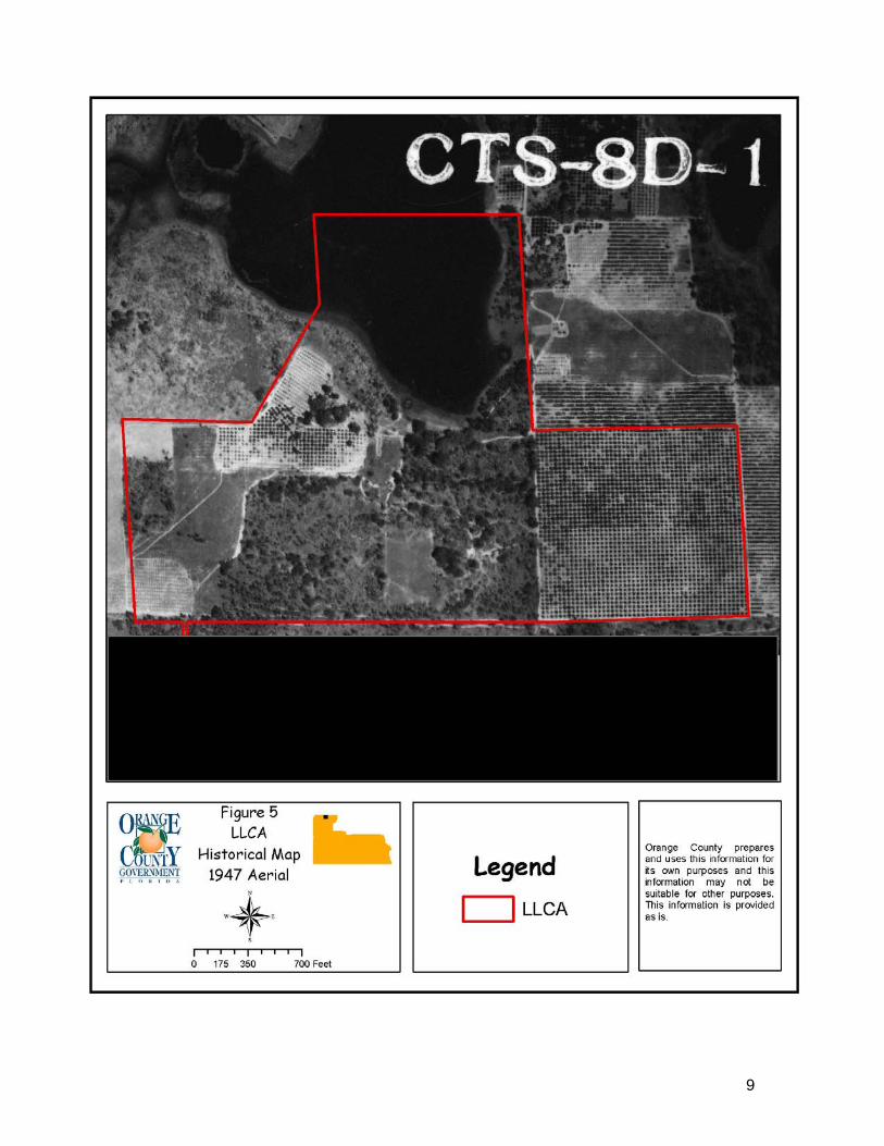
Topography and Surface Hydrology The topographic range on LLCA is diverse with the highest elevations found within improved pasture areas located on the western and southeastern portions of the property. Levels in these areas are generally between 100 to 120 feet above sea level. The majority of the northern portion of the property consists of lower topographic levels of 60 feet above sea level. Within the center of the property topographic levels are between 60 and 95 feet above sea level (Figure 15). LLCA is located within the Lake Apopka Drainage Basin and contains a portion of Lake Lucie within the property boundary. Lake Lucie is located along the northern boundary of the property and is considered to be an ephemeral pond/marsh lake system (Figure 16). Historically, several substantial impacts occurred within Lake Lucie. These include:
A mosquito control impoundment used to control mosquito populations was created on Lake Lucie in the northeast portion of LLCA. This structure was constructed between the years of 1967 and 1971 and consists of an earthen dike which allowed the area to be artificially flooded during the mosquito breeding season.
A lakeshore berm was constructed between the years of 1954 and 1963 along the eastern portion of LLCA. This berm also extends onto adjacent properties and has restricted its natural extent.
It appears that clearing, filling, and fencing activities occurred within the northern and western portions of the lake between the years of 1978 and 1994.
Possible water table drawdown occurring from surrounding developments. Due to these impacts, Lake Lucie’s hydrology appears to have changed significantly and historical aerials appear to show that lake levels have drastically decreased since 1954. In addition, a small borrow pit is located near the center of the property historically used for cattle. Goal: Maintain and restore, where appropriate, the natural hydrological regime and quality of surface waters. Strategy: Restore or improve the hydrology and topography to its original state. Actions:
Investigate any possible water quality issues on Lake Lucie. Investigate the reasons for lower lake levels on Lake Lucie observed throughout
historic aerials. Investigate the feasibility of implementing hydrological restoration on Lake
Lucie. Investigate the feasibility of implementing vegetative enhancement on the small
borrow pit for increased wildlife use.

20

21

22

23

24
Soils The dominant soil types within LLCA, as defined by the Natural Resource Conservation Service (formerly the Soil Conservation Service) are as follows:
• Basinger Fine Sand, Depressional • Candler Fine Sand 0 to 5 percent slopes • Candler Fine Sand 5 to 12 percent slopes • Candler-Apopka Fine Sand 5 to 12 percent slopes • Florahome Fine Sand 0 to 5 percent slopes • Pits • Seffner Fine Sand • Tavares-Millhopper Fine Sands 0 to 5 percent slopes
Basinger Fine Sand, Depressional - Very deep, poorly drained, rapidly permeable soils in depressions, poorly defined drainage ways, and floodplains. Slopes range from 0 to 2 percent. Natural vegetation typically consists of wax myrtle (Myrica cerifera), St. Johns wort (Hypericum spp.), maidencane (Panicum hemitomon), cypress (Taxodium spp.), slash pine (Pinus elliottii), longleaf pine (Pinus palustris), pond pine (Pinus serotina), and other water tolerant plant species. Candler Fine Sand 0 to 5 percent slopes - Nearly level to gently sloping and excessively drained upland plant community soils. The slopes are nearly smooth to convex. Natural vegetation typically consists of scattered slash pine, sand pine (Pinus clausa), longleaf pine, bluejack oak (Quercus incana), Chapman’s oak (Quercus chapmanii), turkey oak (Quercus laevis), indiangrass (Sorghastrum spp.), chalky bluestem (Andropogon virginicus), hairy panicum (Panicum anceps), and pineland threeawn (Aristida stricta). Candler Fine Sand 5 to 12 percent slopes – Sloping to strongly sloping and excessively drained. These soils are found on the upland portions of the property. Natural vegetation typically consists of scattered slash pine, sand pine, longleaf pine, bluejack oak, Chapman’s oak, turkey oak, indiangrass, chalky bluestem, hairy panicum, and pineland threeawn. Candler-Apopka Fine Sand 5 to 12 percent slopes – Sloping and strongly sloping and excessively drained and well drained. Candler soil is on summits and lower side slopes. Apopka soil is on the upper side slopes. These soils are on the upland portions of the property. Natural vegetation typically consists of scattered sand pine, slash pine, longleaf pine, bluejack oak, Chapman’s oak, and live oak (Quercus virginiana). In addition, scattered loblolly bay (Gordonia lasianthus) is on Apopka soil. Understory typically includes grassleaf goldaster (Pityopsis oligantha), eastern bracken (Pteridium aquilinum), lopsided indiangrass (Sorghastrum secundum), dwarf huckleberry (Gaylussacia dumosa), and pineland threeawn. Florahome Fine Sand 0 to 5 percent slopes – Nearly level to gently sloping and moderately well drained. The slopes are smooth to convex. These soils are on the upland portions of the property. Natural vegetation typically includes live oak, turkey oak,

25
longleaf pine, slash pine, saw palmetto (Serenoa repens), wild grape (Vitis spp.), switchgrass (Panicum virgatum), lopsided indiangrass, and pineland threeawn. Pits – Consists of excavated areas of unconsolidated or heterogeneous soil and geologic materials which have been removed primarily for use in road construction or as fill material for low areas and building foundations. Seffner Fine Sand – Nearly level and poorly drained. It is on the rims of depressions and on broad, low ridges on the flatwoods. The slopes are smooth and concave and range from 0 to 2 percent. The natural vegetation typically consists of longleaf pine, slash pine, live oak, laurel oak, wax myrtle, fetterbush (Lyonia lucida), creeping bluestem (Schizachyrium scoparium), lopsided indiangrass, saw palmetto, and pineland threeawn. Tavares-Millhopper Fine Sands 0 to 5 percent slopes – Nearly level to gently sloping and moderately well drained. Located on low ridges and knolls on uplands and on flatwoods. The slopes are nearly smooth to slightly convex. The natural vegetation typically consists of water oak (Quercus nigra), laurel oak (Quercus laurifolia), turkey oak, live oak, slash pine, longleaf pine, lopsided indiangrass, and pineland threeawn.

26

27
Natural Communities LLCA consists of a mosaic of natural communities. This information is summarized in Table 1. A comprehensive survey of the property was conducted by staff from the Florida Natural Areas Inventory (FNAI) in 2007. This survey along with field evaluation conducted by County staff resulted in the identification of five different natural communities. Table 1. Natural Communities
Natural Communities Approximate Acreage Basin Marsh 15 Mesic Hammock 16 Improved Pasture 98 Semi-Improved Pasture 27 Ruderal 10 Approximate Total Acreage 166
BASIN WETLANDS Basin Marsh Historically, this basin marsh area was classified as Lake Lucie. Basin marsh is characterized as an herbaceous or shrubby wetland situated in a relatively large and irregular shaped basin. They usually develop in large solution depressions that were formerly shallow lakes. Typically basin marshes are created through gradual filling with sediments from surrounding upland and with peat derived from plants. The conversion of lake to basin marsh on this property may be attributed mainly to development and agricultural impacts that have slowly drained the lake over decades. The 15 acres of basin marsh is located at the northern portion of the property. Typical plants found in this type of habitat include cutgrass (Leersia spp.), pennywort (Hydrocotyle umbellata), maidencane, redroot (Lachnanthes caroliniana), rushes (Juncus spp.), saltbush (Baccharis spp.), and elderberry (Sambucus nigra). The basin marsh community found on LLCA is dominated by maidencane and a variety of rushes and sedges. FLATLANDS Mesic Hammock Mesic hammocks are hardwood forested communities of open or closed canopy dominated more commonly by live oak and/or laurel oak, with cabbage palm (Sabal palmetto) often present in the canopy and sub-canopy. Approximately 16 acres of LLCA is considered to be this type of habitat, and is located in the center and northern portions of the property. The canopy is dense with live oak and laurel oak, with a moderate amount of camphor tree (Cinnamomum camphora) interspersed. The understory is

28
overgrown with shrubs and dominated by muscasdine grapevine (Vitis rotundifolia) and greenbriar (Smilax spp.), with very few herbaceous species present within the groundcover. Due to historical human disturbances and fire exclusion within the area, the habitat succeeded from a sandhill into a mesic oak hammock. ALTERED AREAS Semi-Improved Pasture The semi-improved pasture on LLCA comprises approximately 27 acres and is located in the center portion of the property, with a small separate area located in the western portion. It is characterized by a mix of planted non-native or domesticated native forage species. Due to an incomplete conversion to pasture, some scattered patches of native vegetation can remain. The semi-improved pasture on LLCA is dominated by perennial peanut (Arachis glabrata) that was planted as a source of hay by the previous land owner. The remaining ground cover consists of common ragweed (Ambrosia artemisiifolia), trailing phlox (Phlox nivalis), poor man's pepper (Lepidium virginicum), and bermudagrass (Cynodon dactylon). Improved Pasture Improved pasture is characterized as pasture that has been cleared of native vegetation and is dominated by planted non-native or domesticated native forage species. The improved pasture areas on LLCA comprise approximately 98 acres and are located in the eastern, western, and northern portions of the property. In Florida, most improved pastures are dominated by bahiagrass, and bermudagrass to a lesser extent. Other typical species include dogfennel (Eupatorium capillifolium), flatsedge (Cyperus spp.), carpetgrass (Axonopus spp.), and rustweed (Polypremum procumbens). The improved pasture community found on LLCA is dominated by bermudagrass. Other species scattered throughout the community include bahiagrass, dogfennel, trailing phlox, lantana (Lantana camara), and passion flower vine (Passiflora incarnata). Ruderal This habitat is defined as natural vegetation that is growing within an area that has been disturbed by manmade activities. This community type comprises approximately 10 acres of LLCA. The ruderal areas located on LLCA are located around previously built residential homes in the center portions of the property. The trees found in the ruderal areas include southern magnolia (Magnolia grandiflora) and crepe myrtle (Lagerstroemia indica). There are also landscaping shrubs surrounding the houses consisting primarily of ornamental palms. The limited groundcover consists primarily of bahiagrass.

29

30
Non-native/Nuisance Species Plants Exotic, non-indigenous, non-native, and alien species are all terms used to describe plants that are of foreign origin. Some non-native species can be invasive when they harm or displace native species and alter native ecosystem function. LLCA has approximately 12 non-native/invasive vegetative plant species including camphor tree, cogongrass, chinaberry (Melia azedarach), and Japanese climbing fern. A detailed inventory of non-native/invasive plant species has not been conducted and other non-native species are likely to exist on-site. Staff has prepared an inventory database for non-native and invasive plant species found within all managed conservation lands and is developing strategies to remove the species or to control their coverage. Staff is currently developing a comprehensive treatment and monitoring program to ensure the long-term removal of these species from LLCA. Table 2: Nonnative/invasive Plant Species List – LLCA
Scientific Name Common Name FLEPPC Category
Cinnamomum camphora Camphor Tree I Colocasia esculenta Wild Taro I Imperata cylindrica Cogon Grass I Lantana camara Lantana I Lygodium japonicum Japanese Climbing Fern I Solanum viarum Topical Soda Apple I Antigonon leptopus Coral Vine II Melia azedarach Chinaberry II Panicum maximum Guinea Grass II Cycas revolute Sago Palm E Indigofera spicata Hairy Indigo E Paspalum notatum Bahia Grass E
The Florida Exotic Pest Plant Council (FLEPPC) compiles invasive species lists that are revised every two years. Professional botanists and others perform studies to determine non-native/invasive plant species that should be placed on the lists. Non-native/invasive plants are termed as Category I, Category II, or Category E which are explained as the following:
• Category I – non-native/invasive plants that are altering native plant communities by displacing native species, changing community structures or ecological functions, or hybridizing with native species. This definition does not rely on the economic severity or geographic range of the problem, but on the documented ecological damage caused.

31
• Category II – non-native/invasive plants that have increased in abundance or frequency but have not yet altered Florida plant communities to the extent shown by Category I species. These species may become ranked Category I, if ecological damage is demonstrated.
• Category E- non-native species that are not or not yet classified in any other category.
Animals Invasive/non-indigenous animal species have the potential to adversely affect ecosystem function and to significantly alter population levels of native wildlife through predation or displacement. A formal inventory of the property for nonnative animal species has not yet been conducted. Feral hogs have been observed on the property. Goal: Maintain and restore native, natural communities including control of nonnative/invasive species and to determine through monitoring what non-native/invasive animal species exist on site. Strategy: Eradicate or control to a manageable level non-native/invasive species. Actions:
Develop a methodology and work plan to accomplish the identification of exotic plant and animal species.
GPS the location of identified invasive species within and/or adjacent to the property.
Control and eradication efforts of newly occurring or re-occurring populations of these undesirable species may include, but are not limited to, mechanical and chemical procedures with priority being given to Category I pest plants listed by the FLEPPC.
Routinely monitor the management area for new or re-occurrence of non-native/invasive species.
Educate neighboring properties and the public regarding the planting of undesirable plants or non-native plants as listed by FLEPPC and the Florida Department of Agriculture and Consumer Services (FDACS).
General Wildlife
This property contains both upland and wetland habitats used by a diverse group of wildlife species. No comprehensive faunal surveys have been initiated for the property. The natural communities found within the site provide suitable habitat conditions for use by a broad range of animal species. For a list of observed species refer to Appendix D. Some examples of wildlife which may be found on the property include; black racer (Coluber constrictor), loggerhead shrike (Lanius ludovicianus), northern mockingbird (Buteo Mimus polyglottos), raccoon (Procyon lotor), swallow-tailed kite (Elanoides forficatus), gopher tortoise (Gopherus polyphemus), blue jay (Cyanocitta cristata), golden-silk orbweaver (Nephila clavipes), zebra longwing (Heliconius charitonius) and pileated woodpecker (Dryocopus pileatus).

32
Listed Species (Fauna)
The United States Fish and Wildlife Services (USFWS) and the State of Florida under the auspices of the Florida Fish and Wildlife Conservation Commission compile lists of protected wildlife species considered to be under possible threat of extinction. These listed species are categorized as Endangered, Threatened or Species of Special Concern. Gopher Tortoise (Gopherus polyphemus) Gopher tortoises have been observed on the site. The FWC changed the status of the gopher tortoise from Species of Special Concern to Threatened in November of 2007. A formal survey conducted by an environmental consulting firm has been conducted on LLCA. Further surveying to determine if the population is stable and in good health will be conducted in the future. Restoring the sparse habitat and reintroducing prescribed fire will enhance the habitat by revitalizing the understory, thereby increasing the amount of habitat open to foraging and colonization. Listed Species (Flora)
Currently, no listed plant species have been observed by County staff during field observations or by FNAI while conducting surveys on the property. In the future, if any listed species are located on this property, staff will add them to the Master Species Database and appropriately consider them in the management of the property. Goal: Maintain and protect listed species. Strategy: Identify and protect on-site populations of endemic, rare, threatened and endangered species through the utilization of existing habitat management and species recovery plans. Actions:
Develop a methodology and work plan to accomplish the survey for and identification of designated plant and animal species.
Plot the location of identified designated species within and/or adjacent to the property for use in the implementation, or re-distribution, of amenities or site improvements.
Periodically update these baseline survey data to determine possible changes in designated species distribution or density.
Implement habitat enhancement and restoration activities for listed species (i.e., removal of non-native/nuisance species, restoration of ecosystem function, prescribed fire, etc).
Establish periodic monitoring of habitat suitability (where indices are available for a given species), species population levels, diversity levels, and exotic/nuisance species, as a means of evaluating the success of management strategies.

33
Climate Change Climate change is a growing concern regarding its possible adverse impacts to natural environments. While scientists remain uncertain about how the effects of climate change will manifest, their research suggests that natural environments are vulnerable. Climate change can affect natural areas and the ecology of managed areas in many ways. Some of the possible changes include:
A rise in temperature that can change the movement of native and invasive plants and wildlife.
An increase in the strength and occurrence of natural disasters such as hurricanes. Increased development adjacent to managed natural areas due to coastal retreat
from a rise in sea level. Fluctuations in rainfall that may cause ecological changes to natural community
types. Altered prescribed fire regimes due to changed weather patterns.
Many of the issues that are being addressed for the adverse impacts from development parallel many of the same issues for climate change. It is EPD’s intention to be aware of climate change and its possible adverse impacts to the natural areas and respond to the issues proactively. Goal: Maintain and restore native, natural communities. Strategy: Address climate change issues for the LLCA. Actions:
Investigate how climate change issues may affect the property. Address, if necessary, any adverse impacts expected from climate change. Investigate grants for climate change preparedness. Continue to monitor the vegetation and wildlife on the property and address any
environmental changes to the ecology of the site. Explore potential partnerships with the University of Central Florida to study the
affects of climate change and how natural areas act as carbon sinks. Develop adaptation policies that combine management, restoration, and
protection. Monitor funding and policies that support natural lands and their ability to adapt
to the impacts of climate change.

34
RESOURCE MANAGEMENT Habitat Enhancement and Restoration LLCA will be managed in such a manner as to promote conditions favoring the natural and historical aspects of the property. As evidenced by historical aerial photographs, the type of vegetative cover that characterized the property prior to the 1930’s is not comparable to present day. Notable differences exist in the density and extent in the coverage of the vegetative communities. These differences are attributed to changes in the fire regime, and cultural activities including changes in the natural drainage patterns, vegetative alterations for agricultural uses and the construction of houses. Some of these alterations include:
• The conversion of native vegetative communities into orange grove, pasture, and hay harvesting areas.
• The conversion of native vegetative communities into houses and yard areas. • Silvicultural activities that included the removal of nearly all longleaf pine on the
property. • Fire exclusion that resulted in historic native sandhill to climax into an oak
hammock community. • Berms and other impacts surrounding Lake Lucie that resulted in hydrological
alterations. Historically, the majority of this property was a sandhill community; however, historical intact upland communities no longer exist on the property. Due to the extent of alterations, enhancement and restoration of this site will be extensive. For this reason, habitat enhancement and restoration will not be a high priority in the short-term. This will allow staff to focus on other Green PLACE properties which provide habitats that require less work and provide a greater benefit to wildlife. Instead, focus will be given to the maintenance aspects on LLCA. For example, the property contains a variety of non-native/nuisance plant species and the first stage of enhancement will likely be to treat these species until they are at a manageable level. Maintenance aspects could be expected to take up to at least 10 years to achieve. As mentioned under the lease portion of this management plan, a short-term cattle and hay harvesting lease may be beneficial in meeting the maintenance aspects necessary for the site. Maintenance of the property may help prepare it for future enhancement and restoration activities. Periodic mowing and treatment of non-native/nuisance species will help keep areas currently used by wildlife maintained and will also assist in preventing the spread of these plant species into other areas of the property and neighboring properties. In addition, the maintenance and upkeep of present water supplies (i.e. water pipes, hose connections, etc.) will assist in our future management activities such as for prescribed fire and invasive species control. Due to the high climax stage of the oak hammock, this area may not be feasible to restore into its historic native habitat of sandhill. The Diameter at Breast Height (DBH) for several oaks is greater than 20 inches which may make the area economically and logistically difficult to restore to a sandhill community. In addition, it is unknown

35
whether native sandhill groundcover species would be able to inhabit the site following intensive canopy removal and past historical disturbances. This area will need to be researched more extensively to see the feasibility of enhancement and/or restoration. Future restoration will be needed in pasture areas by removing pasture grasses and other undesirable species followed by seeding with native seed appropriate for the community type. Based on historical aerials, soil maps, and site visits it appears that most of these areas will be enhanced or restored to a sandhill community type. In addition, following re-seeding of these pasture areas the replanting of canopy species, primarily longleaf pine, will be implemented. Lake Lucie has shown a gradual decrease in lake levels observed through the sets of historical aerials. These changes may be attributed to a number of factors such as; established perimeter and internal berms, and lowering of the aquifer or water table due to drawdown from nearby developments. Hydrological alterations will need to be further investigated for planning restoration possibilities. Restoration and enhancement for all areas on LLCA will be addressed in more detail in future operational plans. Forest and Fire Management Forest and fire management activities are critically important and integrally linked. It is crucial to understand that the planning and application of forest and fire management activities must be coordinated to achieve restoration and management goals. Both fire management activities and forest management activities can be useful tools in promoting natural community diversity and reducing potentially hazardous fuel loads. Forest Management An objective-based approach to habitat management will be used for the property. As such, a set of Desired Future Conditions (DFCs) will be developed for the various managed habitats. The DFCs, which will be established after extensive analysis of the existing conditions, are intended to serve as guides for achieving preferred habitat conditions for plant and animal species. Initial sampling will provide staff with baseline data indicating the vegetative condition. Regular vegetation monitoring, in accordance with standard methods, will be used to assess the level of success in obtaining the desired conditions. Monitoring will involve sampling for variables associated with particular DFCs within a management unit. Results obtained from monitoring will be used to ascertain if the DFCs have been met. Mechanical treatment and replanting of native vegetation may be implemented when restoration activities are developed for LLCA. These activities will be undertaken in the context of furthering the overall health and vitality of a habitat as expressed by the DFCs. These activities will also assist in preparing natural areas for prescribed fire. An analysis of anticipated costs associated with planting activities will be prepared when further investigation of these activities occur in accordance with the DFCs.
36
Silvicultural activities such as timbering may be used on the property to remove trees as needed in the case of insect infestations, disease, damage from severe weather, or other occurrences that could jeopardize the health of the natural communities. If any clearcuts occur due to the above instances, the County will assess each stand and begin to implement appropriate restoration and reforestation techniques based on each stand. This may include burning and any necessary groundcover restoration, followed by planting with appropriate overstory species, typically slash or longleaf pine. When needed, groundcover planting or direct seeding will be used in conjunction with natural regeneration. Fire Management The overall forest management program for the property will include the use of prescribed fire. Prescribed fire is the preferred management technique to be employed for habitat maintenance and enhancement on the property. Much of the management area supports habitats that are dependent upon periodic fires for establishment and long-term viability. Utilizing prescribed fire within LLCA will benefit ecosystems that have evolved under the influences of this natural process in Florida. It is widely recognized that prescribed fire, applied in established frequencies specific to each ecosystem, is an important land management tool to promote biodiversity through the reintroduction of fire to dependant ecosystems. Prescribed fire also has the added benefit of lowering and maintaining fuel loads, thus mitigating the behavior and effects of wildfires that start in or outside of the property. Natural communities within LLCA will be evaluated to determine any constraints upon the use of prescribed burning posed by natural site conditions and adjacent land uses. When necessary, other methods, including mowing, roller chopping, and herbicide, will be utilized in place of or in conjunction with prescribed burning. These alternative strategies will be emphasized in areas where fire cannot be applied, when fuel loads are high, or when the required prescribed burning weather conditions are defined within such a narrow parameter that they are infrequently met. Goal: Maintain and restore native natural communities. Strategy: Develop and implement a detailed restoration plan for the property. Actions:
Further investigate options for enhancing or restoring the oak hammock area. Further investigate hydrological alterations on Lake Lucie. Develop and implement a detailed enhancement and restoration plan for the
property. Develop projected costs for restoration evaluation and implementation. Explore grant opportunities for additional funding of projects. Explore the use of a short-term cattle lease to help prepare the site for future
enhancement and restoration activities.

37
Strategy: Determine communities on site for restoration and reforestation activities. Actions:
Develop a planting plan for restoration areas. Monitor forested areas for drought, disease, or insect infestations and utilize
chemical treatments or timber removal as needed. Evaluate any clearcut areas and implement appropriate restoration techniques.
Strategy: Develop a prescribed fire management program for LLCA. Actions:
Create a fire management plan that includes management unit/subunit maps and corresponding fuel load information.
Develop and implement a prescribed burning schedule. Coordinate cooperative efforts with other agencies.

38
PUBLIC ACCESS AND USE
Access Adequate access is a necessity for land management activities. Law enforcement patrol, prescribed burning activities and fire suppression are but a few of the activities that benefit from improved road access. The property has two access points which are located off of Rainey Road and Boch Road. The Rainey Road access is currently the main access of the property and is in good condition. The Boch Road entrance is overgrown with vegetation and will require some mowing and/or mulching as well as some possible road maintenance (leveling, etc.) and gate installation to use as an access point. This access point may also become inaccessible in the future when the Wekiva Parkway is constructed. In addition, there are a number of internal roads that are currently adequate for access for land management activities. Periodic maintenance of the roads and access areas will be required. Evidence of trespassing has been seen along the Rainey Road perimeter of the property where fences have been removed to access internal roads. A gate has been installed in this area to help prevent future trespassing issues. This gate may also be used as an alternate entrance for future land management activities. A future parking area for public access has not yet been determined for this property. Goal: Provide access to all areas of the property. Strategy: Develop a road and trail plan that addresses access issues and includes maintenance plans with associated costs. Actions:
Address access issues for the property. Develop a road/trail maintenance plan with associated costs. Address access issues during the development of the operational plan.
Recreation Recreational opportunities are essential to establish for all Green PLACE properties. Public uses for all Green PLACE properties are broken down into 3 categories: primary, secondary and prohibited. These categories were developed in conjunction with the Green PLACE AD Hoc Advisory Committee and subsequently approved by the Orange County Board of County Commissioners. Due to the nature of the habitats and their quality, only primary uses are planned at this stage to be allowed to occur on the property. In the future, EPD will evaluate the site to determine if any of the secondary uses would also be compatible on the property. The approved Property Uses is attached in Appendix A. Goal: Provide recreational opportunities for the public. Strategy: Develop a trail system that allows access to the various habitats.

39
Actions
Delineate proposed trail system utilizing GIS and the most current aerials. Ground truth proposed trail layout. Build trail and other associated amenities.
Environmental Education Environmental education is essential to a successful land acquisition and management program. Educating the public on the benefits of a land acquisition program will enhance public support for future bond issues. Educating the public on the types of land management activities that need to be performed, such as prescribed fire and timber harvesting, will lessen negative feedback from the public when these activities are conducted. In addition, a good educational program will increase the publics’ knowledge of the diverse plant and animal species that occur in Florida and give them a better understanding of the uniqueness and beauty of Florida’s various ecosystems. Goal: Develop an educational program specific to LLCA. Strategy: Develop a Docent program that can be utilized for all properties. Develop a land management presentation that can be customized to the specific needs of each property. Actions:
Develop an interpretative trail for LLCA. Conduct guided hikes on LLCA. Conduct a presentation to the adjacent Home Owner’s Associations.
Security Adequate security is essential for all Green PLACE properties. Security in the form of fences and authorized access points will reduce the incidence of trespassing on Green PLACE properties and minimize the damage to the property from unauthorized activities. In addition, securing the boundaries will reduce the County’s liability. County boundary signs will also be utilized on the boundary fence to meet trespassing laws and regulations. Trespass issues have been observed on the property. One issue includes evidence of trespassing along the Rainey Road perimeter of the property where fences have been removed to access internal roads. Fences have currently been re-constructed and a gate has been installed in this area to help prevent future trespassing issues. In addition, trespassing has been observed within the onsite houses. These issues will be reviewed further in order to minimize trespassing on the property. Goal: Secure the boundaries of LLCA and identify authorized public access points. Strategy: Develop a general security Standard Operating Procedure (SOP) for all Green PLACE properties.

40
Actions:
Coordinate with Orange County Sheriff’s Office to patrol property. Post signage that identifies authorized access points for the property and
authorized uses that are allowed on the property. Develop an SOP for patrolling the property to identify and correct security issues
on a timely basis. Develop detailed public use rules for the properties that will be enforceable by
law. Review temporary uses (leases, etc.) that may allow for further security of the
property.

41
IMPLEMENTATION TIMELINE ACTION TIMELINE
Strategy: Address climate change issues for the LLCA.
Investigate how climate change issues may affect the property. Future Issue
Address, if necessary, any adverse impacts expected from climate change.
Future Issue
Investigate grants for climate change preparedness. Future Issue
Continue to monitor the vegetation and wildlife on the property and address any environmental changes to the ecology of the site.
On-going
Explore potential partnerships with the University of Central Florida to study the affects of climate change and how natural areas act as carbon sinks.
Future Issue
Develop adaptation policies that combine management, restoration, and protection.
Future Issue
Monitor funding and policies that support natural lands and their ability to adapt to the impacts of climate change.
Future Issue
Strategy: Restore or improve the hydrology and topography to its original state.
Investigate any possible water quality issues on Lake Lucie. Long-term
Investigate the reasons for lower lake levels on Lake Lucie observed throughout historic aerials.
Long-term
Investigate the feasibility of implementing hydrological restoration on Lake Lucie.
Long-term
Investigate the feasibility of implementing vegetative enhancement on the small borrow pit for increased wildlife use.
Long-term

42
Strategy: Eradicate or control to a manageable level non-native/invasive species.
Develop a methodology and work plan to accomplish the identification of non-native/invasive plant and animal species.
Short-term
GPS the location of identified invasive species within and/or adjacent to the property.
On-going
Control and eradication efforts of newly occurring or re-occurring populations of these undesirable species may include, but are not limited to, mechanical and chemical procedures with priority being given to Category I pest plants listed by the FLEPPC.
On-going
Routinely monitor the management area for new or re-occurrence of non-native/invasive species.
On-going
Educate neighboring properties and the public regarding the planting of undesirable plants or non-native plants as listed by the FLEPPC and the Florida Department of Agriculture and Consumer Services (FDACS).
On-going
Strategy: Identify and protect on-site populations of endemic, rare, threatened and endangered species through the utilization of existing habitat management and species recovery plans.
Develop a methodology and work plan to accomplish the survey for and identification of designated plant and animal species.
Short-term
Plot the location of identified designated species within and/or adjacent to the property for use in the implementation, or re-distribution, of amenities or site improvements.
On-going
Periodically update these baseline survey data to determine possible changes in designated species distribution or density.
On-going
Implement habitat enhancement and restoration activities for listed species (i.e., removal of exotic/nuisance species, restoration of ecosystem function, prescribed fire, etc).
Long-term
Establish periodic monitoring of habitat suitability (where indices are available for a given species), species population levels, diversity levels, and non-native/nuisance species, as a means of evaluating the success of management strategies.
On-going

43
Strategy: Develop and implement a detailed restoration plan for the property.
Further investigate options for enhancing or restoring the oak hammock area.
Long-term
Further investigate hydrological alterations on Lake Lucie. Long-term
Develop and implement a detailed enhancement and restoration plan for the property.
Long-term
Develop projected costs for restoration evaluation and implementation.
Long-term
Explore grant opportunities for additional funding of projects. On-going
Explore the use of a short-term cattle lease to help prepare the site for future enhancement and restoration activities.
Short-term
Strategy: Determine communities on site for restoration and reforestation activities.
Develop a planting plan for restoration areas. Long-term
Monitor forested areas for drought, disease, or insect infestations and utilize chemical treatments or timber removal as needed.
On-going
Evaluate any clearcut areas and implement appropriate restoration techniques.
Long-term
Strategy: Develop a prescribed fire management program for LLCA.
Create a fire management plan that includes management unit/subunit maps and corresponding fuel load information.
Long-term
Develop and implement a prescribed burning schedule. Long-term
Coordinate cooperative efforts with other agencies. Long-term
Strategy: Develop a road and trail plan that addresses access issues and includes maintenance plans with associated costs.
Address access issues for the property. Short-term
Develop a road/trail maintenance plan with associated costs. Long-term

44
Address access issues during the development of the operational plan.
Long-term
Strategy: Develop a trail system that allows access to the various habitats.
Delineate proposed trail system utilizing GIS and the most current aerials.
Short-term
Ground truth proposed trail layout. Short-term
Build trail and other associated amenities. Long-term
Strategy: Develop a Docent program that can be utilized for all properties. Develop a land management presentation that can be customized to the specific needs of each property.
Develop an interpretative trail for LLCA. Long-term
Conduct guided hikes on LLCA. Long-term
Conduct a presentation to the adjacent Home Owner’s Associations.
Long-term
Strategy: Develop a general security Standard Operating Procedure (SOP) for all Green PLACE properties.
Coordinate with Orange County Sheriff’s Office to patrol property. On-going
Post signage that identifies authorized access points for the property and authorized uses that are allowed on the property.
Short-term
Develop an SOP for patrolling the property to identify and correct security issues on a timely basis.
Short-term
Develop detailed public use rules for the properties that will be enforceable by law.
Short-term
Review temporary uses (leases, etc.) that may allow for further security of the property.
Short-term

45
REFERENCES The Guide to the Natural Communities of Florida. Florida Natural Areas Inventory and Florida Department of Natural Resources. February, 1990. Hal Scott Regional Preserve and Park Land Management Plan. St. Johns River Water Management District. October, 2007. Florida Forever Five Year Plan, 2007. Florida Department of Environmental Protection, Division of State Lands. List of Invasive Species, 2009. Florida Exotic Pest Plant Council. Longleaf Pine Preserve Land Management Plan. County of Volusia, Division of Land Acquisition and Management. October, 2006. North Buck Lake Scrub Sanctuary Draft Management Plan. Brevard County, Environmentally Endangered Lands Program, Parks and Recreation Department. 2007. Soil Survey of Orange County, Florida. U. S. Department of Agriculture, Soil Conservation Service in cooperation with University of Florida, Institute of Food and Agricultural Sciences.

46
Appendix A

47

48

49
Appendix B

50

51

52

53

54

55

56

57

58
59

60

61
Appendix C

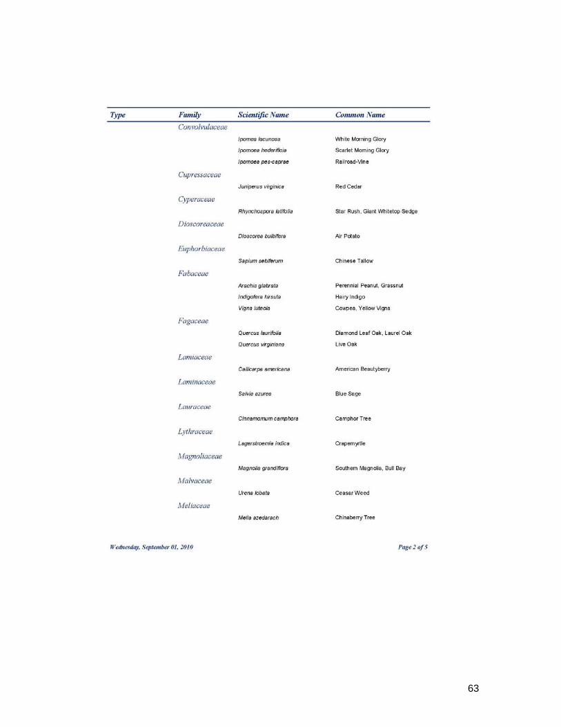
62
63

64

65

66