Introduction to Remote Sensing. Contents What’s GIS Limitation of Classical Map Usefulness of GIS...
43
Introduction to Remote Sensing
-
Upload
lawrence-mccoy -
Category
Documents
-
view
225 -
download
1
Transcript of Introduction to Remote Sensing. Contents What’s GIS Limitation of Classical Map Usefulness of GIS...
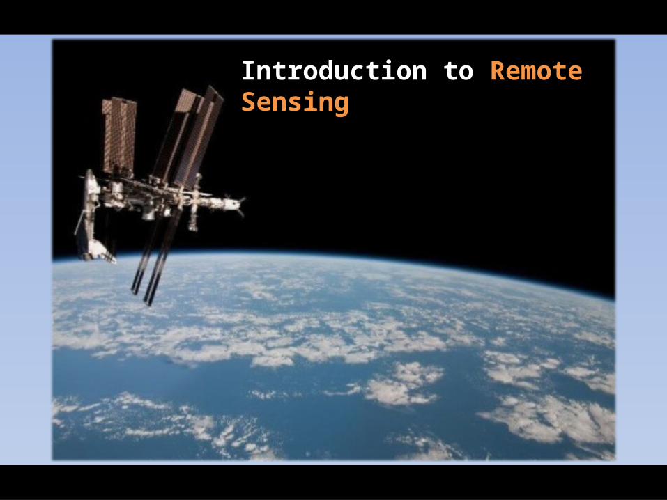
Introduction to Remote Sensing
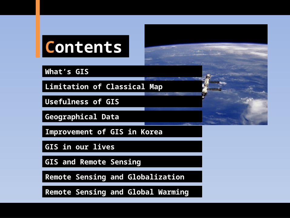
Con-tentsWhat’s GIS
Limitation of Classical Map
Usefulness of GIS
Geographical Data
Improvement of GIS in Korea
GIS in our lives
GIS and Remote Sensing
Remote Sensing and Globalization
Remote Sensing and Global Warming
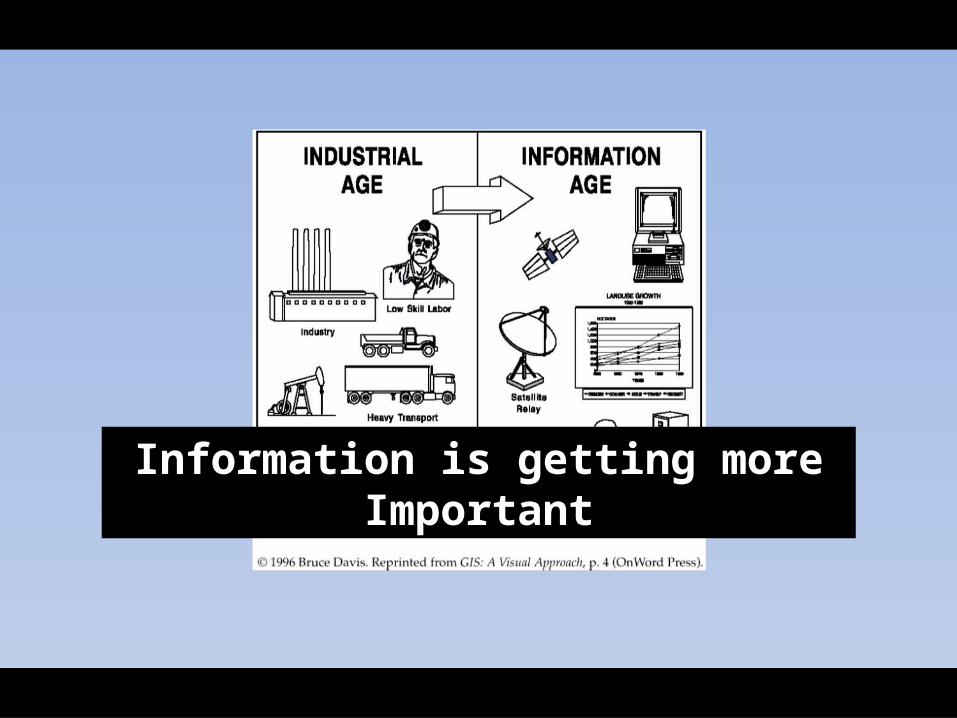
Information is getting more Important
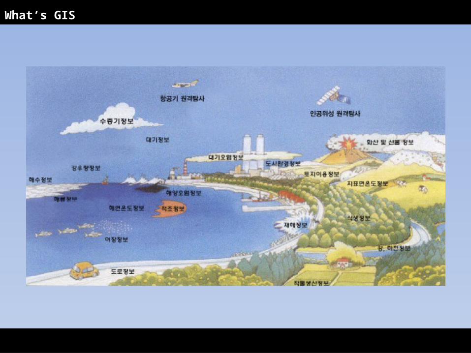
What’s GIS
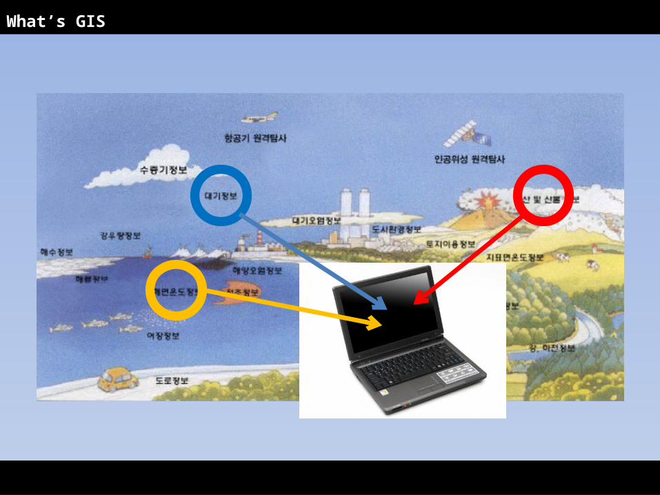
What’s GIS
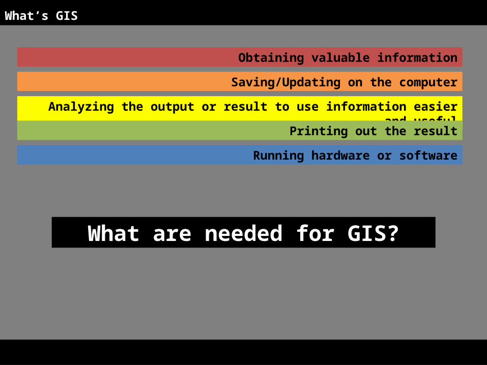
Obtaining valuable information
Analyzing the output or result to use information easier and useful
Running hardware or software
Saving/Updating on the computer
Printing out the result
What’s GIS
What are needed for GIS?

What’s GIS
Informa-tion
(Database)
Hard-ware and Software
Work Process
People
GIS
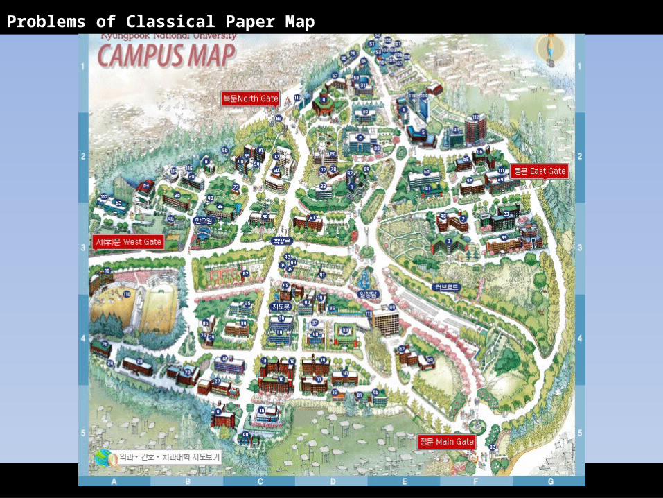
Problems of Classical Paper Map
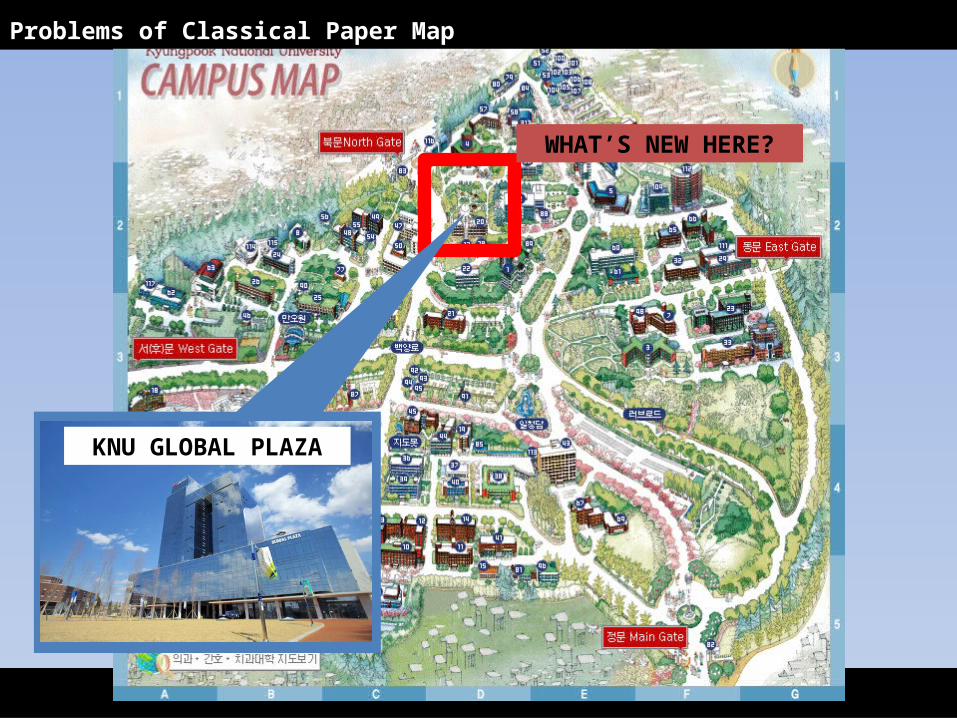
WHAT’S NEW HERE?
KNU GLOBAL PLAZA
Problems of Classical Paper Map
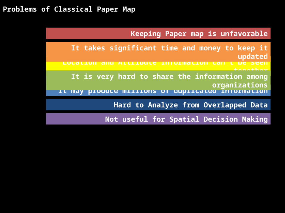
Keeping Paper map is unfavorable
Location and Attribute Information can’t be seen to-gether
It may produce millions of duplicated information
Not useful for Spatial Decision Making
It takes significant time and money to keep it up-dated
It is very hard to share the information among orga-nizations
Hard to Analyze from Overlapped Data
Problems of Classical Paper Map
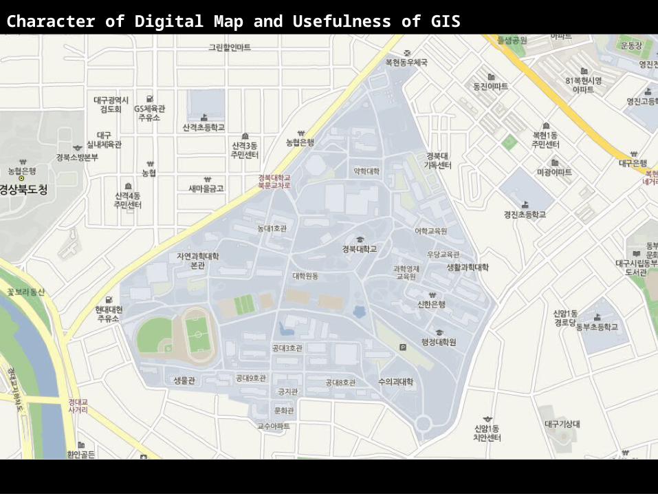
Character of Digital Map and Usefulness of GIS
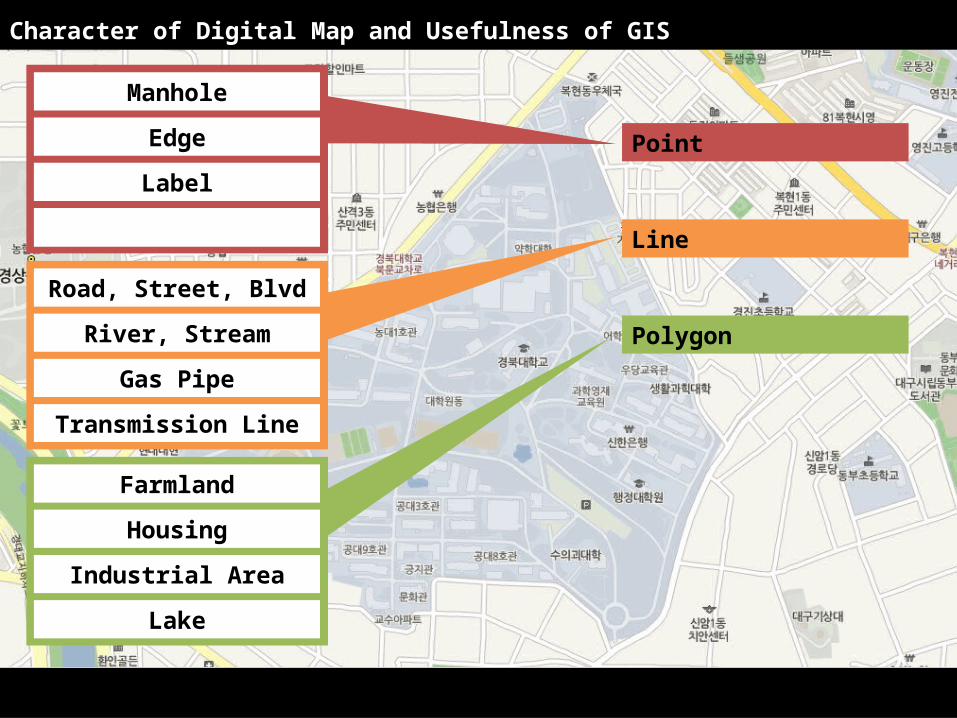
Point
Line
Polygon
Manhole
Edge
Label
Road, Street, Blvd
River, Stream
Gas Pipe
Transmission Line
Farmland
Housing
Industrial Area
Lake
Character of Digital Map and Usefulness of GIS
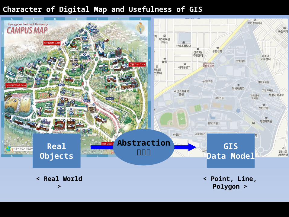
Character of Digital Map and Usefulness of GIS
RealObjects
GISData Model
< Real World >
< Point, Line, Poly-gon >
Abstraction추상화

Population
Classification Area
Accessibility to Road
Price of Land
Character of Digital Map and Usefulness of GIS
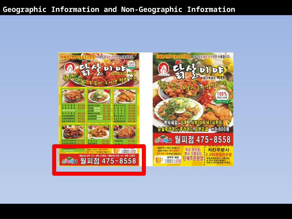
Geographic Information and Non-Geographic Information
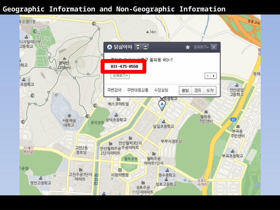
Geographic Information and Non-Geographic Information
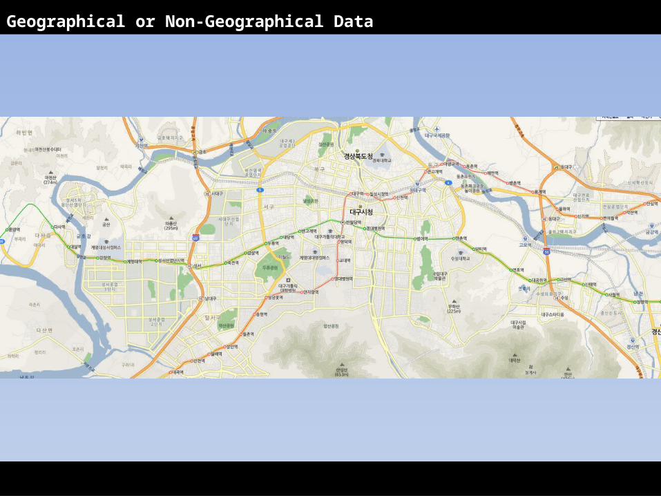
Geographical or Non-Geographical Data
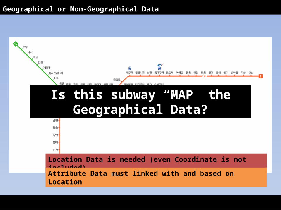
Geographical or Non-Geographical Data
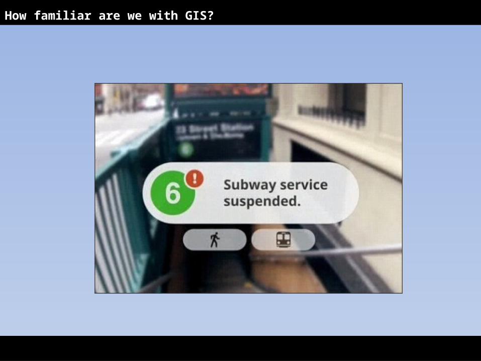
Is this subway “MAP” the Ge-ographical Data?
Location Data is needed (even Coordinate is not in-cluded)Attribute Data must linked with and based on Loca-tion
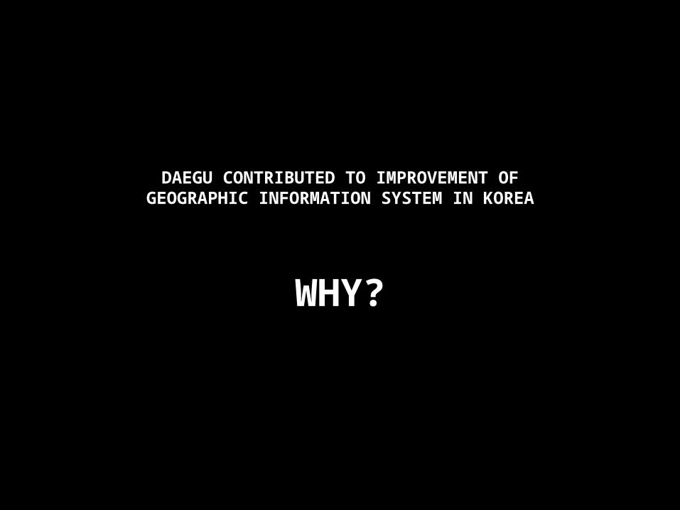
DAEGU CONTRIBUTED TO IMPROVEMENT OFGEOGRAPHIC INFORMATION SYSTEM IN KOREA
WHY?
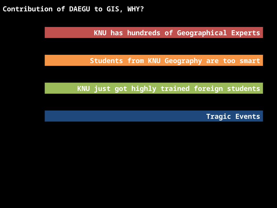
KNU has hundreds of Geographical Experts
Students from KNU Geography are too smart
KNU just got highly trained foreign students
Tragic Events
Contribution of DAEGU to GIS, WHY?
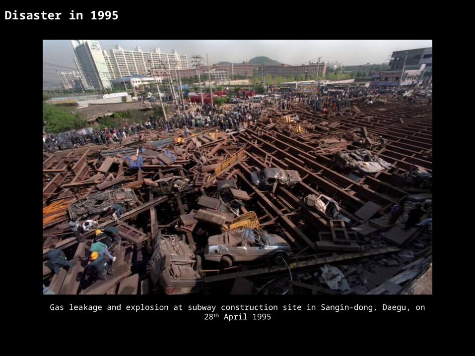
Gas leakage and explosion at subway construction site in Sangin-dong, Daegu, on 28th April 1995
Disaster in 1995
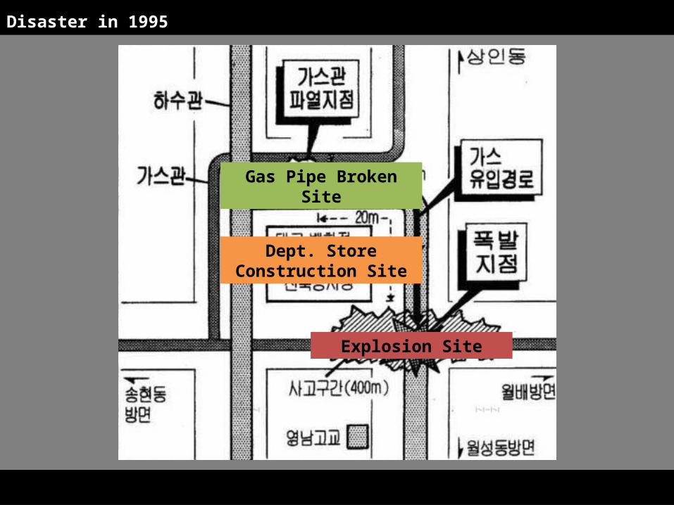
Explosion Site
Dept. Store Con-struction Site
Gas Pipe Broken Site
Disaster in 1995
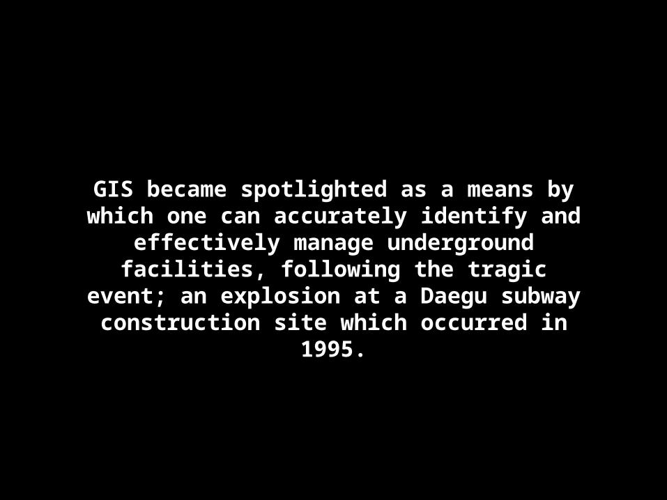
GIS became spotlighted as a means by which one can accurately identify and effectively manage underground facili-ties, following the tragic event; an ex-
plosion at a Daegu subway construction site which occurred in 1995.
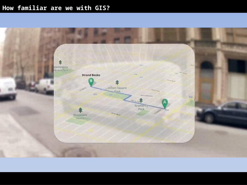
How familiar are we with GIS?
How familiar are we with GIS?
How familiar are we with GIS?
Think about the easiest and fastest way to make Geo-graphical Data on our own
How familiar are we with GIS?
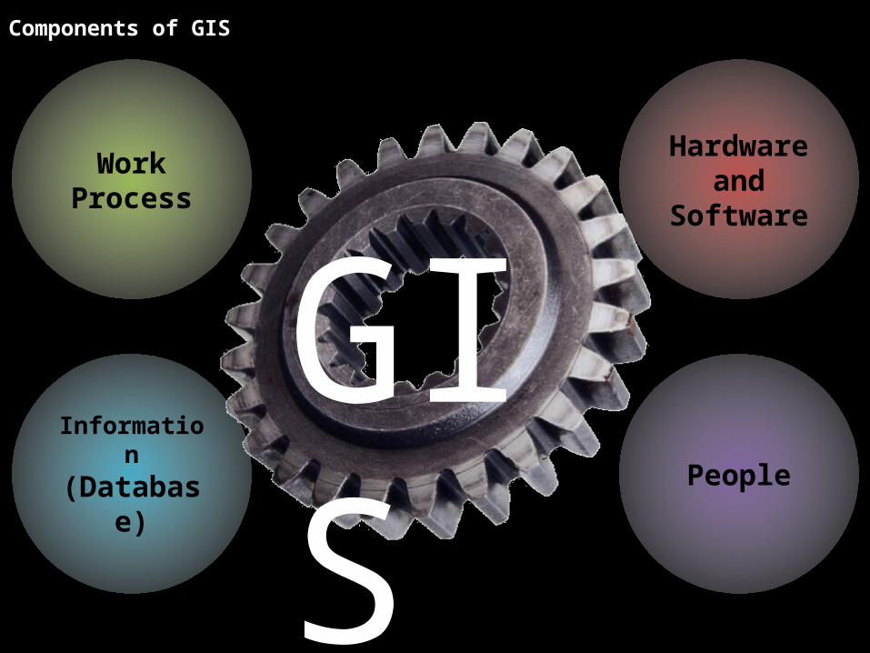
Components of GIS
Informa-tion
(Database)
Hard-ware and Software
Work Process
People
GIS
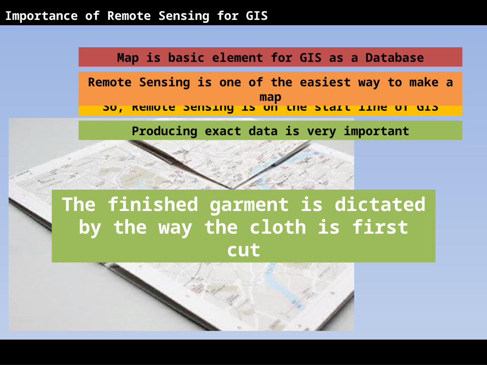
Map is basic element for GIS as a Database
So, Remote Sensing is on the start line of GIS
Remote Sensing is one of the easiest way to make a map
Producing exact data is very important
Importance of Remote Sensing for GIS
The finished garment is dictated by the way the cloth is first cut
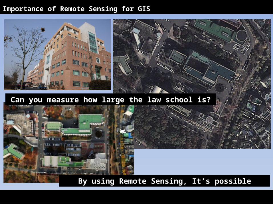
Importance of Remote Sensing for GIS
Can you measure how large the law school is?
By using Remote Sensing, It’s possible
Observing large Scale of Area at the same time
Monitoring usage of land is needed
Saving Time and money
Chasing Change of Land usage continu-ously
Updating Information easily
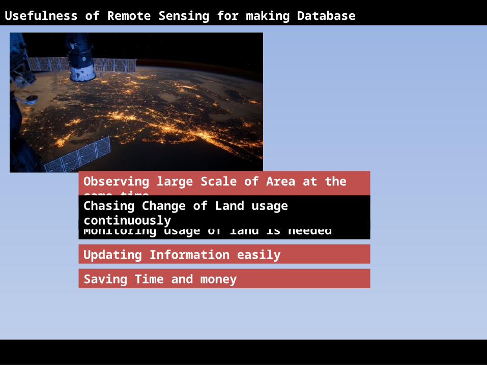
Usefulness of Remote Sensing for making Database
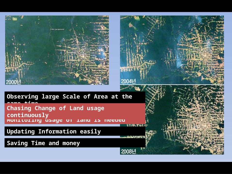
Observing large Scale of Area at the same time
Monitoring usage of land is needed
Saving Time and money
Chasing Change of Land usage continu-ously
Updating Information easily
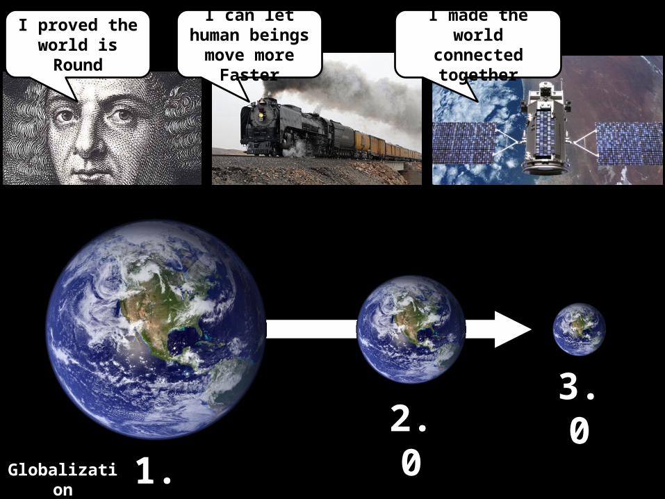
Globaliza-tion
1.0
2.0
3.0
I proved the world is Round
I can let hu-man beings move more
Faster
I made the world con-nected to-
gether
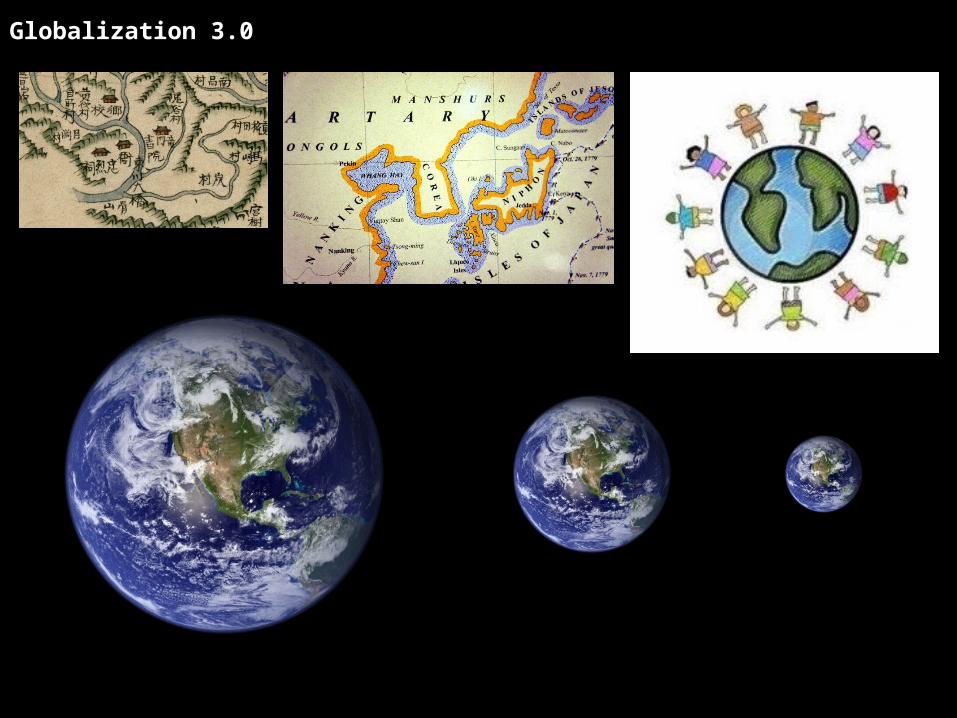
Globalization 3.0
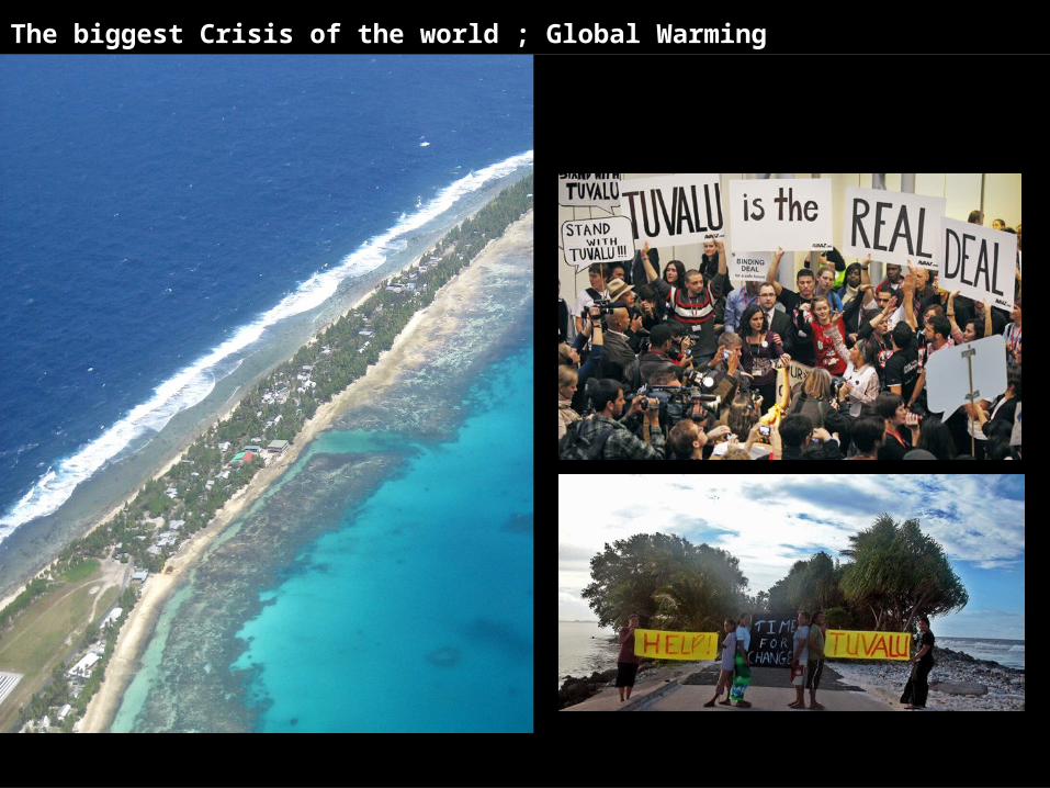
The biggest Crisis of the world ; Global Warming
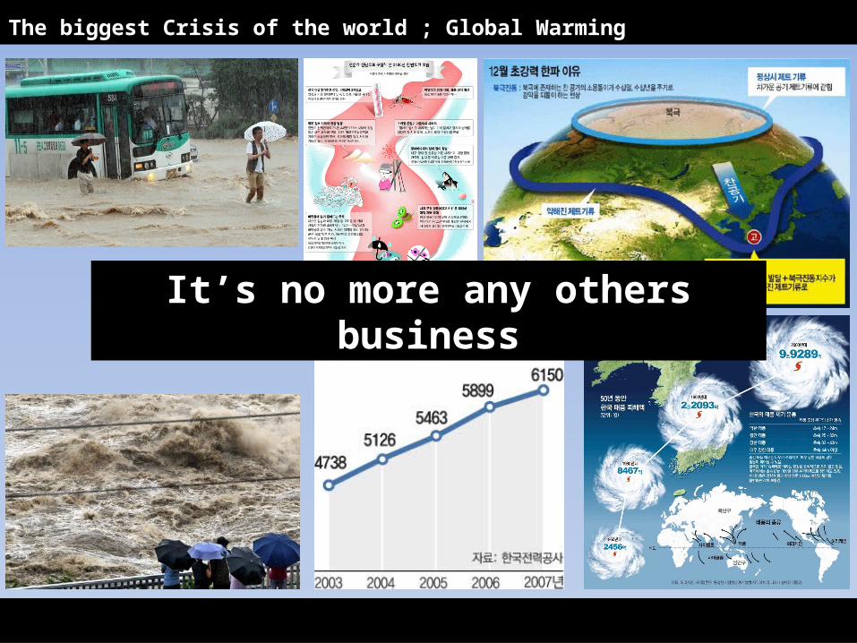
The biggest Crisis of the world ; Global Warming
It’s no more any others busi-ness
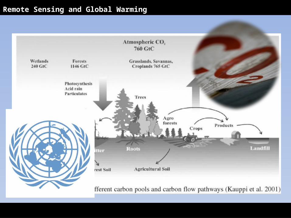
Remote Sensing and Global Warming
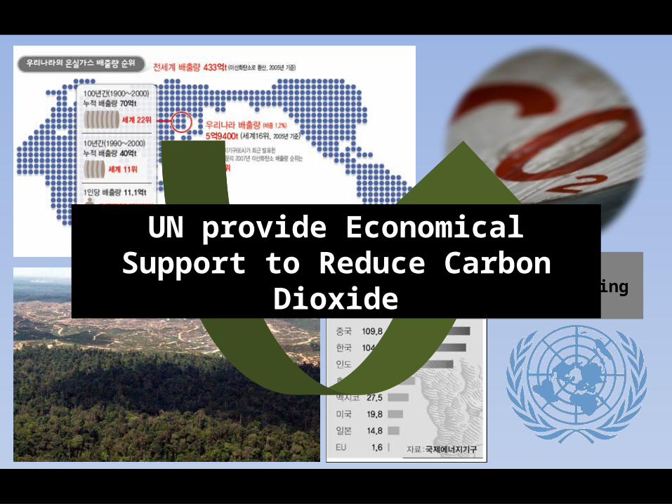
탄소배출권거래제도Emission Trading
Scheme
UN provide Economical Sup-port to Reduce Carbon Diox-
ide
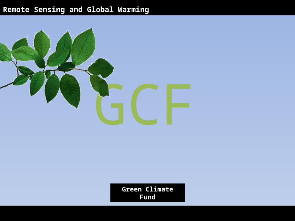
GCF
Remote Sensing and Global Warming
Green Climate Fund
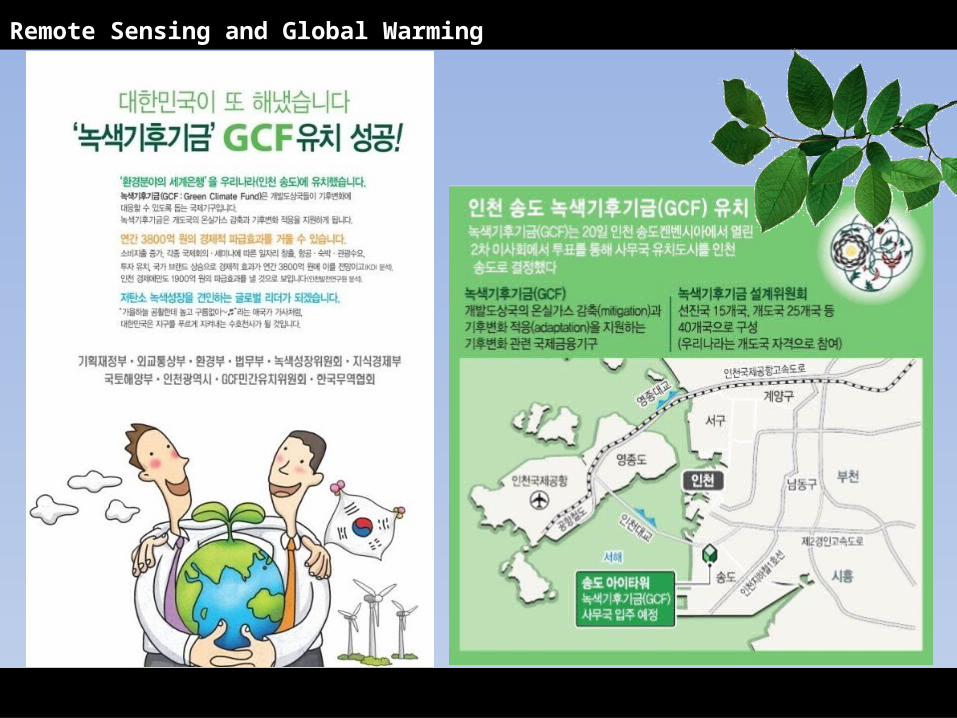
Remote Sensing and Global Warming
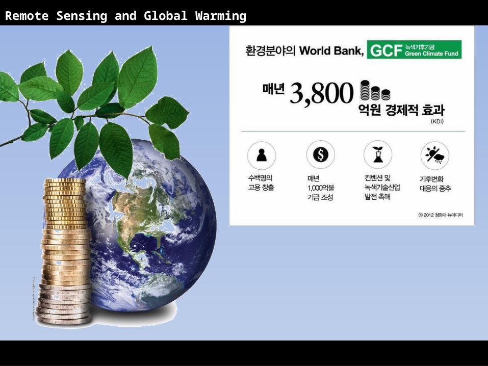
Remote Sensing and Global Warming
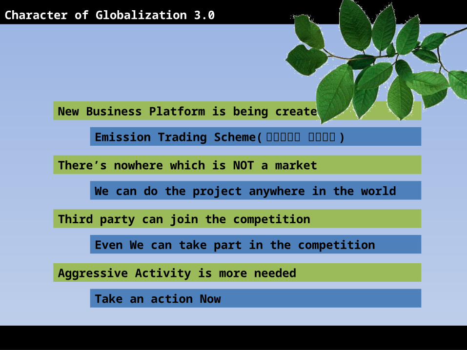
New Business Platform is being created
Third party can join the competition
There’s nowhere which is NOT a market
Aggressive Activity is more needed
Character of Globalization 3.0
Emission Trading Scheme( 탄소배출권 거래제도 )
Even We can take part in the competition
We can do the project anywhere in the world
Take an action Now
![Diagnostic usefulness of an amino acid tracer, a-[N … · ORIGINAL ARTICLE Diagnostic usefulness of an amino acid tracer, a-[N-methyl-11C]-methylaminoisobutyric acid (11C-MeAIB),in](https://static.fdocument.pub/doc/165x107/5b85588c7f8b9a317e8ded7e/diagnostic-usefulness-of-an-amino-acid-tracer-a-n-original-article-diagnostic.jpg)
![On the Relative Usefulness of Fireballssacerdot/PAPERS/lics15.pdf · 2016-07-28 · arXiv:1505.03791v1 [cs.LO] 14 May 2015 On the Relative Usefulness of Fireballs Beniamino Accattoli](https://static.fdocument.pub/doc/165x107/5f085be17e708231d4219e2e/on-the-relative-usefulness-of-sacerdotpaperslics15pdf-2016-07-28-arxiv150503791v1.jpg)