An Incremental Approach For Teaching Field Mapping Using Rugged Tablet Computers & GIS Paul Umhoefer...
17
An Incremental Approach For Teaching Field Mapping Using Rugged Tablet Computers & GIS Paul Umhoefer (Instructor) Professor of Geology Mark Manone (Technical leader) Geospatial Research & Information Lab Geology Program, School of Earth Sciences & Environmental Sustainability Northern Arizona University
-
Upload
edmund-osborne -
Category
Documents
-
view
216 -
download
2
Transcript of An Incremental Approach For Teaching Field Mapping Using Rugged Tablet Computers & GIS Paul Umhoefer...
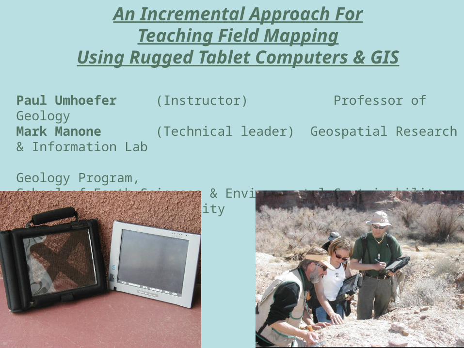
An Incremental Approach ForTeaching Field Mapping
Using Rugged Tablet Computers & GIS
Paul Umhoefer (Instructor) Professor of GeologyMark Manone (Technical leader) Geospatial Research & Information Lab
Geology Program, School of Earth Sciences & Environmental SustainabilityNorthern Arizona University
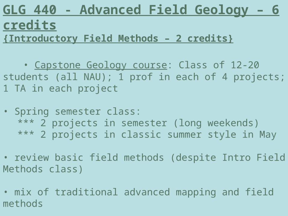
GLG 440 - Advanced Field Geology – 6 credits{Introductory Field Methods – 2 credits}
• Capstone Geology course: Class of 12-20 students (all NAU); 1 prof in each of 4 projects; 1 TA in each project
• Spring semester class:*** 2 projects in semester (long weekends)*** 2 projects in classic summer style in May
• review basic field methods (despite Intro Field Methods class)
• mix of traditional advanced mapping and field methods
• always include one hydro – geomorphology project
• included tablet computer component for the last 8 years
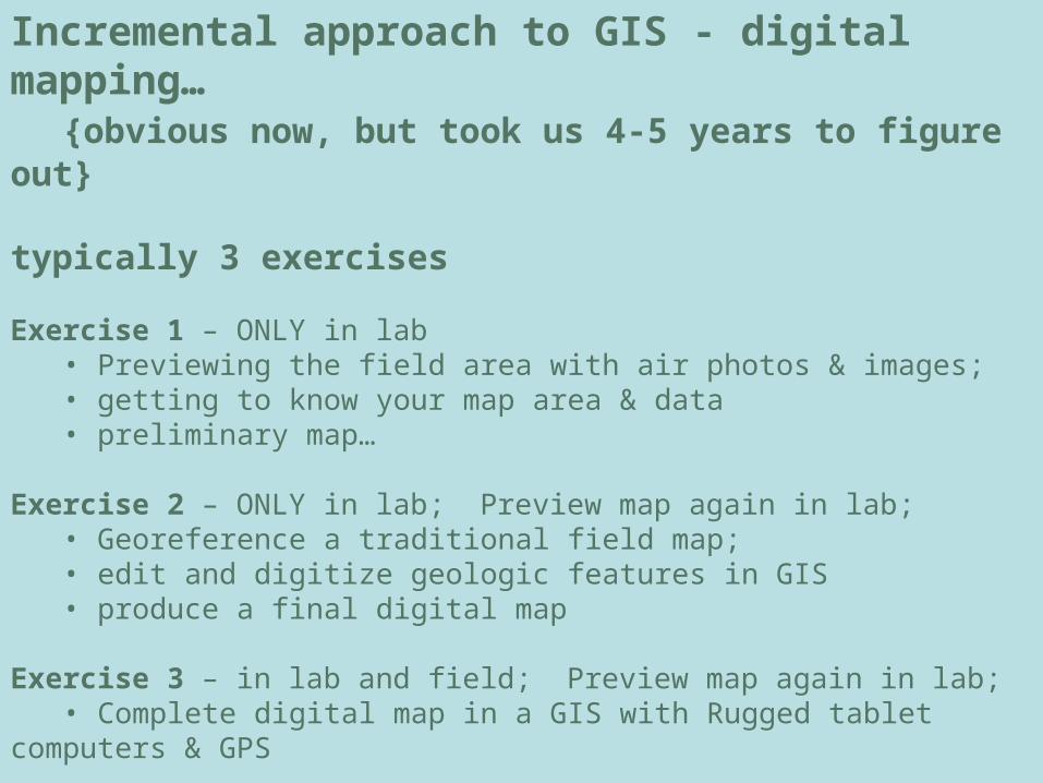
Incremental approach to GIS - digital mapping…{obvious now, but took us 4-5 years to figure out}
typically 3 exercises
Exercise 1 – ONLY in lab• Previewing the field area with air photos & images;• getting to know your map area & data• preliminary map…
Exercise 2 – ONLY in lab; Preview map again in lab;• Georeference a traditional field map;• edit and digitize geologic features in GIS• produce a final digital map
Exercise 3 – in lab and field; Preview map again in lab;• Complete digital map in a GIS with Rugged tablet computers & GPS
Exercise 4 – return to traditional mapping…. OR• Optional mapping with tablets
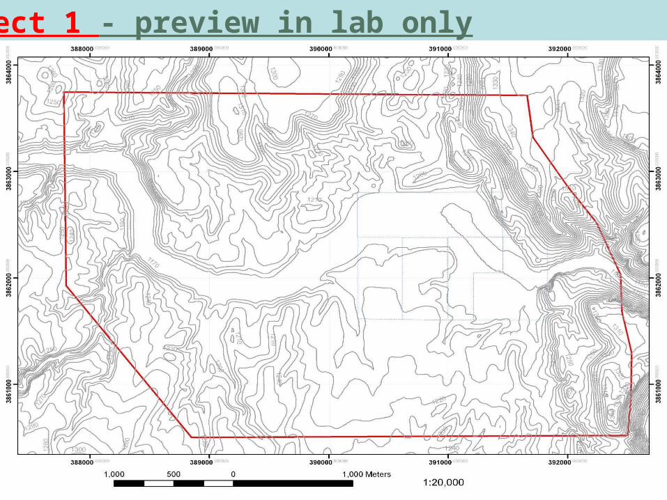
Project 1 - preview in lab only

Project 1
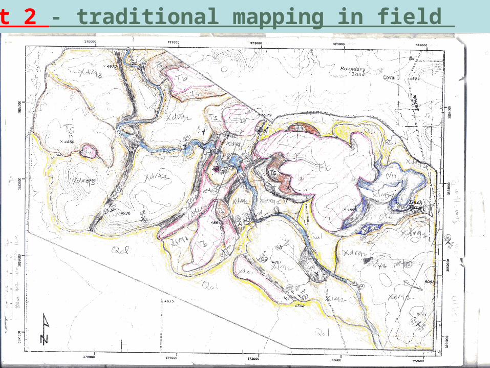
Project 2 - traditional mapping in field
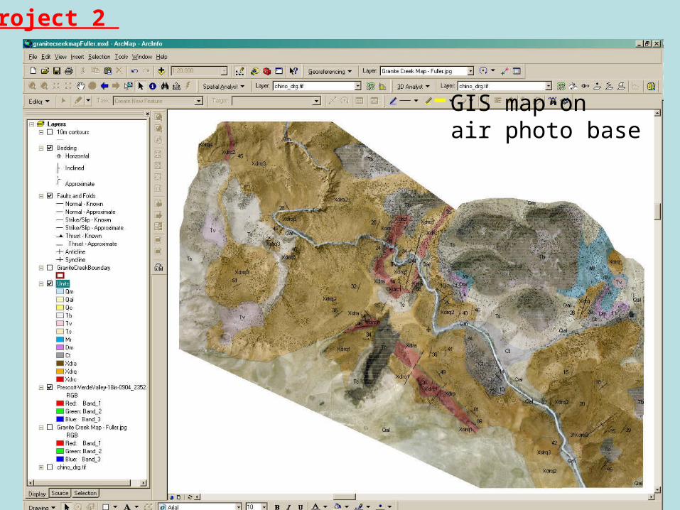
GIS map onair photo base
Project 2

Project 2
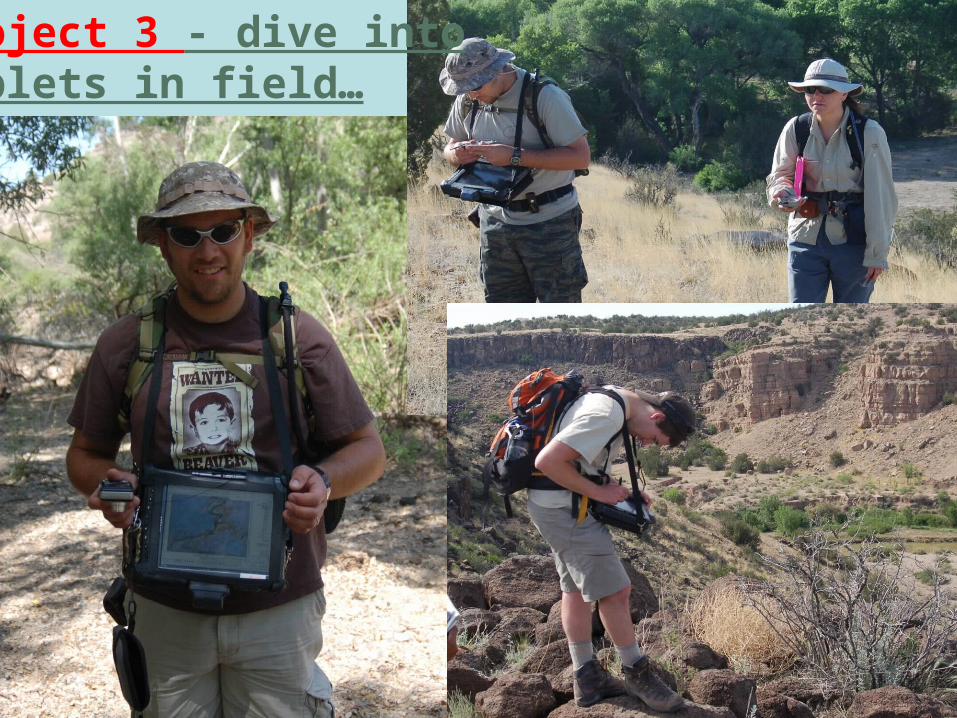
Project 3 - dive intoTablets in field…
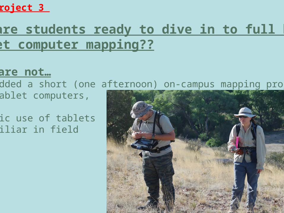
BUT are students ready to dive in to full blownTablet computer mapping??
some are not…• We added a short (one afternoon) on-campus mapping projectwith tablet computers,
so basic use of tabletsIs familiar in field
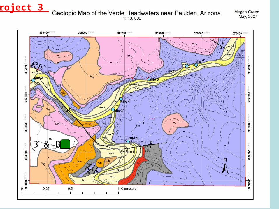
Project 3
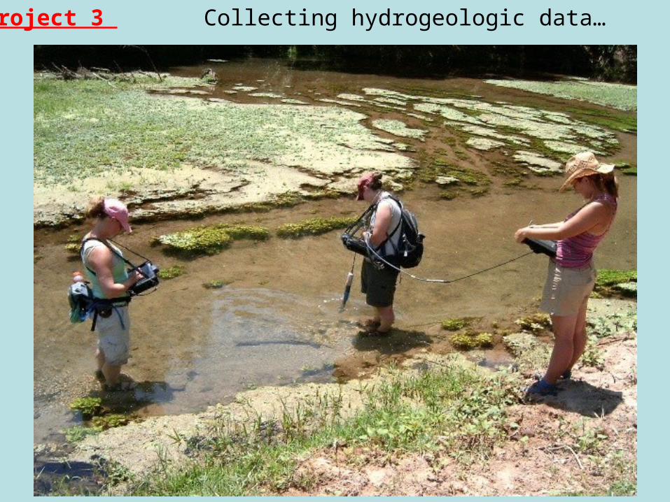
Collecting hydrogeologic data…Project 3
Tertiary
Paleozoic
Quaternary
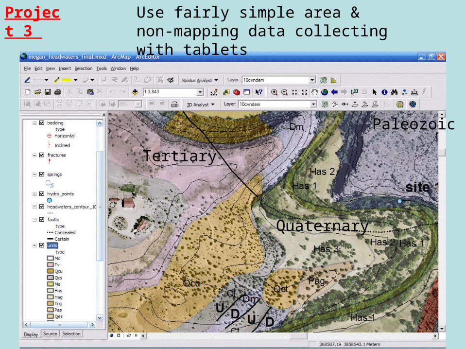
Use fairly simple area &non-mapping data collecting with tablets
Project 3
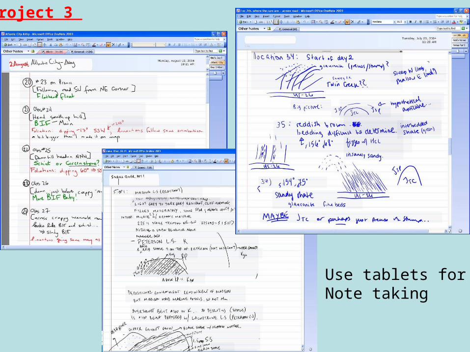
Use tablets forNote taking
Project 3

Stay at RuralBed & Breakfast
Within field area
• electricity for charging• good evening workconditions
PicklogisticallySimplelocation
Project 3
B & B
Project 3
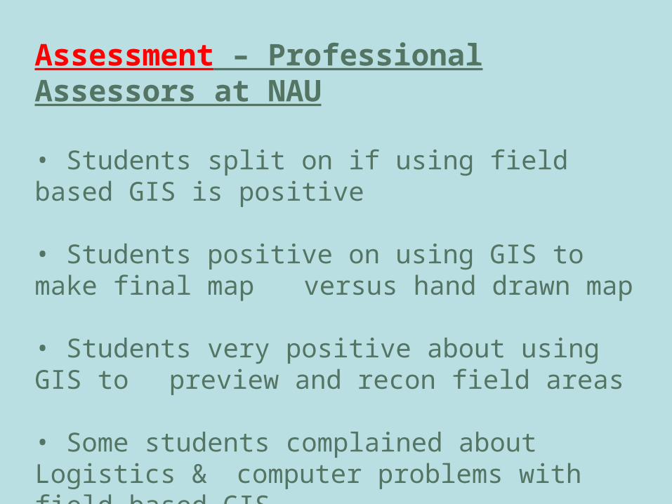
Assessment – Professional Assessors at NAU
• Students split on if using field based GIS is positive
5 yes, 3 neutral, 5 no• Students positive on using GIS to make final map versus hand drawn map
8 yes, 3 neutral, 2 no• Students very positive about using GIS to preview and recon field areas
13 yes• Some students complained about Logistics & computer problems with field-based GIS
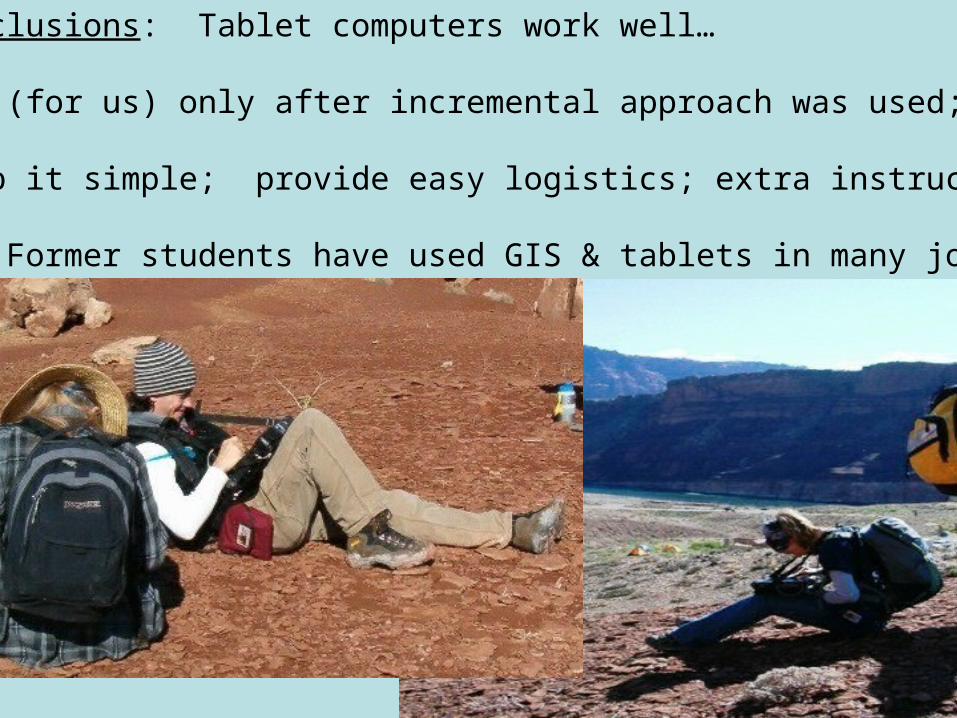
Conclusions: Tablet computers work well…
But (for us) only after incremental approach was used;
Keep it simple; provide easy logistics; extra instructors
••• Former students have used GIS & tablets in many jobs.